Garmin Edge 530 | Prueba y análisis completo
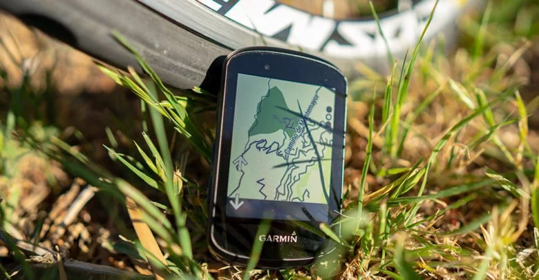
El Garmin Edge 530 promete no sólo igualar el éxito del Edge 520, sino superarlo. Y la verdad… cuenta con innumerables razones para hacerlo. Antes de este Edge 530 hubo un Edge 520 Plus, pero lo cierto es que pasó por el mercado sin pena ni gloria dadas las escasas diferencias que había con el resto de la gama y, sobre todo, teniendo en cuenta que el Edge 820 también estaba ahí a un precio muy similar.
La historia ha cambiado ya que el Edge 530 ha dado un notable salto de calidad. Se encuentra casi a la altura del Garmin Edge 830, del que muy pocas cosas le separan.
No hablo de un salto notable exclusivamente a funcionamiento o velocidad (algo que es muy evidente), sino también en cuanto a funciones. Garmin ha dotado al Edge 530 de un montón de novedades en su software y no se ha guardado nada para sus hermanos mayores. Tal es así que en esta generación veo un futuro más difícil para el Edge 830 porque, salvo la pantalla táctil y pequeños detalles de la navegación, ambos ofrecen lo mismo.
Tras bastantes horas de pruebas con el Edge 530 estoy en situación de contarte todos los detalles de lo último de Garmin para el ciclismo. Estos últimos días ha tocado dar muchos pedales –si me sigues en Strava te habrás dado cuenta– pues la presión por parte de Garmin para devolver las unidades de prensa ha sido alta (tienen que rotarlos entre los medios). Pero ha sido tiempo suficiente para comprobar el funcionamiento tanto de este Edge 530 como del Edge 830 y poder contarte todas sus virtudes (y los defectos).
Recuerda que si te gusta el contenido que te ofrezco, este análisis te ha ayudado (porque a diferencia de otros, aquí sí se analiza el producto de verdad y no me limito a repetir la hoja de características llamándolo «el mejor análisis» sin siquiera haber tocado el producto) y quieres colaborar soportando la página, puedes hacerlo comprando tu nuevo Garmin Edge (o cualquier otra cosa, como este cortador de pizza que no debería faltar a ningún ciclista) a través de los enlaces que facilito. De esa manera recibiré una pequeña comisión que es lo que soporta la página y las muchas horas necesarias para realizar todas estas pruebas.
Si lo prefieres, puedes suscribirte como miembro VIP. Además de ayudar a soportar la página disfrutarás de beneficios exclusivos.
¡Vamos con la prueba!
Navegar a secciones específicas
Resumen
Funcionamiento global - 7
Posibilidades de entrenamiento - 9
Plataforma y aplicaciones - 10
Autonomía - 9.5
Acabados y comodidad - 7
Relación precio/prestaciones - 9.5
8.7
Total
¿Puede tratarse del mejor ciclocomputador GPS del mercado? Pues se clasificaría muy arriba... pero de lo que no hay duda es que es el que mejor relación precio/prestaciones ofrece. Lo único que no me ha gustado es el tacto de los botones y que de momento la compatibilidad con Galileo es problemática. Pero si todas las pegas que puedo ponerle se limitan a eso...
Lo mejor
- Salto importante en procesador. Es rápido en los menús, pero sobre todo en el cálculo de rutas
- Muchas funciones nuevas, varias de ellas nunca vistas hasta ahora
- Enfocado no sólo al ciclismo de carretera, también pone el foco en la bici de montaña
- Cuesta 100€ menos que el Edge 830 y tiene muy poco que envidiarle
Necesita mejorar
- El tacto de los botones al pulsar es mejorable, además de haber un problema con el botón de volver atrás en las primeras unidades
- Forksight depende de una base de datos externa. Si en tu zona no hay senderos señalizados… no hay Forksight para ti
- Traducciones al español muy poco trabajadas
- Aunque en general he tenido buen rendimiento de GPS, he tenido problemas cuando he seleccionado la opción de GPS + Galileo
Garmin Edge 530, todas las novedades
El Garmin Edge 530 viene cargado de novedades y algunas de ellas son muy interesantes. Pero antes de ir al software vamos con las diferencias físicas con respecto al Edge 520, que es el modelo al que sustituye (o el Edge 520 plus, según quieras mirarlo).
Su diseño cambia, ahora tiene una estética más redondeada. Pero sobre todo destaca la pantalla que ahora es más grande (de 2,3″ a 2,6″).
También hay novedades importantes en su interior, destacando el nuevo chipset GNSS de Sony que está ya prácticamente en todos los dispositivos de los diferentes fabricantes. Este chipset de Sony es notablemente parco en el uso de batería, lo que permite dar unas cifras de autonomía francamente buenas sin necesidad de aumentar el tamaño físico de la batería.
Pero el cambio que más me gusta es sin duda su procesador, mucho más potente que hasta ahora y que no sólo permite que el dispositivo se sienta más rápido cuando nos movemos por los menús, sino especialmente cuando hacemos uso de funciones de navegación. Ahora es capaz de cargar rutas en muy pocos segundos, cuando en el Edge 520 o Edge 520 Plus (incluso el Edge 820) hablábamos más bien de minutos.
Resumiendo, estas son las diferencias de hardware con respecto al Edge 520:
- Pantalla más grande, pasando de 2,3″ a 2,6″
- Nuevo chipset de Sony para mayor autonomía
- Hasta 20 horas de duración de batería (y 48 horas en modo de ahorro de batería)
- Procesador mucho más rápido
- Ahora tiene WiFi para sincronización de todos los datos como rutas, actividades, etc. Antes estaba reservado a modelos superiores
- Añade sensor de iluminación para variar la intensidad de la luz de pantalla (y también para el uso de luces Garmin Varia)
- Compatible con sensores Bluetooth además de los tradicionales ANT+
- Compatible con la batería externa Garmin Edge
Y no todo queda en aumentar la autonomía o añadir WiFi, donde más novedades aporta es en cuanto a su software. Y como aspecto más novedoso con un especial cuidado hacia el ciclismo de montaña, algo importante ya que hasta ahora los Garmin Edge siempre habían estado más centrados a su uso en carretera.
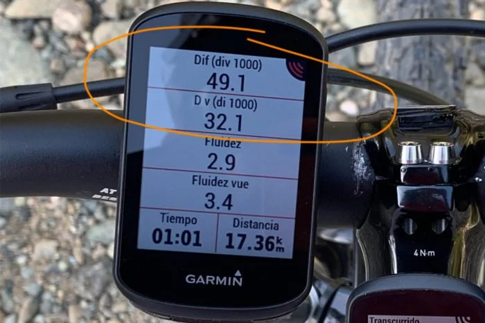
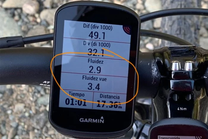
- Métricas específicas para MTB. Cuenta la distancia y duración de tus saltos, la dificultad del trayecto y la fluidez en el descenso
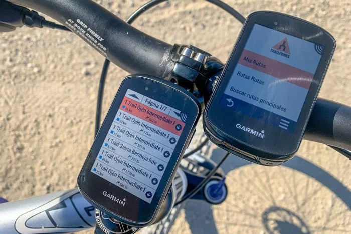
- Mapas completos para carretera y montaña que, como novedad, incluye datos de Trailforks con información de los senderos por los que estamos circulando
- Al hacer rutas de navegación y detenernos ante una bifurcación la pantalla muestra diferentes opciones que se presentan a continuación. Esta función se llama ForkSight
- ClimbPro, una función que se estrenó en los Fenix 5 Plus y que separan las subidas de forma individual, indicando la distancia y elevación que queda para completar cada una de ellas. Es una vista exclusiva de la subida o puerto en el que estamos sufriendo ahora, no del global de la ruta
- Control dinámico de rendimiento, teniendo ahora en cuenta el calor, humedad y altitud para las métricas de recuperación y rendimiento
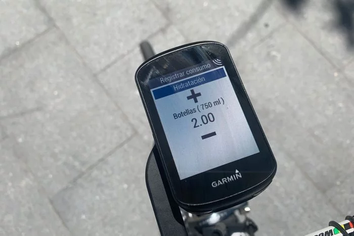
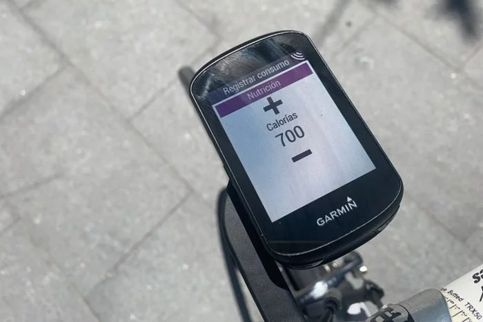
- Alertas de nutrición e hidratación también dinámicas. En función de diferentes valores el Edge recomendará cuánto deberíamos estar comiendo e hidratándonos. Así mismo registrará también lo que hemos tomado y podremos verlo luego en el resumen de actividad de Garmin Connect
- Buscar mi Edge, en caso de que se caiga el Edge quedará marcado en qué punto perdió la conexión con el móvil, para tratar de encontrarlo al saber dónde se pudo descolgar
- Función de alarma de bicicleta. Una vez activada la función y gracias a los acelerómetros internos sonará una alarma en caso de que la bicicleta se mueva. Ideal para cuando paras en un bar o una gasolinera a rehidratar
- Curva de potencia, algo similar a lo que encontrarás en aplicaciones como TrainingPeaks, Golden Cheetah o similares
- Interfaz de usuario rediseñada. Un cambio de look para hacerlo algo más moderno, aunque todo te resultará muy familiar
Por supuesto voy a dar un repaso a todas y cada una de esas funciones, pero antes de eso te recordaré en qué se diferencia del Edge 830.
Diferencias con el Edge 830
La principal diferencia es el precio, eso es lo primero que vas a notar (sobre todo en el peso en el bolsillo que te quedará con 100€ más en la cartera). Pero no es lo único, hay otras cosas que debes tener en cuenta:
- El Edge 530 no tiene pantalla táctil y se maneja a través de los botones laterales. Tiene un total de 7 botones
- La navegación del Edge 530 es más sencilla. No puedes introducir una dirección para realizar la navegación a ese punto, ni cuenta con base de datos de puntos de interés. Pero sí tiene mapa completo de Europa con todas las carreteras y calles, y casi todos los senderos
- El Edge 530 no permite variar la escala de la página de perfil de altitud de ruta, mientras que en el Edge 830 sí es posible (porque permite «pinchar» en cada eje y aumentar o reducir de forma directa)
Y ya está, esa es la diferencia entre ambos. La forma de control y las posibilidades de navegación. Ahí es donde están los 100€ de diferencia, porque en el resto de aspectos ambos son idénticos.
Es cierto que el Edge 830 ofrece más opciones a la hora de crear rutas, pero todo depende de cuál sea tu uso y cómo hagas la navegación. Yo personalmente no las usaría con mucha frecuencia ya que suelo salir de casa con una ruta ya cargada.
Haciéndolo de esa manera no hay ninguna diferencia entre la navegación de uno y otro dispositivo, los dos cuentan con mapas completos, aviso de giro con antelación y recálculo de ruta en caso de salirte del trazado inicial.
Lo cual no quiere decir que no fuese igual de feliz con el Edge 530. De hecho si no tuviera uno en cada mano lo que ofrece el Edge 530 por su precio me parece realmente magnífico, aunque me llama más la atención el Edge 830 por su pantalla táctil. Especialmente porque no me gusta el tacto de los botones del Edge 530.
¿Todo aclarado? Bien, pues voy a refrescarte un poco la memoria con todo lo que puedes hacer con un Edge y algunas cosas nuevas que incluye.
Un repaso rápido al Garmin Edge 530
Si ya estás habituado al uso de un Garmin Edge no te engañaré, el Edge 530 es prácticamente lo mismo. No es un cambio de experiencia radical, pero si vienes de modelos más recientes (Edge 520, Edge 820, etc.) te parecerá que todo permanece en su sitio.
De los dos modelos que Garmin presentó de forma conjunta (este Edge 530 y el Edge 830), la principal diferencia entre ambos es el modo de control. En el caso del Edge 530 la pantalla no es táctil, siendo todo su control a través de los botones que se sitúan en los laterales del ciclocomputador.
De hecho estéticamente es la única manera de diferenciarlos.
Precisamente éste ha sido un foco de atención en las primeras unidades. Como es habitual en Garmin, sus dispositivos no destacan precisamente por el tacto de sus botones. Esa sensación de presión que podemos encontrar en otros dispositivos, de forma que sabemos que hemos presionado el botón… está ausente en el Edge 530.
Y para añadir más leña al fuego el botón de regreso es especialmente poco informativo. Garmin dice que ya ha encontrado el origen del problema y que ha modificado los útiles de fabricación de la carcasa trasera, pero si la primera tirada han sido de miles de unidades es probable que haya muchas dando vueltas por ahí…
En mi unidad de prueba no he notado un mal comportamiento en el botón de regreso (el inferior derecho), o al menos no mucho peor que el resto de botones, de los que ya digo que no me entusiasman. Muchos usuarios se han quejado de falta de que al pulsar el botón no hay respuesta por parte del Edge, por el sencillo motivo de que no se ha efectuado la presión.
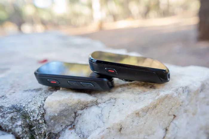
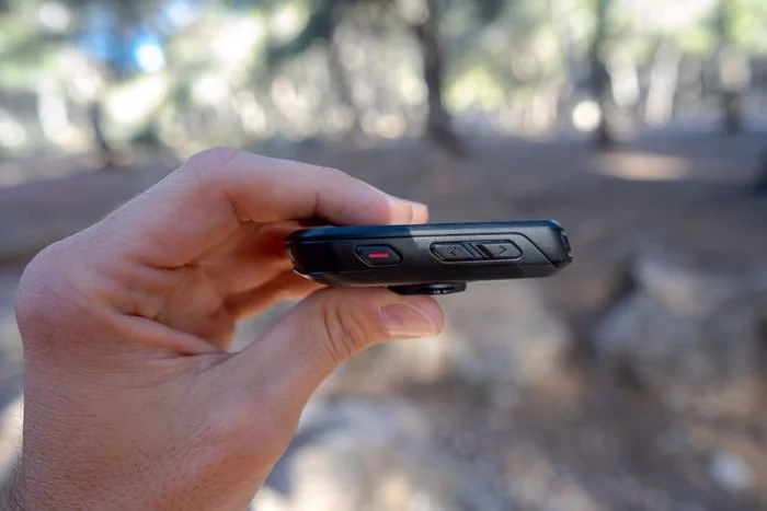
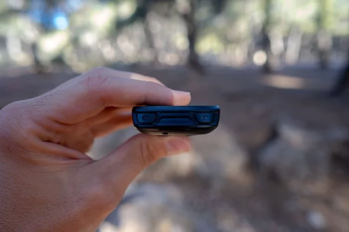
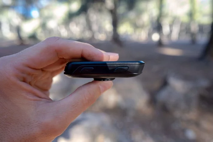
La distribución de botones es la misma que en el Edge 520. En el lado izquierdo están los botones para encender y apagar el dispositivo junto con los de desplazamiento que permitirá moverte por los menús así como cambiar las pantallas de datos. En el derecho encontrarás los botones de confirmar o vuelta atrás, mientras que en la parte de abajo están los botones principales para iniciar/pausar la actividad y marcar una vuelta.
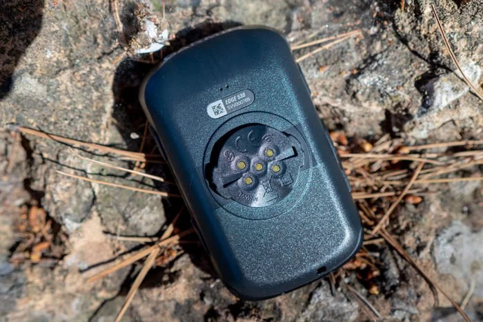
Y por seguir dando un repaso a la parte externa del dispositivo, si le damos la vuelta verás que ahora tiene unos pines de carga en la parte inferior.
Son para poder usar la batería extendida de Garmin, capaz de dar muchas más horas de uso además de las 20 horas que ofrece por defecto. Ciertamente no es un accesorio que se haya vendido excesivamente, no sólo por su precio sino porque no muchos usuarios necesitarán más de esas 20 horas de uso sin estar cerca de un enchufe.
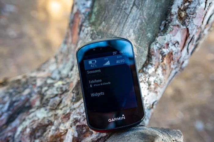
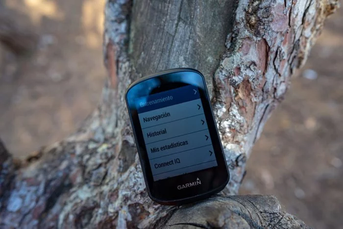
Tras encender el ciclocomputador tendremos ante nosotros la pantalla principal del menú. Ahora es diferente en su presentación, pero básicamente todo permanece igual. Y obviamente dadas las diferencias en el manejo del dispositivo, es completamente diferente al que tiene el Edge 830.
En la parte superior tendrás datos de sensores, estado de señal GPS o información de hora, temperatura y batería.
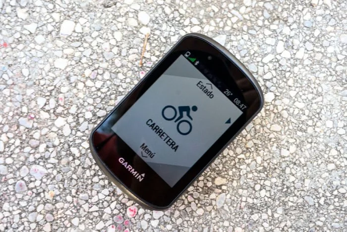
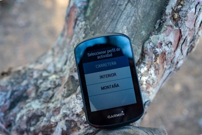
Si pulsamos el botón de desplazamiento hacia arriba accederás a un menú rápido de estado con acceso directo a configuración de GPS, brillo de pantalla o sensores. Pulsándolo hacia abajo entramos en el menú principal y si pulsamos el botón superior derecho podemos seleccionar el perfil de actividad a utilizar.
Los perfiles son totalmente configurables tanto en funciones, en páginas de datos y en los datos que queremos mostrar. Puedes personalizar su nombre, el color, si quieres mostrar segmentos de forma automática, recordatorios de nutrición/hidratación, etc.
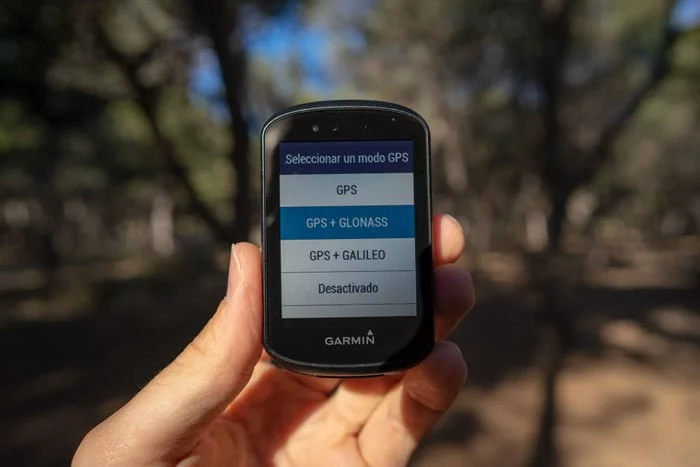
Dentro de las opciones de personalización tenemos la posibilidad de elegir las opciones de GPS. Otra de las novedades es la posibilidad de elegir GPS+Galileo (pero de esto ya hablaré más adelante). El Edge 530 añade esta opción gracias al uso del chipset de Sony, el que virtualmente todos los fabricantes están usando en los últimos meses.
El uso del chipset de Sony es el que además de ofrecer compatibilidad con satélites Galileo también permite la autonomía que alcanzan los nuevos dispositivos.
Dentro de las posibilidades de configurar los perfiles de deporte también tenemos opciones para mostrar algunas gráficas.
Son campos de datos a priori bastante interesantes, pero lo cierto es que yo personalmente opto por las opciones más clásicas de campos tradicionales. Es a lo que me he acostumbrado y lo que quiero ver en pantalla (y en cierto modo un TOC por no tener delante lo que acostumbro a ver). Siempre tengo una pantalla principal con los mismos datos, y lo tengo así en todos los dispositivos (salvo en el Edge 130 que tengo una configuración específica para competición).
En cuanto a los sensores que utilices en tu bici, no tendrás que añadirlo de forma individual en cada uno de los perfiles. Se añaden todos en el mismo lugar y luego el Edge 530 se conectará simplemente con los que encuentre, independientemente de cuál sea la bici que vayas a usar.
Como novedad de este Edge 530 también está que puedes usar sensores Bluetooth, además de los clásicos ANT+. Hoy ya no es tan novedoso pues la inmensa mayoría de los sensores tienen compatibilidad dual ANT+/Bluetooth, pero aún así es interesante que Garmin opte por este camino.
Y hablando de sensores, todo esto es lo que puedes emparejar con el Garmin Edge 530.
- Frecuencia cardíaca, ANT+ o Bluetooth
- Velocidad y/o cadencia, ANT+ o Bluetooth
- Potenciómetro, ANT+ o Bluetooth
- Rodillos inteligentes, con ANT+ FE-C
- Cambios electrónicos, ANT+ o ANT
- Bicicletas eléctricas eBike, ANT+
- Luces, ANT+ (tanto de Garmin como otros fabricantes)
- Radar, Garmin Varia a través de ANT+
- Garmin Varia Vision, a través de ANT+
- Mando de control remoto de Garmin, ANT+
- Cámara Garmin Varia, a través de ANT+
Mi recomendación es que en la medida de lo posible conectes los sensores a través de ANT+, simplemente porque no bloquea el uso del sensor por parte de otros dispositivos y porque en general suele dar menos problemas.
Y hablando de sensores duales, los Edge 830 pack incluyen los nuevos sensores de velocidad, cadencia y frecuencia cardíaca ANT+/Bluetooth de Garmin. El de frecuencia cardíaca se presentó hace algunas semanas, pero los de cadencia y velocidad son novedad tanto con el Edge 530 como con el 830. Además el sensor de velocidad guarda una pequeña sorpresa, ya que dispone de una memoria que permite registrar entrenamientos sin necesidad de ningún otro dispositivo.
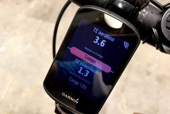
La información que se muestra en pantalla tras completar el entrenamiento ahora es mayor ya que incluye todos los detalles de las métricas fisiológicas como la carga de entrenamiento, el efecto de entrenamiento, etc.
Y como siempre, tras sincronizar con el teléfono o a través de WiFi al llegar a casa tu entrenamiento se subirá de forma automática a Garmin Connect, donde podrás ver todos los detalles del entrenamiento, tanto en la aplicación móvil como a través de la página web.
Aquí te dejo enlace a uno de mis entrenamientos para que puedas comprobar tú mismo todos los detalles.
Nuevas funciones
Todo lo que has visto anteriormente es más o menos lo mismo que ha estado presente en las unidades Edge hasta el momento. Pero hay muchas novedades en el software del Edge 530 que merecen ser explicadas de forma detallada. Así que iré detallando una a una con todos los detalles para aclararte todas las dudas que puedan surgirte.
Funciones específicas para ciclismo de montaña (MTB)
Por primera vez Garmin pone un poco especial en el ciclismo de montaña. Hasta ahora todos sus dispositivos han estado orientados hacia ciclismo en general, pero todos teníamos la sensación que se hacía con el ciclismo de carretera en mente y que los ciclistas de montaña «se adaptaban con lo que había».
Esto ha cambiado totalmente en el nuevo Edge 530 ya que ahora ofrece multitud de posibilidades orientadas de forma exclusiva a la MTB. Desde campos de datos específicos, pasando por la capacidad de medir datos de tus saltos o funciones específicas de navegación pensadas en exclusiva para los senderos de montaña.
Distancia y duración de saltos
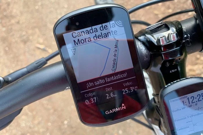
Cada vez que hagas un salto mínimamente interesante (es decir, no vale bajar un bordillo), el Edge 530 lo registrará junto con métricas específicas de ese salto.
Esto lo hace combinando los datos del acelerómetro interno junto con los de velocidad del GPS. En la pantalla del Edge aparecerá una pequeña línea en la parte inferior nada más completar el salto con los detalles del mismo.
Los datos que indica son:
- Colgar: El tiempo que has pasado en el aire
- Dist.:Distancia que has recorrido sin tocar el suelo
- Velocidad: Lógicamente, a la velocidad a la que has tomado el salto
Lo cierto es que es algo curioso y que no habíamos visto hasta ahora. ¡Me gusta! Si bien le pediría a Garmin que mostrara los datos posteriores al salto en pantalla completa para poder ver los detalles de un vistazo rápido.
Lo más normal es que cuando hagas un salto estés en un descenso, y seguro que tienes cosas más importantes a las que prestar atención que a la pantalla del Edge para ver cuánto tiempo has pasado en el aire.
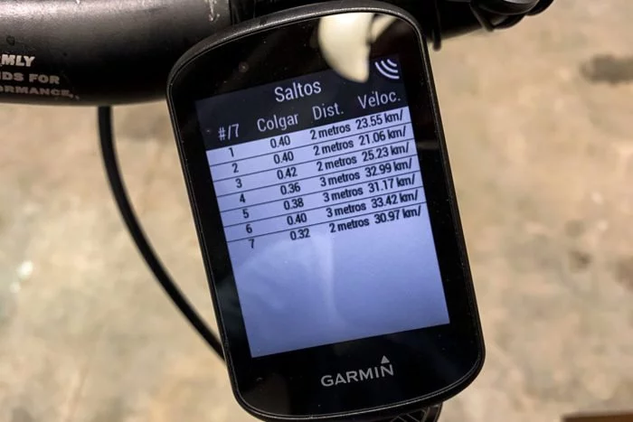
De todas formas todo queda grabado en el archivo de actividad. Cuando termines el entrenamiento puedes acceder al resumen de saltos de tu salida.
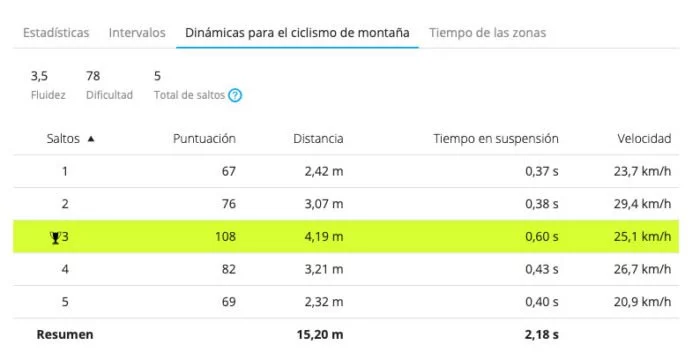
En Connect podrás ver algo más de detalle porque también le asignará una puntuación.
Y también quedan marcados en el mapa de la actividad, para que sepas en qué punto has realizado ese salto y, por qué no, compararlos con los de tus compañeros de salida.
Dificultad del trayecto
Es una métrica que aplica una puntuación para cada recorrido. Utiliza factores como velocidad de ascenso y descenso gracias al GPS, el ángulo de los giros, etc.
Cuanto más alto sea el número más difícil es la ruta. Así, una ruta hasta 20 puntos es calificada como fácil, entre 20 y 40 moderada y a partir de ahí dura.
Puedes tener dato de dificultad total de la ruta o de la vuelta. Por tanto puedes marcar una vuelta al comienzo de una ascensión complicada (o de un descenso) y ver cuál es la valoración que se le aplica a esa ruta. La puntuación de dificultad es bastante equiparable entre dos ciclistas que recorran la misma ruta, por lo que puedes comparar dos rutas diferentes para ver cuál está catalogada como más dura incluso aunque tú no la hayas realizado.
De nuevo estos datos quedan registrados en Garmin Connect a modo de gráfica (nótese también que aquí aparecen los saltos al igual que en el plano anterior).
Fluidez
Por su parte la fluidez otorga una puntuación para valorar lo bien que has realizado una ruta, especialmente en llano y bajada. El objetivo es no tener cambios de velocidad bruscos. Cuanto más baja sea la cifra mejor has realizado la ruta.
A diferencia de la dificultad esta métrica puede cambiar totalmente entre dos ciclistas que realicen la misma ruta. Si tu compañero traza peor las curvas y frena más a la entrada tendrá una puntuación más alta que la tuya.
Al igual que la dificultad puedes tener la métrica para toda la salida, o marcar una vuelta cuando vayas a comenzar un descenso para ver tu efectividad en esa parte específica de la ruta.
Nuevamente en Garmin Connect vas a tener una gráfica de fluidez, como en el caso de la dificultad.
Pero también en el mapa de la actividad, estableciendo los códigos de colores en las zonas de deceleración brusca.
Mapas Trailforks y función ForkSight
Trailforks es una base de datos de senderos para bici de montaña, mantenida principalmente por los usuarios para tener los mejores datos e información de cada una de las rutas. La diferencia principal con otras plataformas similares (como Wikiloc) es que Trailforks está creado desde el principio para el mountain bike.
El Edge 530 incluye esta base de datos en los mapas integrados. Por tanto los mapas para realizar rutas no son exclusivamente de carreteras o grandes caminos rurales, también hay senderos interesantes para la práctica del ciclismo, junto a valoraciones de esas rutas.
Eso sí, primero hay que desbloquear los mapas, para lo cual deberás acceder a tu cuenta de Trailforks (gratuita). En el menú de navegación debes dirigirte a la opción de «Nave rutas bici mon» y te pedirá iniciar sesión a través de tu teléfono móvil, quedando a continuación desbloqueados los datos de Trailforks.
Esto es diferente a la aplicación de Connect IQ de Trailforks que ya existía con anterioridad (y que viene precargada en el dispositivo) , con la que puedes aprovechar mejor la integración con Trailforks descargando las rutas que tengas en tu cuenta, etc. Pero para eso no necesitas un Edge 530, puedes instalarla en cualquier otro ciclocomputador compatible con Connect IQ.
Pero quizás la opción más interesante de todo el Edge 530 es lo que Garmin ha denominado ForkSight. Tras desbloquear los datos de Trailforks en los mapas esta función se habilitará, mostrando una pantallla cada vez que te pares en una bifurcación en el camino siempre y cuando haya una ruta conocida en ese punto de giro.
Es decir no te va a saltar una pantalla en todas y cada una de las bifurcaciones en las que te pares para decirte qué es lo que hay a continuación o lo que te vas a encontrar.
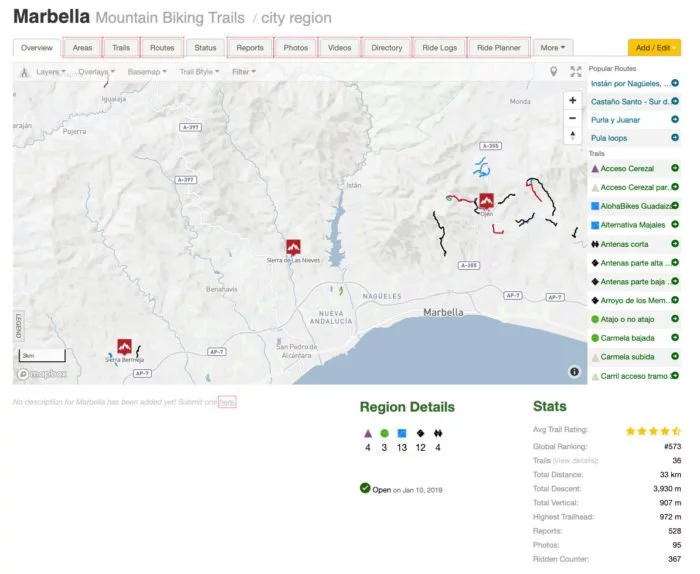
Se trata de una base de datos, y para que funcione lógicamente tiene que haber datos almacenados. Desgraciadamente en mi zona no hay mucho trabajo alrededor (no hay que olvidar que esto está realizado por la comunidad), por lo que tampoco he tenido mucha oportunidad de probarlo. Si entro en la web de Trailforks y busco rutas en mi zona desgraciadamente no encuentro nada.
Es la parte específica de «Trails» del menú de la derecha donde las puedes ver. Hay varias en la zona de Ojen, pero con mucha separación. El resumen es que son 33km lo que aparece en base de datos.
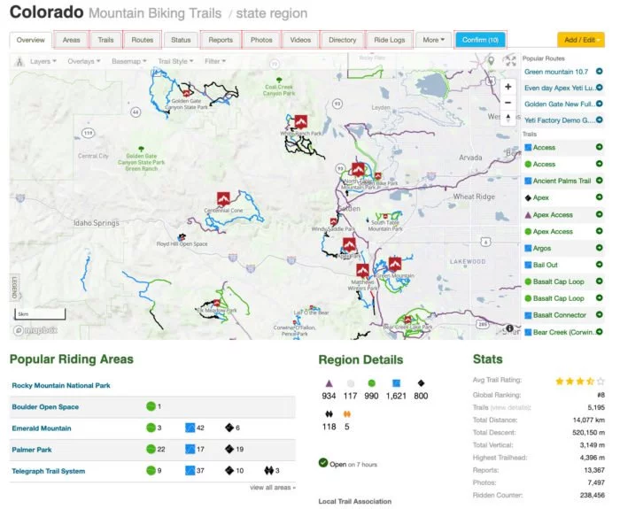
Sin embargo si nos vamos a otra zona… qué se yo, una parte de Colorado donde hay mucha pasión por la bicicleta de montaña, la cosa es muy diferente.
Muchos más senderos catalogados y 14.000km de rutas.
ForkSight funcionaría en el caso de pararnos en algún cruce en el que uno de esos senderos estuviese presente. La idea es muy buena pero el problema al que se enfrenta es depender de un servicio externo que además se nutre de los usuarios. Y si no hay usuarios en la zona… no hay ninguna información.
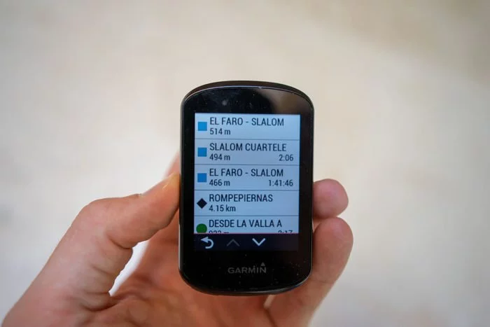
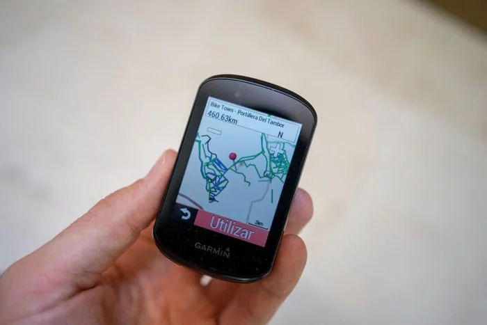
Aún así aquí tienes un ejemplo de lo que te podrías encontrar. Simplemente he hecho una búsqueda de rutas de montaña en la zona de la sierra norte de Madrid, esto es el listado que aparecería en tu pantalla.
En ese listado puedes buscar las diferentes opciones que están catalogadas por su nivel de dificultad, longitud y en algunos casos el tiempo estimado para completarlas.
Seleccionando el sendero podrás ver cómo es y a dónde se dirige, así como las cosas que hay a su alrededor. Si hay muchas rutas en la zona quizás pueda ser algo lioso, pero con un poco de cuidado y tras acostumbrarte a cómo se muestra cada una lo verás bastante claro.
La idea es buena, pero su utilidad real depende de lo que tengas cerca. Puedes echar un ojo en la web de Trailforks y ver qué es lo que te encuentras. Y si ya de paso te das de alta en la aplicación y empiezas a marcar rutas, pues más cosas que podrán aparecerle en un futuro a tus compañeros ciclistas.
Buscar mi Edge
Por último está la función de «Buscar mi Edge» que, aunque es perfectamente válida para usar en cualquier momento quizás es en ciclismo de montaña donde más sentido tiene (por los baches, caídas, etc.).
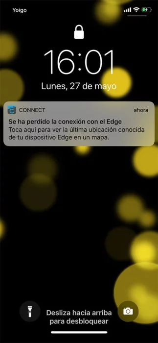
Es mucho más sencillo de lo que pueda parecer. Simplemente quedará registrado el momento en el que el Edge 530 y tu teléfono móvil han perdido la conexión. En la pantalla del teléfono aparecerá una notificación indicando que el Edge se ha desconectado, que también hará que vibre cualquier reloj inteligente que lleves en la muñeca para advertirte.
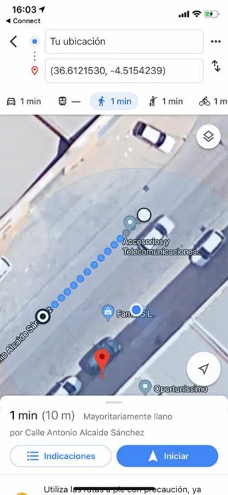
Si en las opciones del dispositivo seleccionas «Última ubicación conocida» te mostrará en Google Maps dónde perdieron la conexión tu Edge con el teléfono móvil.
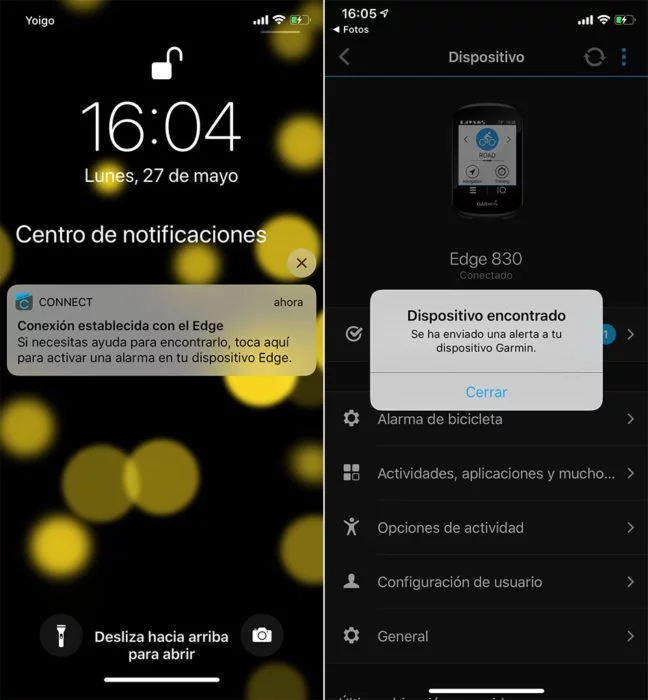
Tan sólo tendrás que dirigirte a ese lugar y esperar a que tu teléfono y el Edge vuelvan a conectarse. ¿Que es una zona de matorrales y no lo ves a simple vista? Puedes hacer que el Edge emita un sonido de alarma que te ayude a localizarlo.
Lo único que te queda es rezar para cuando vuelvas al lugar donde lo has perdido, siga allí esperándote…
ClimbPro
La función ClimbPro ya la vimos con anterioridad en otros dispositivos. Se estrenó con el Garmin Fenix 5 Plus. ClimbPro separa las principales subidas de tu ruta y las muestra de forma separada en forma de perfil de ascenso.
Para que se muestre es necesario que estés recorriendo una ruta previamente cargada ya que lógicamente el Edge tiene que saber a dónde te diriges para poder mostrarte la información de las subidas. Por tanto si no cargas una ruta no aparecerán los detalles de las subidas incluso aunque delante tengas el Tourmalet.
A la hora de cargar la ruta, podrás ver el listado de subidas a las que te vas a enfrentar desde las opciones de la ruta, en el menú de ascensos.
En la parte superior verás el resumen de total de metros que vas a ascender, en cuantas subidas principales y cuántos kilómetros vas a estar sufriendo. Y en el listado inferior el desglose de cada una de ellas con la información de a partir de qué kilómetro comienza la ascensión, cuál es la pendiente media y cuál la longitud de la subida.
Esa misma pantalla la podrás ver durante el entrenamiento, sabiendo la distancia restante para la próxima subida pronunciada, eliminándose aquellas por las que ya has pasado.
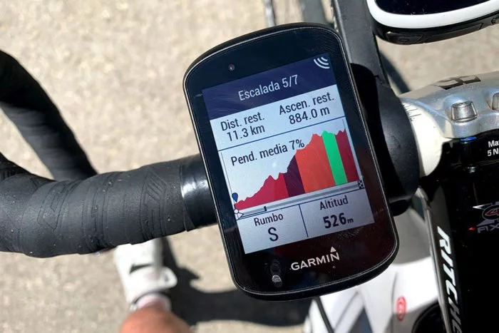
Cuando estés realizando la ruta y te aproximes a la subida se mostrará la pantalla de ClimbPro. En ella te indica cuál es la distancia restante para completar la subida, los metros positivos que quedan por delante y el lugar en el que te encuentras.
La codificación de colores destaca las zonas más duras de la subida, dividiéndolas en diferentes categorías:
- Verde: Falso llano, de 0% al 3%
- Amarillo: Eso que dices que pica para arriba, del 3% al 6%
- Naranja: Pues no parecía para tanto, del 6% al 9%
- Rojo: Cuando sabes que te van a doler las patas, del 9 al 12%
- Rojo oscuro: «Yo no traigo desarrollo para esto, mejor me doy la vuelta», más del 12%
Se trata de una pantalla de datos más e incluye un par de campos de datos que puedes personalizar con la información que desees (para no tener que abandonar esa pantalla).
Eso sí, depende mucho de la calidad de la cartografía, en este caso de Garmin. En mis salidas me he encontrado que no está bien calculado y existen zonas en la gráfica donde aplica subidas y bajadas. La realidad es que es una subida constante. Por lo tanto no coinciden ni los metros positivos restantes ni el perfil exacto de la ruta.
Sin ir más lejos la ruta que he hecho este fin de semana marcaba algo más de 3.000 metros positivos de ascenso. A la hora de la verdad han sido «sólo» 2.100. Por lo que cuando tocaba una subida de 1.500 metros no sabía si eran de verdad «o de artificio».
Pero bueno, aunque los datos no eran certeros en mi caso particular es una ayuda de agradecer, sobre todo porque ves lo que te queda en esta subida y en cualquier momento podrás saber qué es lo que queda por delante, aunque sea simplemente de modo «aproximado».
Junto con ForkSight es una de las novedades que más me gustan de los nuevos Edge. No sólo porque porque te ayuda a ver lo que queda por sufrir a continuación, también porque mentalmente es una ayuda el poder separar una ruta dura en diferentes porciones.
Métricas de rendimiento dinámicas
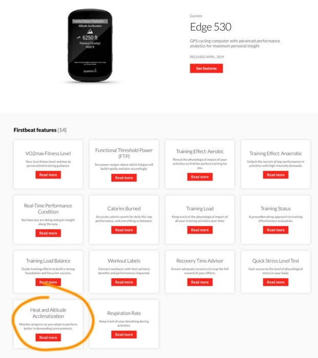
El Garmin Edge 530 ahora tiene métricas de rendimiento, pero con ajuste dinámico dependiendo de en qué condiciones hemos realizado el entrenamiento. Esto es una característica que viene directamente de Firstbeat (como el resto de los algoritmos de cálculo que utiliza Garmin).
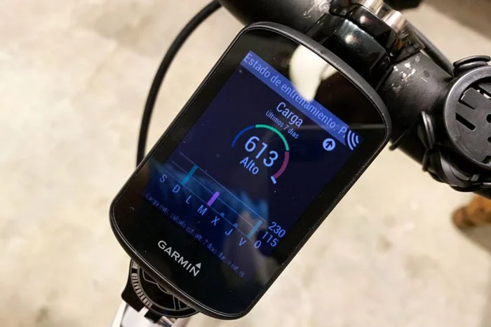
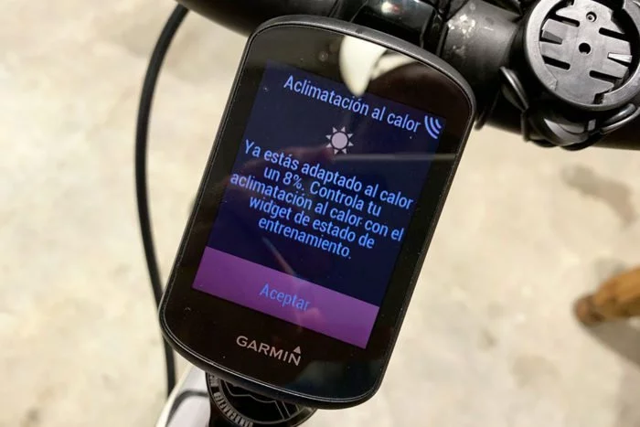
A la hora de calcular el estado de entrenamiento, aplicará factores de corrección cuando hay cambios importantes en valores de temperatura, humedad o altitud.
Por ejemplo para la aclimatación a la temperatura tendrá en cuenta cambios notables a partir de 22ºC. Es decir, tiene que haber un cambio importante, por ejemplo de estar entrenando a 18ºC habitualmente y de repente que tu próximo entrenamiento sea a 26ºC. Si te pasas entrenando todo el verano con esos 26ºC, no mostrará ninguna información de aclimatación, porque evidentemente ya estás acostumbrado al esfuerzo en esas condiciones.
Lo mismo ocurre con la altitud, donde los cambios tienen que ocurrir a partir de 850m. Las condiciones son las mismas, tiene que existir un cambio importante en las condiciones del entrenamiento, como estar siempre entrenando a nivel del mar y un día hacer una salida a 1.500m de altitud.
Nutrición e hidratación
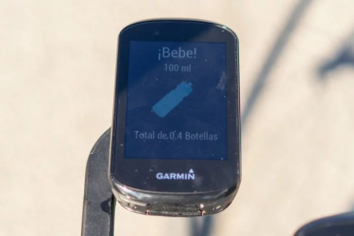
En primer lugar tenemos los avisos de nutrición e hidratación. Dirás que ya estaban disponibles antes a modo de alerta, y tengo que darte la razón. Siempre ha sido posible establecer una alerta que te recordase comer o beber cada 10 minutos o el tiempo que estimaras oportuno. Esto es distinto.
Ahora es posible establecer ambos avisos de forma inteligente. La frecuencia de las alertas dependerán de la configuración que hayas introducido en tu perfil (altura y peso), de los datos de temperatura y humedad actuales (que se ha obtenido a través de la conexión con el teléfono móvil y del termómetro interno) y de la intensidad del ejercicio.
No debemos olvidar que se trata simplemente de recomendaciones, no quiere decir que tengas que seguirlas al pie de la letra. Si tienes otro plan, como parar a comer en 30 minutos o llevas un plan de carrera específico, lógicamente tú sabes más que el Garmin.
Y si no sirve para recordarte cuándo y cuánto debes beber y comer, al menos que te sirva para darte cuenta de que comes muy poco cuando sales con la bici.
Esto está unido al seguimiento de hidratación y nutrición que puedes hacer cuando terminas un entrenamiento (la pantalla sólo aparece para entrenamientos de más de 90 minutos). Al completar el entrenamiento se mostrarán las pantallas donde te pedirá que introduzcas lo que has consumido durante tu salida.
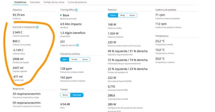
Esos datos también se sincronizarán a Garmin Connect donde podrás comprobar que casi siempre bebes y comes bastante menos de lo que deberías.
No es algo que vaya a cambiar totalmente tu entrenamiento o tu rendimiento, pero sí es un buen recordatorio de buenas prácticas que debes seguir y no está de más que apuntes lo que has consumido durante la salida para que, con respecto a las sensaciones que tengas después de un entreno largo, puedas modificar tu estrategia de nutrición e hidratación para futuros entrenamientos o competiciones.
Alarma anti robo
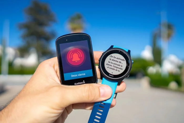
Hay una nueva función que hace uso de los acelerómetros internos que tiene el dispositivo. Se trata de una función de alarma que te alertará si, una vez activada la función, hay algún tipo de movimiento en la bicicleta.
No se trata de una alarma terriblemente sonora, sino que está más bien pensada para cuando haces una parada en mitad de una ruta y te alejas unos metros de la bicicleta. Si alguien la mueve o la toca, la alarma se activará y el Edge comenzará a emitir un sonido (si bien no de forma demasiado elevada…).
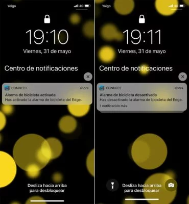
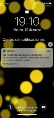
De todos los eventos que suceden con la alarma habrá notificaciones en el móvil. Así que sabes en todo momento si la alarma se ha activado o desactivado.
Y como son notificaciones se mostrarán también en cualquier reloj inteligente que lleves (ya sea de Garmin o cualquier otro). Por lo tanto también vas a tener un aviso en cuanto haya un movimiento en la bicicleta.
¿Va a prevenir que te roben la bicicleta? En absoluto, pero sí es una función que puede resultar útil si has parado un momento para ir al baño, a comprar agua o a tomarte un café y no estás junto a la bicicleta en todo momento.
Como digo no es que el sonido de aviso sea estruendoso o que se entere todo el mundo alrededor, pero el mensaje en el móvil siempre es un detalle y aunque no demasiado fuerte, siempre es esto mejor que nada. Lo normal es que no te encuentres demasiado lejos de la bici, pero sí quizas pendiente a la charla con la grupeta, y te despreocupes un poco. El aviso tanto del Edge como del teléfono te alertarán en cuanto se produzca un movimiento.
Curva de potencia
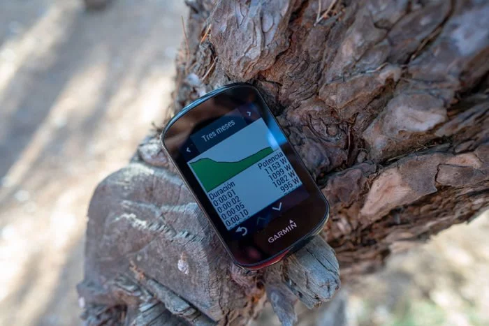
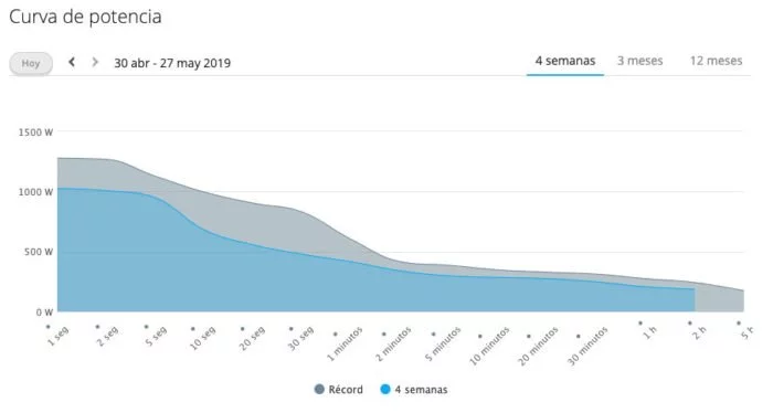
La curva de potencia es algo similar a lo que podemos encontrar en aplicaciones como TrainingPeaks, Golden Cheetah o similares. Si bien en este caso donde se muestra es en la pantalla del Edge.
Te pongo la imagen del Edge 830, porque por algún bug presente en el firmware del Edge 530 se desplaza automáticamente a la parte inferior de la pantalla, algo que espero Garmin corrija en la próxima versión de Firmware.
Puedes ver curva de potencia de un mes, tres meses y un año junto con los datos y la duración del esfuerzo.
Personalmente creo que los datos que podemos ver en la pequeña pantalla del Edge 530 no aportan demasiado, pero al menos podemos encontrar el mismo informe en Garmin Connect donde podemos pasar el ratón y ver los detalles de forma más exacta.
No quiero detenerme en exceso en esta sección, no porque no haya cambios notables en el Edge 530 con respecto al Edge 520 (me olvido del Edge 520 plus), sino porque no quiero alargar esta prueba innecesariamente.
El Edge 530 dispone de un mapa completo del continente. En el caso de los dispositivos comprados en España incluye por tanto los mapas de toda Europa (recuerda esto y mucho ojo con las compras a vendedores de fuera de España… todos los enlaces que yo facilito incluyen mapas de España y Europa).
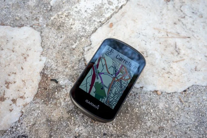
El mapa contiene información de todas las calles y carreteras, por lo que al realizar una ruta de navegación te indicará que debes girar en la calle tal o tomar la tercera salida de la rotonda.
La unica diferencia con respecto al Edge 830 es que en el caso del Edge 530 no podemos crear la ruta desde el dispositivo, sino que debemos enviarla desde Garmin Connect o cargar el archivo de la ruta de algún servicio externo (Strava, Wikiloc, del organizador, etc.). Tampoco hay información de puntos de interés (POIs o PDIs), por lo que tampoco podemos crear una ruta desde donde nos encontramos al supermercado más cercano, o que nos lleve a una gasolinera.
¿Presenta esto algún problema de uso? Pues todo depende de cómo sea tu navegación. Si normalmente sales con una ruta ya pensada, la habrás creado o cargado directamente desde el ordenador y la guía será exactamente la misma en el Edge 530 que en el Edge 830.
Sin embargo si te mueves por zonas no conocidas, no tienes acceso fácil a ordenador o teléfono o haces mucho cicloturismo entonces sí necesitarás las posibilidades de cálculo de rutas que ofrece el modelo superior.
No quiere decir que no puedas hacer navegación a un punto determinado sin haberlo previsto con anterioridad. En el caso del Edge 530 podrás hacerlo pero no introduciendo una dirección o un POI, sino que tendrás que abrir el mapa y desplazar el cursor al punto elegido para indicarle al Edge 530 dónde quieres dirigirte.
¿Ha quedado esto claro? Bien.
Independientemente de esto, donde más notamos el salto al Edge 530 es que ahora el procesador es mucho más rápido. Eso significa que cuando cargamos una ruta sólo necesitamos unos segundos para poder comenzar la navegación. En los Edge 520 y Edge 520 plus podríamos estar hablando tranquilamente de minutos.
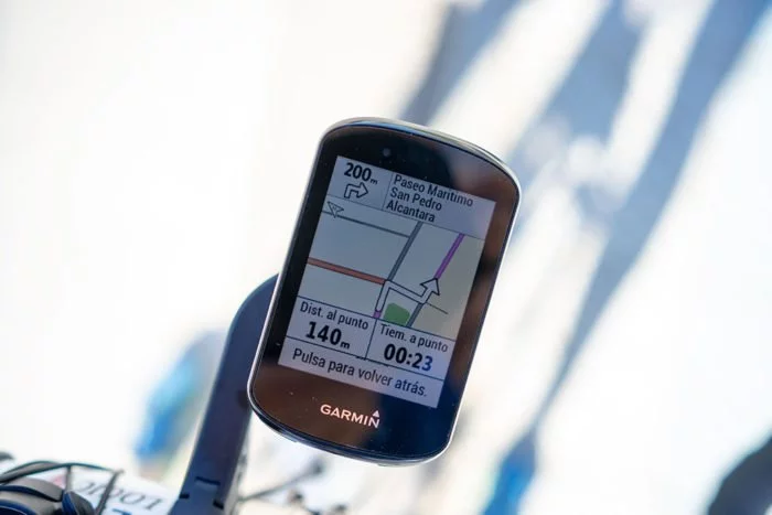
Por supuesto tendrás aviso de giro antes de llegar a una intersección junto con la distancia restante para el giro.
La indicación de giro se muestra independientemente de que estés en la pantalla del mapa o en cualquier otra pantalla de datos.
Si por el motivo que sea no tomas ese desvío el Garmin Edge 530 tratará de buscarte una alternativa. Puede ser simplemente dar la vuelta cuando sea posible o recalcular la ruta para llevarte a tu destino.
Es decir, no es como la navegación simple del reloj que simplemente te indica en qué dirección está la ruta, sino que te crea una nueva ruta para que encuentres el camino adecuado.
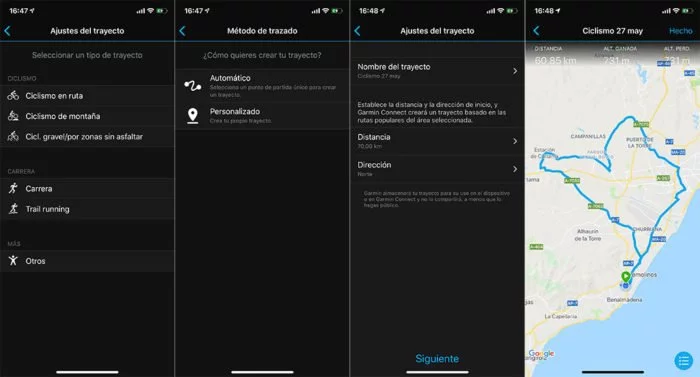
Por último recordarte que la aplicación de Garmin Connect en el teléfono también es capaz de crear rutas de forma rápida con las mismas posibilidades que ofrecen el Edge 830 y Edge 1030, indicando la dirección donde dirigirte y la distancia aproximada a cubrir.
La creación de rutas de ida y vuelta está bastante bien resuelta. Quizás conociendo las carreteras no serían los mismos recorridos que yo usaría, pero están bien elegidas.
Hay también la posibilidad de crear una ruta de forma manual marcando los puntos uno a uno, pero de momento no he tenido buenos resultados y creo que Garmin debe trabajarlo un poco más.
GPS
Generalmente no suelo hacer comparativas de GPS para los ciclocomputadores, pues es algo que por su ubicación en el manillar y el tamaño del dispositivo no suele presentar ningún tipo de problema salvo fallos esporádicos.
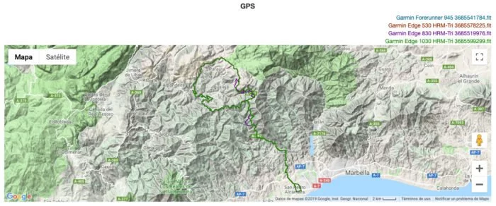
No obstante el caso del Edge 530 (y del Edge 830) es diferente. En primer lugar porque Garmin está comenzando a trabajar con el chipset de Sony, con el que todos los fabricantes han tenido sus más y sus menos debido a lo agresivo que es en el consumo de batería -que es su mejor baza-. Y en segundo lugar porque mientras los he estado usando he estado viendo cosas extrañas que se achacaban al GPS.
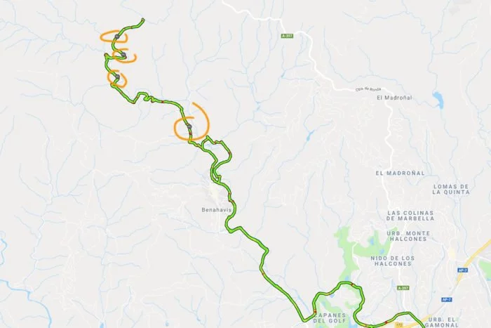
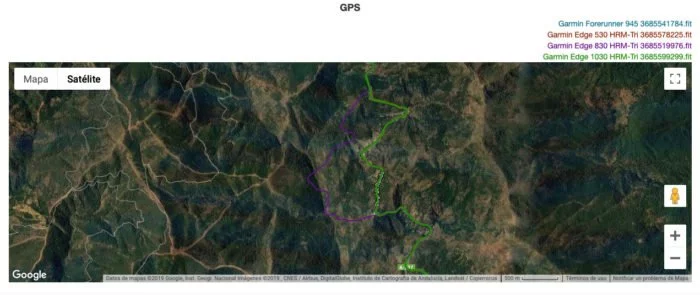
Por ejemplo en esta salida de bici, en la primera subida y llegando un momento determinado el Edge 830 marcaba insistentemente que estaba fuera de la ruta marcada. Sí, era una zona montañosa, pero para nada complicada.
Llevaba diferente configuración entre el Edge 530 y el Edge 830. El primero estaba configurado en GPS + GLONASS mientras que el segundo en GPS + Galileo.
No hace falta ni hacer zoom para ver dónde han estado los problemas. De hecho no fue un fallo puntual sino que se prolongó durante bastantes kilómetros.
Aquí puedes ver la primera zona donde el Garmin Edge 830 se perdió totalmente. Y no estamos hablando de uno o dos metros fuera de ruta, es que estaba muy fuera de ruta. Insisto en que no se trata de un cañón muy escarpado ni con problemas de cobertura, de hecho ninguno de los otros tres dispositivos se perdió.
Y tal y como el problema vino, se fue, recuperando de nuevo la misma ruta.
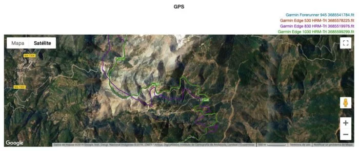
Más adelante volvió a hacer lo mismo, pero en una distancia mayor. Nuevamente sólo el Edge 830.
Finalmente opté por cambiar su configuración a GPS + GLONASS al igual que el Edge 530, y no volvió a dar más problemas.
No se trata sólo de un fallo de ubicación, también recibí varios mensajes de que había perdido señal de satélites al inicio de la ascensión en lugares donde no había ningún motivo para que ocurriera. Durante el resto del entrenamiento y una vez cambiado a GPS + GLONASS no hubo ningún otro problema.
He hecho varias pruebas tanto con el Edge 530 como con el Edge 830 configurando GPS + Galileo y el fallo se ha repetido, por tanto es algo en lo que Garmin debe trabajar. No obstante dejando la configuración en GPS o GPS + GLONASS no ha habido ningún incidente, por lo que no se trata de un problema de chipset o de antena sino simplemente algo que Garmin puede (y debe) corregir en sucesivas actualizaciones de firmware.
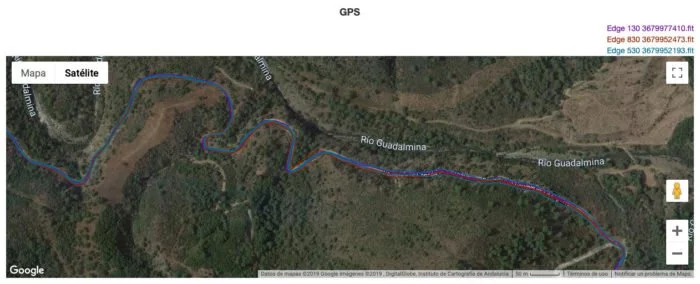
A continuación te muestro otro entrenamiento en un día diferente, en este caso en bicicleta de montaña.
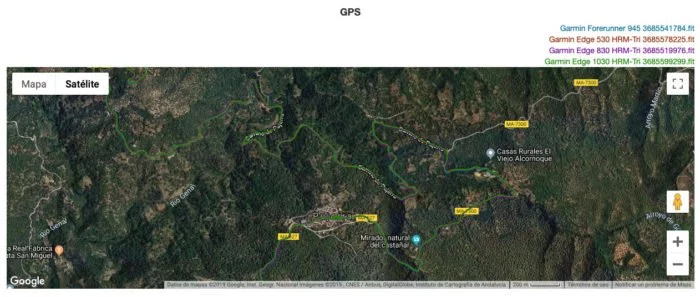
En este caso no me percaté de ningún problema ni en la subida ni en la bajada. La ruta se realizaba paralela al río y el camino de ida y vuelta se realizaba por el mismo recorrido.
Este es uno de los tramos más revirados y, como puedes ver, no se aprecian errores destacables.
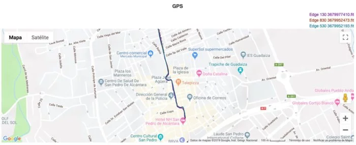
Tampoco al circular dentro de población entre edificios, que es lo que típicamente puede presentar mayores problemas.
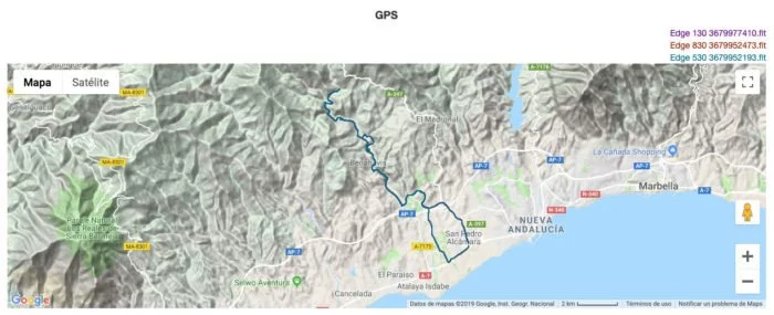
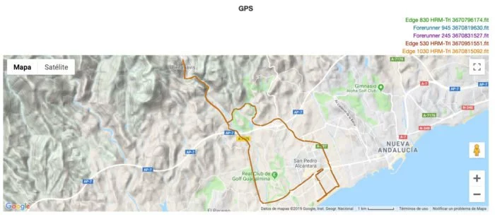
Un tercer ejemplo, circulando mucho más rápido (bici de carretera, pendientes no demasiado pronunciadas).
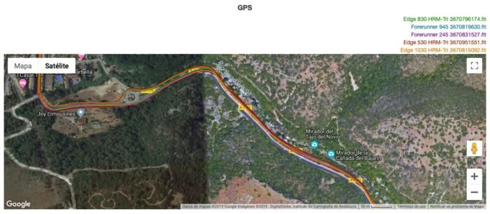
De nuevo sin problemas destacables, ni siquiera en la zona más complicada por tratarse de un cañón estrecho. Por esta carretera se pasa tanto a la ida como a la vuelta, y no hay ninguno de los tracks que se haya desviado de esa zona.
¿Qué hay de la elevación? Pues en general no he tenido ningún problema. Nunca he realizado ninguna calibración de los dispositivos antes de comenzar la ruta, por lo que las gráficas no coinciden exactamente al mismo metro de salida y de llegada, pero son todas perfectamente paralelas en todo momento (salvo en el caso del Garmin Forerunner 245, que no cuenta con altímetro barométrico).
Aquí tienes otro ejemplo, también totalmente perfecto.
En definitiva, salvo los problemas que hay actualmente en la versión de firmware 3.20 con la configuración de GPS + Galileo, no hay ningún otro detalle que me preocupe. El seguimiento es bueno siempre que seleccionemos GPS o GPS+GLONASS y no hay fallos de señal o errores en los tracks.
Los datos de altímetro son correctos en las dos unidades y concuerdan en todos los dispositivos, por lo que tampoco es algo que me preocupe.
Aún así espero que Garmin pueda corregir ese error de firmware en su configuración GPS + Galileo porque, a priori, es la configuración que más exactitud puede ofrecer. Si bien te recuerdo que en caso de rodar por zonas sin problemas de cobertura con seleccionar sólo GPS tienes más que suficiente, y el consumo de batería no será tan alto.
Comprar Garmin Edge 530
Espero que este análisis completo te haya ayudado a decidir si es un dispositivo válido para ti o no. Todo el trabajo que realizo puedes consultarlo sin ningún tipo de coste, pero si quieres apoyar la web y con ello el trabajo que realizo, la mejor forma de hacerlo es comprar tu nuevo dispositivo a través de los enlaces que facilito a continuación. Y si no lo compras hoy, ¡acuérdate de pasar por aquí cuando vayas a hacerlo!
A través de estos enlaces no sólo conseguirás un precio muy competitivo y la mejor atención al cliente, sino que además yo recibiré un pequeño porcentaje sin que a ti te cueste ningún desembolso adicional. Es eso lo que permite que pueda seguir ofreciéndote pruebas como esta en la página. No lo vas a comprar, ya lo tienes o Amazon no es una opción; ¿pero te gustan las pruebas que realizo y quieres mostrar tu apoyo a la página? Entonces considera suscribirte como miembro VIP. Por encima de todo estarás ayudando a soportar la página, pero además disfrutarás de beneficios exclusivos.
Si tienes dudas, recuerda que tienes la sección de comentarios en la parte inferior, donde trataré de resolver todas tus preguntas.
Mi opinión
Con el Edge 530 Garmin ha creado un auténtico dominador del mercado. Por los 299€ que cuesta no existe ningún dispositivo que se acerque mínimamente a lo que ofrece este nuevo modelo de Garmin.
Es un auténtico puñetazo encima de la mesa, y a la vez un nuevo clavo en el ataúd para sus competidores, que cada vez eran menos.
El nivel de prestaciones que ofrece es impresionante y cualquier otro dispositivo de la competencia palidece a su lado. No sólo por número de funciones, también por su precio. Por ejemplo está el caso de Wahoo, que presentó su ELEMNT ROAM una semana más tarde que Garmin con la incorporación de la pantalla a color como su principal novedad, a un precio de 349€. Pero sin mapas, sin la misma velocidad de procesador y sin muchas de las prestaciones que puedes encontrar en el Edge 530. ¡Ah, y se me olvidaba mencionar que el Garmin es 50€ más barato!
Da lo mismo con qué dispositivo lo compares y de qué marca: Polar, Sigma, Bryton, Mio, Hammerhead… Ninguno se acerca ni remotamente al Garmin. Puedes dudar por ejemplo con el ciclocomputador de Stages si lo que buscas es la plataforma de entrenamientos tan extensa que tiene, pero es un uso muy residual.
La relación precio/prestaciones es tan buena que incluso puede ser que en Garmin se terminen arrepintiendo. A día de hoy el Edge 530 tiene más prestaciones que el Edge 1030 (que vale casi el doble), y la diferencia con respecto al Edge 830 es muy pequeña. Si eres capaz de soportar el tacto de los botones del Edge 530, que es lo único que no me ha gustado, no veo mucho motivo para hacerte con cualquiera de los otros antes de este Edge.
Es cierto que hay algunas cosas mejorables. Tenemos algún bug inicial, como los problemas de GPS cuando se selecciona satélites Galileo o lo malas que resultan las traducciones. Tampoco ayuda que Garmin parece que no termina de coger el punto a la hora de diseñar unos pulsadores con un buen «feedback». Y me gustaría que TrailForks tuviese una base de datos mucho más extensa, pero eso ya no depende de Garmin sino de un servicio externo.
Pero a pesar de todo esto el Edge 530 es un dispositivo magnífico en el que los aspectos positivos brillan muchísimo más que los negativos.
Te lo puedo resumir en que, probablemente, el Edge 530 es el mejor ciclocomputador hasta la fecha. Y por sólo 299€.
¡Gracias por leer!








Hola Eduardo,
Muchas gracias por tu análisis.
La pregunta que te voy a hacer es de novato 100% te pido pues que no lo tengas en cuenta.
¿En qué se diferencia un ciclocomputador de un smartphone?
¿Para que sirve el ciclocomputador? ¿no puede hacer un smartphone un trabajo similar? ¿sabiendo ademas que complementos (cadencia, potencia, etc) tienen bluetooth y se pueden conectar con el teléfono sin problema o que los mapas los puedes tener en wikiloc u otras plataformas?
Gracias,
Pues lo principal es para qué está diseñado. Si haces salidas muy esporádicas, cortas y tranquilas un teléfono te puede servir sin mayor problema. Pero como aumentes un poco más el uso es totalmente distinto.
Para empezar la autonomía, un teléfono con la pantalla encendida ni se acerca a un ciclocomputador. Después la tecnología usada para la pantalla, el teléfono a pleno sol es muy difícil de ver. La resistencia, con un ciclocomputador no tienes problemas de agua, sudor, restos de geles, etc. A un teléfono al que le va a estar cayendo sudor constantemente o que puedes tocar con las manos mojadas no le doy más de una semana de vida. Y son sólo algunos ejemplos.
En definitiva, están diseñados para ser usados de una forma determinada; los teléfonos se diseñaron para otras cosas.
Muchas gracias Eduardo por el Análisis, estupendo como siempre. Y te agradezco que no seas como todas esas páginas de chollos y demás que hay por ahí, todos dicen hacer el mejor análisis y lo único que hacen es repetir como papagayos las hojas de características. Pero aquí lo fundamental es cómo funciona y lo que aporta, y eso sólo nos lo das tú.
Muchas gracias Gabriel
Hola!
Buen análisis, a la altura del conocido DC Rainmaker.
Hay un par de datos que no aparecen en el análisis, desconozco si es por no hacerlo mas extenso o porque que se te ha pasado por alto.
1- Otra de las diferencia entre el garmin 530 y 830 es la pagina del perfil de altura del track. En el 830 puedes personalizar los ejes X e Y por lo que puedes ver el perfil de una ruta de 100km y en que punto te encuentras. En el 530 solo puedes ver los 2km que vienen a continuación, lo cual es inútil. Se rumorea en el foro de garmin que en la proxima actualizacion se podra modificar el eje X en el 530
2- La versión pack incluye unos sensores, cadencia, velocidad y pulso de nueva generación.
Saludos
Gracias Mick, buen aporte. Había pasado por alto el tema de la gráfica de altitud, y mira que en el artículo de presentación ya me lo habían preguntado… ya lo he añadido.
Que lo incluyan en el Edge 530 no lo veo del todo claro, tendría que ser por menú y hasta ahora nunca hicieron nada parecido. Y estoy de acuerdo contigo, el perfil de elevación para 2km no sirve para mucho, especialmente cuando para eso ya tenemos ClimbPro en los nuevos dispositivos.
En cuanto a lo de los sensores, la verdad es que no tengo ninguna sección específica donde meterlo, pero tienes razón en que al menos haré una pequeña mención en el artículo.
Gracias de nuevo
Buen análisis.
Yo tengo un Edge 530 y, lo que echo en falta, o no logro encontrar es:
– Acceder rápidamente a establecer un porcentaje de la retroiluminación. Que en los modelos anteriores era mediante una pulsación en el botón de encendido y, en el 530 hay que andar navegado por los menús, lo cual lo hace muy difícil en situaciones de oscuridad si hay que encender la retroiluminación y establecer un porcentaje de la misma.
– El calibrado manual de la altitud: En los otros modelos era pulsando la tecla enter desde la pantalla de datos. En este no logro encontrar como hacerlo, que no sea fijando una ubicación conocida y estando en el radio de la misma.
Por lo demás, para mí es el mejor modelo que he tenido (500, 510, 520 y 520 Plus).
Un Saludo.
Hola Eduardo,
Los enlaces que has puesto para comprar el dispositivo no funcionan. Mira a ver si lo puedes arreglar. ????
Muy raro… Cual no te funciona? Porque yo acabo de probarlos y me van bien. ¿Tienes algún bloqueador de publicidad?
Muy buen análisis
Yo lo que echo en falta o no logro encontrar en mi Edge 530 es lo siguiente:
– El acceso rápido a la retroiluminación mediante un toque al botón de encendido. En los modelos anteriores esto permitía encender o apagar la retroiluminación en condiciones de poca visibilidad. Ahora hay que ir navegando entre los menús para hacerlo.
– No logro encontrar como hacer la calibración manual del altímetro. En los modelos anteriores se hacia presionando el botón de enter desde la pantalla de datos. La opción del calibrado automático a partir de un punto de ubicación si está, pero no es cuestión de estar agregando puntos de ubicación. Yo prefiero la manual.
Por lo demás, me parece el mejor Garmin de todos los que he tenido hasta la fecha (500, 510, 520 y 520 Plus), es muy rápido en su procesamiento, cosa que se nota en el encendido.
Un Saludo.
Si no recuerdo mal tienes acceso a la configuración de pantalla desde el menú de acceso rápido. Pero recuerda que el Edge 530, a diferencia del 520, tiene sensor de iluminación por lo que regula de forma automática la luz de pantalla.
En cuanto a la elevación, lo tienes en la página 7 del manual. Debería estar también en el menú de acceso rápido.
Buenas tardes, encantado con el artículo del 530, Mis preguntas son:
1: en el sensor de cadencia que tamaño tiene, ya que ni el fabricante lo específica, y entre mi biela i el tirante inferior de la rueda no me cave nada por encima de los 6mm de espesor, i si el mismo se puede agarrar con bridas para darle mejor confianza de agarre ( mi bicicleta es una GIANT XTC Adbanced 29 2 GE Con Bielas XT, otra opción es ponerlo dentro el buje pero dudo de si cabe o funcionara correctamente. ¿Cuáles son las medidas? ¿Hay alternativas? (el sensor combinado de sigma con imanes en rueda trasera i biela no es una opción estoy harto de fallos).
2: En el manual del 530 Pagina 10 pone que puedes navegar a una ubicación con opción de buscarla en el mapa o desde una ubicación guardada (Cita: 1 Selecciona Menú > Navegación. 2 selecciona una opción: • Para desplazarte a una ubicación del mapa, selecciona Buscar en mapa busca una ubicación (Buscar en el mapa, página 12) y mantén pulsado. • Para desplazarte a una ubicación guardada, selecciona Ubicaciones guardadas, selecciona la ubicación y, a continuación, selecciona Detalles. 3 selecciona Ir. 4 sigue las instrucciones que se muestran en la pantalla para llegar a tu destino). Esto es casi una función de navegación a un lugar conocido como es tu punto de partida, Casa u Hotel. ¿Has experimentado con dicha función?
3: En muchos casos realizo rutas sin abrir una actividad, pero mie interesa que registre solo los km totales sin preocuparme de encender i configurar el Edge, con la nueva memoria del sensor de velocidad. Como funciona exactamente
4: ¿Obtendré mejor experiencia que con mi rox 11, me da problemas en conectividad con el móvil por Bluetooth?
Gracias de antemano.
No tengo datos de medidas del sensor.
Como detallo en la navegación, se puede pinchar en cualquier lugar del plano para navegar ahí, pero no es que sea la forma más sencilla de navegar… Moverse en el plano no es como hacerlo en Google Maps en el móvil.
No hace falta tener nada configurado, simplemente inicias la actividad y guardas todos los detalles del entrenamiento.
Yo no he tenido ningún problema de conexión con el móvil en todos estos días que he estado probando ambos dispositivos. Una vez emparejados la sincronización era correcta.
Gracias
Buenas tardes, muy buen articulo.
Tengo una duda con los perfiles de actividad, me gustaría saber si el 530 se pueden crear perfiles de actividad que no sean de ciclismo. O bien se puede hacer utilizando alguna aplicación de Garmin IQ.
Muchas gracias.
No, todos los perfiles que crees son de tipo ciclismo. Pero después de sincronizar podrías cambiar el tipo de actividad.
Desconozco si hay alguna aplicación para lo que buscas.
Hola buenos dias!!! Decirte q he llegado a esta pagina de casualidad, pero me gusta mucho la forma que tienes de contar las cosas, directa y clara. Ademas q muy detallista.
Pues queria consultarte si este modelo de ciclocomputador gps de garmin o algun otro del estilo (520 o similar) tiene la posibilidad de configurar diferentes perfiles de deportes como tiene el polar m460 q es el q tengo actualmente.
Decirte q estoy contento con él, pero los amigos y compañeros de grupeta me hablan maravillas de los garmin y tengo curiosidad, aparte q como capricho, podria hacer la inversion para adquirir uno, pero me echa para atras no saber si puedo utilizarlo para otros deportes, ya q aunq mayoritariamente sea el ciclismo lo q mas practico, tambien suelo hacer senderismo, correr e incluso patinaje en linea, ademas de btt y ciclismo indoor con los rodillos.
La unica pega q tengo con el polar es q tiene pocos datos por pantalla y continuamente tienes q estar cambiando de pantalla para verlos, cosa q con los garmin no pasa porq creo haber visto q entran bastantes datos.
Un saludo y gracias por la respuesta
Gracias Ismael. Pues ya sabes, acuérdate de la página para la próxima.
En los Edge sólo es posible crear perfiles para ciclismo, aunque podrás configurar multitud de datos. Lo único que debes tener en cuenta es que cuando se sincronice la actividad con Garmin Connect lo hará como si hubiese sido de ciclismo y podrás cambiarlo manualmente a lo que hayas hecho (por ejemplo senderismo). Pero no tendrás problema en tener creado diferentes perfiles de deporte.
Buenas noches Eduardo. La verdad que el artículo es espectacular, mi enhorabuena. No te dejas nada sin contar y no es un tostón a la hora de leerle entero. Aún así, sigo con una pequeña duda.
Hace poco empecé a andar en bici, y actualmente estoy utilizando como GPS el Garmin FR 235, y quiero comprarme un ciclocomputador, pero no logro decidirme entre el Edge 820 (199 euros en amazon) o este.
¿Qué recomendación me harías tu?
Un saludo y gracias de antemano.
Claramente el Edge 530. El Edge 820 no es que sea mal dispositivo, pero está lastrado por su procesador y cualquier operación que hagas en cuanto a navegación se hace muy larga. El Edge 530 es un salto importante y merece bastante la pena el desembolso adicional.
Recuerda hacer tu compra a través de los enlaces facilitados en la web, así estarás colaborando en el mantenimiento 😉
Hola Eduardo , para empezar quiero darte la enhorabuena por el trabajo qué haces y la dedicación a este tipo de dispositivos. Dificil es no tomar una decisión al adquirir uno de ellos leyendo tus pruebas.
Esta mañana he realizado mi primera ruta en BTT y al ver la actividad en la app de Garmin Connect me he dado cuenta que en la grabación de la ruta el dispositivo traza líneas rectas en las curvas, como si de atajos se trataran, sabes a qué se debe?.
Muchas gracias y un saludo.
Probablemente sea porque en la configuración de grabación de datos no lo tienes puesto en por segundos, y está grabando datos en intervalo «inteligente»
Es extraño, porque en la app de Garmin Connect me sale tal como te comentaba antes, pero en la web sale bien.De todas formas, en el Edge 520, la grabación la tengo en inteligente y me sale bien, según Garmin , en grabación por segundos dice que el consumo de batería es mucho mayor y ocupa bastante más espacio el archivo generado. Seguiré haciendo pruebas , muchas gracias por tu respuesta, si detectas alguna otra cosa o algún usuario, agradeceria los comentarios.Un saludo
No hay diferencia en el consumo de batería, es prácticamente el mismo.
Buenas tardes
Eduardo, enhorabuena por el trabajo que realizas, se nota que le dedicas tiempo y lo tomas en serio, cosa que sinceramente los lectores agradecemos.
Tras leer el articulo del 530 que me han recomendado ya tengo una muy buena idea de como va el dispositivo, pero he leído en la pagina oficial de garmin esta función: Trayectos (competición contra actividades anteriores) , sabes de que va? quiere decir que compites en ciertos trayectos o segmentos contra ti mismo sin necesidad de vincular la cuenta de strava? o se refiere al tratamiento de segmentos de strava que describes en articulo del 520 plus?
Muchas gracias, y mucho animo para seguir trabajando así.
de un lector del blog, un cordial saludo.
Es simplemente una opción para cargar un recorrido que ya has realizado e intentar batir tu tiempo. Si por ejemplo has hecho una salida de 70km en 2 horas y vuelves a repetirla te irá diciendo si vas por encima o por debajo de tu tiempo anterior.
Hola Eduardo,
Antes de nada, quisiera agradecerte los análisis tan completos que haces. Increíble.
Aquí van mis dudas: el Garmin 530…es compatible con el sensor H7 de Polar? Incluye la función Grouptrack y Livetrack?
Gracias de antemano.
Un saludo.
Respuesta positiva a las tres cuestiones.
Buenos días Eduardo.
En primer lugar me gustaría decirte que estoy con algunos de los comentarios que he leído sobre tus análisis de los dispositivos. Impresionante trabajo!
Tengo una duda que seguro tú me la sabes resolver.
Llevo un año dándole a la MTB y la verdad es que estoy enganchado por lo que voy a pasar de pantalla y comprar un GPS. este no es mi deporte principal por lo que busco algo económico y que pueda compaginarlo con otro de mis hobbies que es coger setas mientras me pierdo por los bosques.
Llevo un tiempo mirando dispositivos y la criba me dejaba entre el 820, 830 y el 530, y después de leer este artículo tuyo sobre el último, casi que me decanto por el. Pero antes de tomar esa decisión me gustaría preguntarte si en estos dispositivos existe la opción de «go to» qué se utiliza en los GPS de montaña para volver al punto de salida sin necesidad de ir por ningún camino o sendero.
Si estos dispositivos no la tienen por qué están enfocados principalmente a rutas existentes, me puedes recomendar algún dispositivo que me sirva tanto para la bici ( con medidor de cadencia pulsaciones etcetera) y para perderme por el bosque?
Muchas gracias de antemano y un saludo
Alexander
Te diría que el Edge 820 lo descartes, se nota mucho la velocidad a la hora de realizar cualquier proceso.
En cuanto a la vuelta a inicio, harán el cálculo basándose en caminos. No recuerdo que exista la función de mostrar símplemente la flecha para ir en línea recta.
hola, espectacular review del GPS.
como estoy en operación búsqueda y captura… parto de la base del 520 plus (150€) y el 530 lo mejor que he visto (sin entrar a detalles) esta en 250€. consideras que la diferencia no es considerable por lo que ofrece?
gracias
Hola Txetxu,
Gracias. Para los precios, puedes encontrar las mejores ofertas actualizadas en el artículo resumen de Black Friday. Y recuerda que comprando a través de los enlaces de la web estarás ayudando a la página.
En cuanto a Edge 520 Plus o Edge 530, sinceramente el 520 Plus no lo plantearía. Su problema es de falta de procesador, y a poco que se utilice la navegación o cualquier otra función que demande un poco se va a notar MUCHO.
El Edge 530 es mucho más fluido en todo, independientemente de todas las posibilidades extra. La realidad es que la diferencia es poca para lo mucho mejor que es el 530.
se me paso preguntar por la capacidad de la APP, graficos o datos que facillita por no endredar en el GPS
No tienes problema, lo tendrás todo tanto en la aplicación móvil como en la web, con estadísticas, gráficas, mapas, etc.
Hola, gracias por el análisis. No logro hacer que Trainingpeaks se cargue en el menú de Connect IQ como lo tenía en mi anterior 520 y así podía cargar los entrenamientos que me enviaba mi entrenador al TP directamente al Edge para hacer rodillo
TrainingPeaks ya no tiene aplicación de ConnectIQ porque ya está integrado en el sistema operativo de Garmin y realiza la descarga del calendario de forma automática.
estupendo articulo
Buenos dias, no logro enlazar la banda de frecuencia HRM-TRI con el 530, con el 935 me funciona, pero no con el 530. Puede estar vinculada a 2 dispositivos a la vez y funcionar simultaneamente? Gracias
Hola Vicente, yo creo que NO. No puede vincularse a 2 dispositivos a la vez. O con el reloj o con el ciclocomputador.
Sí, ANT+ permite conexiones ilimitadas entre dispositivos (es el Bluetooth el que no lo hace), por lo que puedes emparejarlo con ambos.
Gracias Eduardo, ya sé una cosa más. Me he confundido con Bluetooth. ????
Para eso estamos 🙂
Hola muy buenas. Magnifico análisis, muchas gracias. Tengo una duda, se que la diferencia entre el 530 y 530 mtb es que en el mtb ya viene precargada la aplicación de senderos y rutas de montaña pero, es el mismo dispositivo? He visto en los enlaces para comprarlo que nos aportas algo más barato el 530mtb pack que el 530 pack. Que diferencia existe entre los dos? Muchas gracias.
Gracias Salva.
No, en cualquier caso todos los dispositivos son iguales, con los mismos mapas y aplicaciones, no hay ningún cambio.
Lo que cambia en los packs es el contenido de los mismos.
El que es sólo dispositivo trae el Edge 530, un soporte de manillar y un soporte adelantado.
El pack performance incluye (además de lo anterior) sensores de velocidad, cadencia y pulso.
Y el pack MTB trae también sensor de velocidad, pero no de cadencia o frecuencia cardíaca. En su lugar incluye mando a distancia y funda de silicona, y el soporte frontal es diferente (permite variar el ángulo del mismo.
¡Gracias por ayudar a la página comprando a través de los enlaces!
Vale muchas gracias. Lo he mirado en la página de Bikeiin y lo que me ha confundido es que en las especificaciones te pone que trae gps, glonass…. y cinta de pecho, sensores de cadencia y velocidad. Imagino que estará mal. Gracias de nuevo
Sí, lo tienen fijado bajo «funciones» y se refiere a que permite conectar frecuencia cardíaca y otros sensores. Pero lo que incluye es lo que se ve en la imagen.
Hola!! Estaba pensando en adquirir un Garmin Edge 530 para salidas de Mountain Bike. Pero quería saber si es una compra útil ya que ya dispongo del reloj gps e inteligente Suunto Spartan Ultra. Muchas gracias!!
Sí, totalmente. No sólo por la comodidad de una pantalla mayor que está siempre visible con los datos, sino por las prestaciones de navegación que ofrece un dispositivo de este tipo.
compre 1 hace 3 meses y es muy completo y preciso pero me parece muy delicado porque se me cayo de la altura de la bicicleta y se daño quedo la pantalla negra y no se si lo cubra la garantia
Excelente análisis muchas gracias .pido un favor y como hago para saber los kilómetros que llevo en total ,osea si se van acumulando en el trascurso de cada recorrido. ,cordial saludo.
Menú, historial, totales. Ahí aparece el total de distancia para cada perfil.
Hola. Primero que todo gracias por tus análisis. Cuando tenga que renovar el GPS contaré contigo, ahora de momento me han regalado el Egde 530, y tengo una duda con su funcionamiento: Me han dejado un Fenix 3, que llevo en el muñeca, y el Edge 530 en el bolsillo y salgo a caminar por la montaña varias horas. Pongo los dos Garmins a gravar en el mismo momento. Al final del recorrido los dos me marcan la misma ganancia de altura y duración del recorrido, pero el Edge 530 me marca un 10% menos de distancia recorrida. En el Garmin Connect los dos tracks parecen los mismos y también aparece la diferencia en la distancia. Me pasa en todos los recorridos. Que podría ser? Muchas gracias por tu tiempo.
Llevando el Edge 530 en el bolsillo no va a recibir bien la señal. Desde lejos seguro que ambos tracks serán parecidos, pero te garantizo que si aproximas verás que en el caso del Edge habrá múltiples errores y cortes en los giros.
Uff, no se si es esto o no ya que el track parece sin cortes y muy paralelo al del Fenix. Aún estoy haciendo pruebas ya que algún dia el error entre tracks ha sido superior al 30%. Ahora he exportado los 2 tracks al Basecamp y aparece que la distancia de los dos tracks aproximadamente es la misma dentro del Basecamp (y diferente que la que indica el Edge i casi igual que la que indica el Fenix). Creo que es algún problema de visualización del Connect y del mismo dispositivo Garmin. Podría ser que calcule la ruta en plano sin tener en cuenta la inclinación? He buscado en internet y no encuentro ninguna opción para cambiar esto.
Si hay mucha (pero mucha) inclinación si es posible que haya variaciones entre calcular la distancia 2D o distancia 3D. El Fenix sí permite cambiar a calcular distancia 3D, en el Edge no está presente.
Buenas noches estoy dudando entre el Garmin 530 y wahoo me dicen que como mapas y navegación Garmin.Pero en sencillez y pantalla se ve muy bien wahoo pero en navegación algo flojo y mapas igual .Yo práctico tanto MTB como carretera cual me aconsejas
Cualquiera de los dos te va a dejar satisfecho. Si vas a hacer mucha navegación me inclinaría más por el Garmin, no tanto por los mapas o la navegación en sí sino por el resto de funciones adicionales como puede ser Climb Pro que créeme, se agradece bastante.
Buenas
Una consulta, porque si hago una ruta de ida y vuelta me marce menos km? ayer sali hice 24km en una rotonda di la vuelta a casa y me cuando llegue me marco31 o 36, no recuerdo. Sabes que tengo que modificar? para que lo marque todo.
GRacias
Pues lo siento, pero con esos datos poco te puedo decir…
edge 510
https://connect.garmin.com/modern/activity/3707538184?share_unique_id=2
edge 530
https://connect.garmin.com/modern/activity/5534240637?share_unique_id=4
Buenas
que datos necesitas?. he estado mirando una ruta del año pasado y de este con 2 garmin distintos un 510 y un 530(el que me falla) con el 530 me marca menos km que el garmin antiguo. Tambie si salgo hacer una ruta de ida y vuelta por la misma carretera no me da los km bien, me da menos km, si de ida hago 35 la vuelta debe ser 70, pue me marca menos km!!!.
Buenos dias.
Estoy pensando en comprar el 530 y tengo el 520 el cual me gasta casi el 80% en una salida de 4h
Del 520 tengo la banda del pecho para el pulso, sensor de velocidad , cadencia del 520 y el soporte para la bici.
¿Son compatibles todas con el 530?
Muchas gracias.
Sí, todos esos sensores son totalmente compatibles con el Edge 530.
Buenas Tardes Jesus,
He adquirido el garmin 530, y tambien los pedales Favero Duo y no consigo poder visualizar la potencia dual, en dos casillas potencia derecha e izquierda, se puede hacer?
Desde configuracion puedo modificar todas las pantallas que tengo, y en la de potencia, puedo poner a 3″ a 10″ etc, equilibrio me indica en porcentanje, he probado en todos los campos y consigo hacerlo.
Un saludo y muchas gracias.
No, la separación de potencia sólo la vas a ver en Garmin Connect, pero en el momento sólo vas a ver la potencia total. En el equilibrio sólo verás el porcentaje.
el garmin 530 ,tiene termometro para medir la temperatura ambiente en el istante y en la ruta, no hay manera de encontrar la respuesta , puedo en la pantalla visualizar la temperatura actual mientras pedaleo, espero respuesta , gracias.
Sí, el Edge 530 tiene termómetro. Puedes ver temperatura en todo momento, aunque ten en cuenta que puede estar algo influenciada por luz del sol directa, lluvia, etc.
Un análisis genial como siempre, y que me ha hecho decidirme por comprar uno. Tengo un Fénix 6 pro, pero acabo de pasarme al ciclismo de carretera a parte de la BTT y le veo útil ahora el edge, y me voy animar por este modelo creo. También le probaré algún día en senderismo a ver que tal aunque no tenga esos perfiles.
Te quería preguntar unas cosillas:
Crees que saldrá un nuevo modelo tipo 540 o así a lo largo de 2021?.
Tengo el sensor de cadencia y le uso; pero mi duda es si el sensor de velocidad en el exterior tiene sentido su uso?, has probado algún sensor compatible que no sea de la marca de Garmin?.
Un saludo y muchas gracias de antemano.
Gracias Javi. Ahora mismo es en Alltricks donde lo tienes más barato (¡y recuerda, comprando a través de los enlaces estarás ayudando a la web!)
De momento no tengo previsión de que haya sustituto para el Edge 530, al menos todavía…
El sensor de velocidad puede tener sentido si te mueves en zonas de cobertura complicada (mucha montaña, bosques, etc). Puedes utilizar cualquier sensor ANT+ o Bluetooth. Yo he usado sensores de Wahoo, y una de mis bicicletas incluye un sensor de Cannondale, cualquiera de ellos sin ningún problema.
Impresiinante articulo Javi, el mejor con diferencia.
Solo tengo una duda, para mostrar la potencia necesita potenciometro o lo calcula con los datos que va registrando tipo strava? (Peso, altura ganada….)
Es necesario tener un potenciómetro, no hay estimación de ningún tipo aunque me consta que en Connect IQ hay aplicaciones que hacen algo parecido (aunque en mi opinión no sirve para nada).
Buebisimo review! Muchas gracias!
Me surge una consulta «tonta» pero soy algo novato en esto y vengo de usar Strava con Apple Watch. Se puede conectar algun reloj Garmin para linkear las pulsaciones y evitar utilizar la banda cardiaca?
Muchas gracias!
Sí, los últimos modelos permiten transmitir datos de frecuencia cardíaca a otros dispositivos. Pero no lo recomiendo, el sensor óptico integrado en relojes funciona bastante mal en ciclismo.
Hola!
Compré el 530 la semana pasada por tu chivatazo en el canal de Telegram.
En su día me leí esta review (genial, como todas) y esta tarde me metí en Alltricks para mirar un par de cosas con las que tenía dudas.
¿Es necesario tener los accesorios del paquete “bundle”? Tengo sensores de pecho de Polar y Garmin y un Fénix 6 y un Far 945 (soy corredora lesionada, me he metido en bici hace tres meses).
No sé si merece la pena comprar alguno de los accesorios por separado o con lo que tengo ya va bien.
¡Lo primero Nuria gracias por el apoyo!
Los sensores del bundle son velocidad y cadencia. El de velocidad, salvo que hagas rutas por lugares de recepción muy complicada como puede ser bosques o cañones profundos, no vas a notar diferencia con sólo GPS.
Cadencia es útil especialmente para hacer intervalos a una cadencia específica, bloques en subida a 80 y similar. Si es para un uso recreativo no es demasiado importante.
¡A recuperar esa lesión!
Muchas gracias, Edu.
Probé el sábado el Edge y me gustó mucho.
Tengo un Garmin Edge 530 comprado en diciembre del 2022 y el problema que tengo es que cuando el día es soleado no se ve los datos de la pantalla. He probado con brillo automático y con todos los porcentajes de 100% hasta el 10% y no he conseguido visualizar los datos.
No entiendo el problema que tienes, precisamente cuanto más sol e iluminación hay, mejor se ve una pantalla transflectiva. Si no es así tendrás que tramitar garantía.