Hay un nuevo ordenador de la serie 500 en la sala. Tras el Edge 500 original y su sustituto, el 510, Garmin nos presenta este Edge 520. Y no por ser de la gama 500 va a ser un dispositivo simple o básico. Todo lo contrario, se convierte de forma automática en el ordenador de Garmin que mayor número de prestaciones ofrece de toda la gama. Al menos de momento, ya que otros dispositivos irán recibiendo algunas de las nuevas funciones presentes en el 520, pero para eso tendrán que esperar. Mientras tanto, siempre te quedará el Edge 520.
Bien es cierto que os debía esta prueba desde hace tiempo, pero se ha ido quedando entre los borradores hasta que finalmente he podido robar unas cuantas horas de aquí y de allá para poder sacarla adelante. Siempre me gusta aclarar cuál es el origen de los dispositivos. En esta ocasión el Garmin Edge
de la prueba no ha sido cedido para la prueba, sino que lo he comprado directamente en tienda con la intención de poder comenzar a realizar mis pruebas lo antes posible. Y del mismo modo también quiero dejar claro, como siempre hago, que las pruebas se realizan de forma totalmente independiente, sin presiones externas de ningún tipo para maquillar mi opinión sobre los diferentes dispositivos.
Recuerda que si quieres mostrar tu gratitud por las pruebas que realizo y quieres ayudar a soportar la página (y como puedes comprobar, a disponer de pruebas lo antes posible), puedes comprar tu Edge 520 a través de los enlaces que facilito. De esa manera recibo una pequeña comisión por cada dispositivo (o cualquier otro artículo que compres), que es lo que permite que continúe esta página web y cubre parte del trabajo que yo realizo.
Ahora que ya ha quedado todo claro, vamos con la prueba. Todo lo que querías saber y nadie te había contado del Garmin Edge 520.
Navegar a secciones específicas
- VALORACIÓN
- Desempaquetado
- Accesorios incluidos y soportes
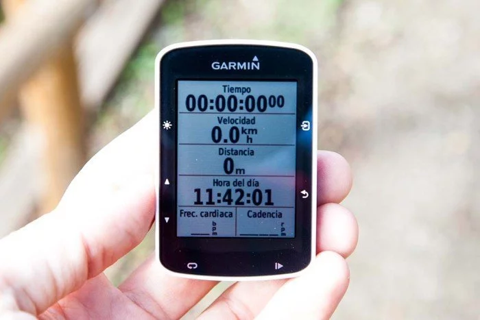
- Configuración y pantallas de datos
- Uso general en la bicicleta
- Entrenamientos avanzados
- Virtual partner
- Navegación
- Strava
- Entrenamiento en interior ANT+FE-C
- Historial, estadísticas y records
- Compatibilidad con luces Varia y Varia Radar
- Autonomía
- Sensores internos y externos
- Conectividad
- Mi opinión
- ¿Te ha gustado la prueba?
- Comprar Garmin Edge 520
- VALORACIÓN
VALORACIÓN
Funcionamiento - 8.5
Conectividad - 8.5
Diseño, acabado y comodidad - 8.5
Autonomía - 10
Aplicaciones - 9.5
Precio - 8
Lo mejor
- Con botones físicos, no siempre la pantalla táctil es lo más práctico (especialmente con guantes en invierno o lluvia)
- Posibilidad de navegación con mapas, tanto carretera como MTB
- ANT+ FE-C para control de rodillos
- Incluye soporte frontal
- Posibilidad de entrenamientos avanzados (intervalos, etc)
- Connect IQ abre muchísimas posibilidades
- Compatible con segmentos Strava
Necesita mejorar
- Memoria limitada a mapas de tu región cercana
- La navegación es de rutas, necesario cargarlas con anterioridad
- Por seguir con la navegación, es de punto a punto y no indica giros específicos (por ejemplo, gira en la calle mayor a la derecha). Indica el giro en pantalla pero debes ver en el plano dónde se sitúa
https://www.amazon.es/dp/]B010SDBGQU&tag=c1mes-21
https://www.amazon.es/dp/]B010SDBFIE&tag=c1mes-21
Desempaquetado
La presentación de la serie Edge es algo diferente a la que Garmin hace con los relojes Forerunner. En este caso es una caja realizada completamente en cartón, donde en la parte frontal puedes ver una imagen del Garmin Edge 520. Debajo puedes encontrar el texto que indica que el tamaño mostrado en la foto es el real, por lo que te puedes hacer a la idea de lo pequeño que es en realidad.
Y es que con un tamaño de 4,9 x 7,3 x 2,1 cm supone una reducción importante con respecto al modelo que sustituye, el Garmin Edge 510 (que tiene unas medidas superiores, 5,2 x 8,6 x 2,4 cm). Es decir, el tamaño se reduce en todos los aspectos (anchura, altura y grosor). Y con esta reducción de tamaño llega la consecuente reducción de peso, pasando de 80 a sólo 60 gramos, un 25% menos.
A pesar de tener un tamaño menor, el tamaño de la pantalla aumenta. Si antes la pantalla medía 4,4 x 3,5 cm ahora es ligeramente más grande en altura y anchura, midiendo 4,7 x 3,5 cm. Un trabajo impresionante por parte de Garmin. 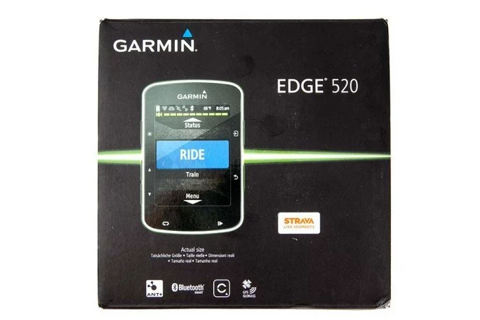
Además con la compra tienes derecho a disfrutar de tres meses de uso gratuito de la versión Premium de la red social deportiva. 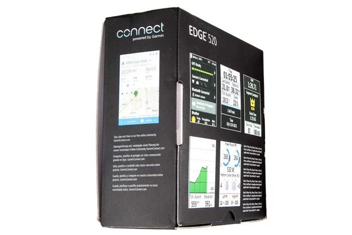
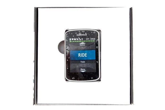
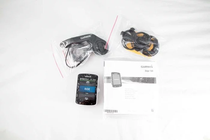
Éste es el contenido de la versión estándar. Si compras la versión pack, añadirás a lo que ves un sensor de velocidad, un sensor de cadencia y un sensor de pulsaciones. No es un mal trato, desde luego.
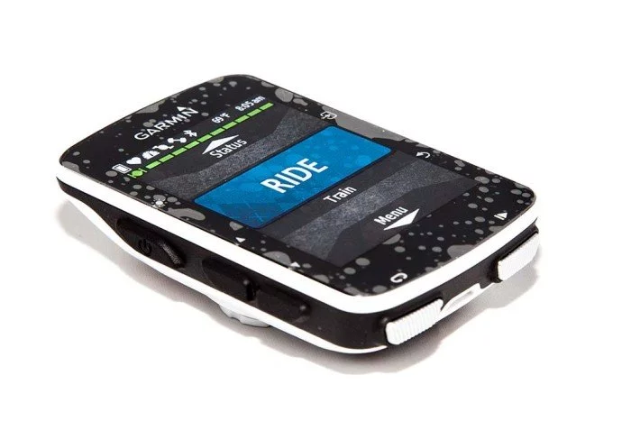
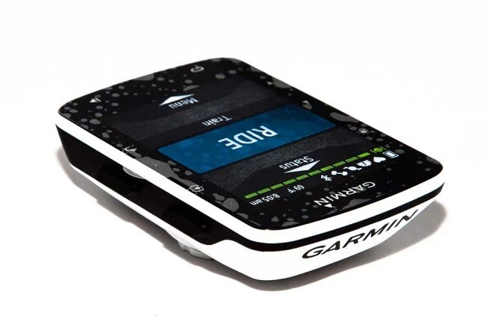
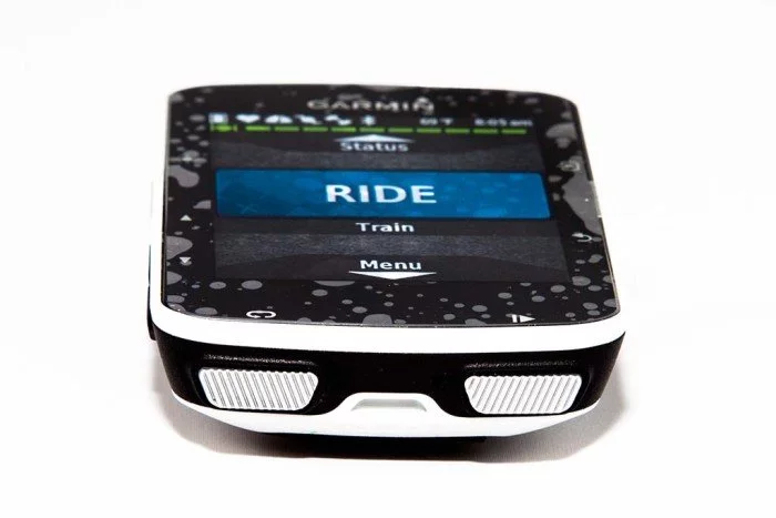
Vamos con el dispositivo en sí. El Edge 520 dispone de un total de 7 botones, tres en el lado izquierdo, dos en el derecho y dos en la parte inferior. La pantalla no es táctil, quizá algo que alguno puede echar de menos. Los botones son de buen tamaño y garantizan un tacto firme, por lo que aunque te pongas los guantes de invierno vas a poder usar el ordenador sin mucho problema. En el lado izquierdo puedes encontrar el botón de iluminación (que servirá para encender y apagar el dispositivo), justo por encima de los dos botones de desplazamiento.
En el otro extremo están los botones de acceso a menú y confirmación de selección, junto con el de retorno. En este caso y a diferencia de lo que ocurre con las unidades Forerunner, éste último no servirá para marcar vueltas.
Ya que para marcar esas vueltas tenemos el botón inferior izquierdo. El inferior derecho será el que uses para iniciar y detener la grabación de la actividad.
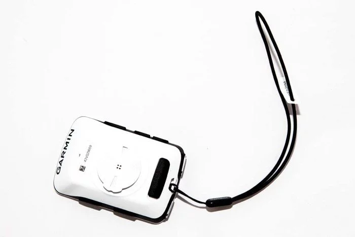
Dentro de la caja también podrás encontrar una correa. ¿Para qué? La correa sirve para añadir una sujeción de seguridad. Se fija en el manillar y en el caso de que en un bache el Edge 520 se saliera de su soporte, estaría asegurado por la correa y no caería. Algo que en carretera no debería preocuparte, pero que en bicicleta de montaña y dependiendo de las trialeras puede llegar a suceder.
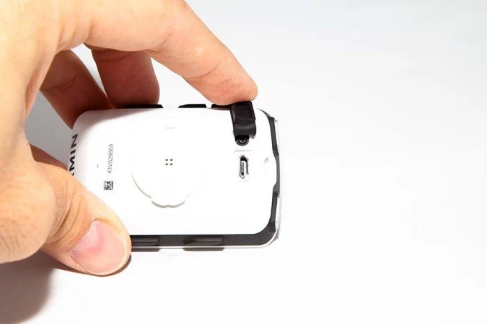
El conector de sincronización y carga se encuentra en la parte inferior del dispositivo, y está protegido por una tapa de goma. La resistencia es IPX7 así que no tendrás problemas en días de lluvia o nieve.
Esto en cuanto al dispositivo en si, ahora vamos con los soportes.
Accesorios incluidos y soportes
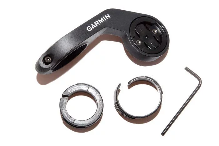
Garmin es generosa y nos incluye tres soportes para colocar nuestro nuevo Edge 520 en el lugar de tu bicicleta que prefieras. Este lugar suele ser el manillar o la potencia. El tipo de soporte usado es el típico de cuarto de vuelta (no confundir con el cuarto de libra, eso es otra cosa). Es el que usa Garmin para todos sus dispositivos de ciclismo desde hace bastantes años, por lo que si ya has tenido algún ordenador de Garmin tendrás unos cuantos de estos en casa.
En primer lugar vas a encontrar dos soportes pequeños. Encima de los soportes puedes ver unas bases de goma sobre las que se montan, para evitar arañazos en tu manillar o potencia. Y debajo de ellos dos juegos de gomas elásticas que son las que usarás para fijar el soporte en su lugar. Debes elegir las que mejor se adapten al grosor de tu manillar o potencia.
El tercer soporte que se incluye es el frontal alargado. Se coloca sobre el manillar y se sujeta a éste mediante una abrazadera y un tornillo Allen. Sitúa el ordenador por delante del manillar, en un punto que es más cómodo para poder visualizar la información, sobre todo en el caso de bicicletas de carretera donde tu posición más adelantada agradecerá llevar el ordenador en éste punto, en lugar de sobre la potencia.
Ya que Garmin no ha variado el tipo de soporte es fácil encontrar propuestas de otros fabricantes con diferentes configuraciones, como el soporte K-Edge para Garmin Edge y cámaras de acción
Hay multitud de soportes, así que será fácil que puedas encontrar la configuración ideal para ti.
Configuración y pantallas de datos
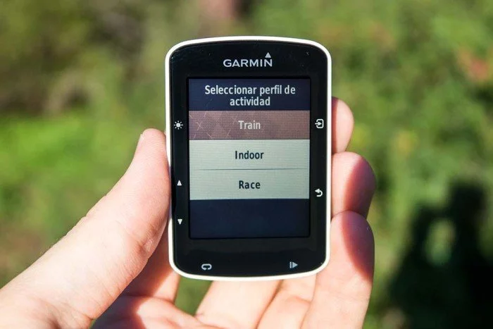
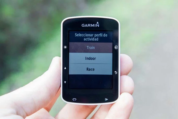
Antes de comenzar a entrenar con él querrás configurarlo a tu gusto. Lo primero que encontrarás es que debes seleccionar el tipo de actividad que vas a realizar.
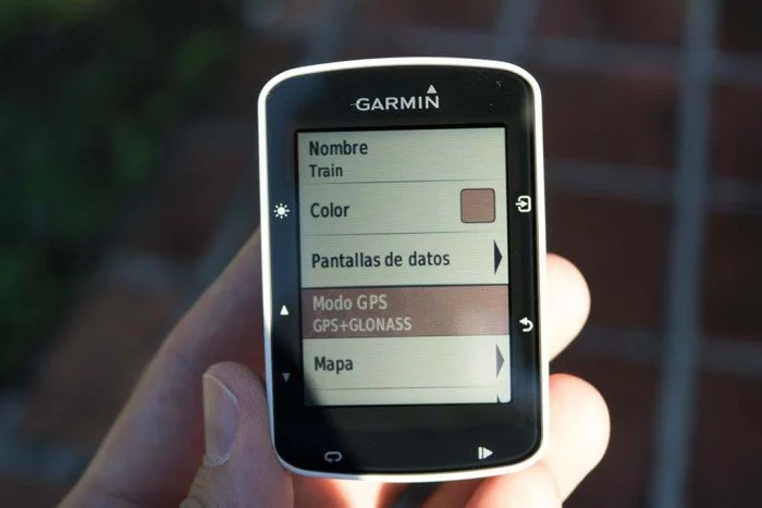
Estas actividades son las que vienen por defecto. Puedes modificarlas a tu gusto, o eliminarlas y comenzar desde cero. Para ello puedes dirigirte a la configuración y a los perfiles de actividad. Las configuraciones que se pueden realizar en cada perfil son las siguientes:
- Nombre
- Color
- Pantallas de datos
- Modo GPS
- Mapa
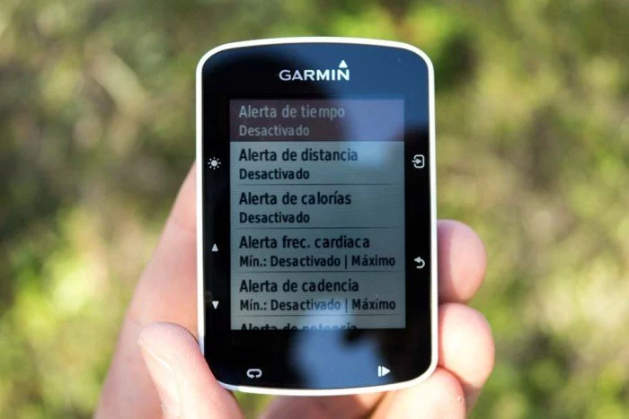
- Alertas
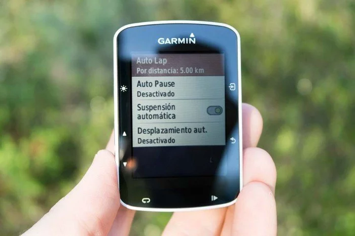
- Funciones automáticas
- Notificación de comienzo
El color de la actividad te servirá para identificar cuál es la que tienes seleccionada en la pantalla principal, así como para dar color a todo el menú.
Pero sin duda la sección más importante es la que corresponde a las pantallas de datos, pues es la información que mostrará en pantalla mientras estás entrenando. Se pueden configurar hasta 5 pantallas de datos diferentes con entre 1 y 10 datos en cada una de ellas. así que no será por falta de información.
Como es evidente, a mayor número de datos en pantalla, más pequeños serán, por lo que debes encontrar el punto en el que sea sencillo consultar la información de un vistazo y el tener toda la información que requieres. A la hora de dividirse la pantalla, primero alineará los datos en vertical hasta un máximo de 5.
A partir de ese momento cada fila se dividirá en dos columnas, desde la parte inferior a la parte superior. Esta organización no se puede modificar, por lo que no puedes tener la fila dividida en el centro o en la parte superior.
Y por supuesto, la selección de datos posibles es muy, muy extensa. [table id=83 /] [table id=84 /] [table id=85 /] Uff, creo que no me he dejado nada. Como ves, infinidad de datos para que puedas configurar la información que vas a ver totalmente a tu gusto. Y como es evidente, hay campos de datos que están supeditados a disponer de algún componente de hardware específico, como la dinámica de ciclismo (pedales Garmin Vector), marchas (cambio Shimano Di2), indoor trainer (rodillo ANT+ FE-C), Potencia (medidor de potencia) o Varia (luces o radar varia). Esto en cuanto a páginas de datos, porque hay otra serie de pantallas que puedes activar o desactivar según desees.
- Mapa, permite mostrar dos datos adicionales
- Brújula, permite mostrar dos datos adicionales
- Altura, permite mostrar dos datos adicionales
- Resumen de vuelta, que es la información que verás al completar una vuelta manual o automática y que donde puedes añadir hasta 4 valores diferentes
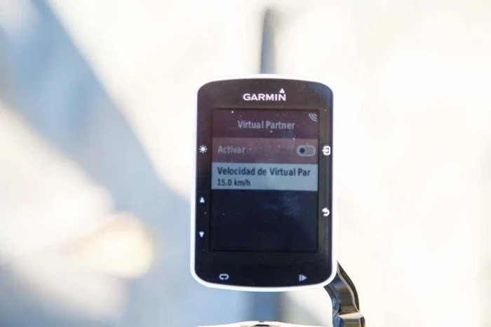
- Virtual Partner, configurando la velocidad de éste
- Dinámica de ciclismo, sólo válido si dispones de pedales Garmin Vector
- Varia, sólo válido si dispones de luces o radar Varia
Estas pantallas serán específicas para cada perfil de actividad que configures. Por tanto para el perfil de entrenamiento en interior no es necesario que actives el mapa, la brújula o la altura. Al igual que si tienes un perfil de competición. Pero esas páginas sí pueden resultar de utilidad a la hora de configurar tu perfil de entrenamiento, o crear un perfil para navegación de rutas donde lo más importante será disponer de mapa, brújula y demás datos específicos.
En fin, multitud de opciones que dependen exclusivamente de qué es lo que quieres ver en pantalla. Cada perfil de actividad permite además seleccionar otros valores, como el modo de GPS. Puedes activar GPS+GLONASS para tener la mayor calidad de señal, GPS sólo para ahorrar algo de batería o desactivarlo para depender exclusivamente del sensor de velocidad o entrenar en interior.
También permite configurar diversas alertas de tiempo, distancia, calorías, FC, cadencia o potencia. Todas ellas con diferentes valores y, en los tres últimos casos, con mínimos y máximos. Así puedes activar una alerta que te avise cuando tu cadencia descienda de 70 o pase de 100, o cuando tu potencia supere los 300W.
Por último, dentro de las funciones automáticas podrás configurar el auto lap, la pausa automática, el desplazamiento automático y la suspensión de la actividad.
Y repito nuevamente. Cada una de estas opciones es específica para el perfil de actividad que estés configurando y no afectará al resto. Así que si quieres tener las mismas pantallas de datos en varios perfiles pero diferentes alertas, deberás crear perfiles diferenciados, hasta un máximo de 10 distintos.
Uso general en la bicicleta
Bien, una vez que ya ha quedado cubierta la configuración general del ordenador, que realmente es la parte más extensa, queda salir y entrenar. Lo primero que te interesará saber es la velocidad tanto de inicio como de sincronización de satélites. Es decir, el tiempo que pasa desde que presionas el botón de encendido hasta que te puedes poner a dar pedales. Nada mejor que lo puedas ver tu mismo en un vídeo.
Es un proceso bastante rápido, además en la parte inferior de la pantalla te indica qué está cargando y qué queda para completar el encendido. También podrías añadir un mensaje personalizado que aparezca durante el arranque y demorar el tiempo hasta que aparece la pantalla principal, ya expliqué en su momento cómo hacerlo.
En la parte superior izquierda de la pantalla verás parpadeando los iconos de los sensores que hayas sincronizado (pulso, potencia, cadencia, etc). Dejarán de parpadear en el momento en que la conexión ya se haya establecido. Como sabes los sensores que se montan en la bicicleta han de activarse, generalmente, dando algunos pedales.
Con señal de GPS y sensores conectados ya puedes comenzar tu ruta. Para ello simplemente pulsas el botón superior derecho y aparecerá la pantalla de selección de perfil de actividad.
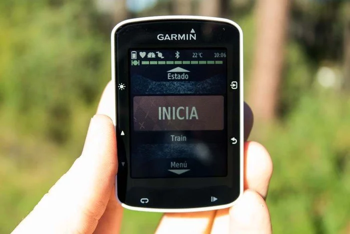
Seleccionas el perfil adecuado y aparecerá tu pantalla de datos principal.
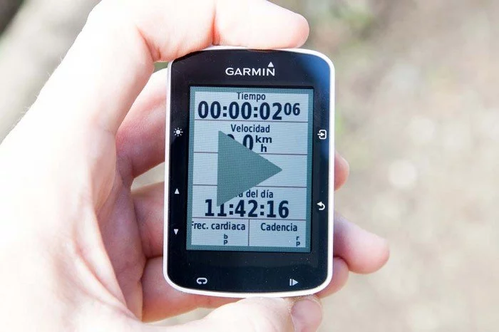
Ahora no tienes más que presionar el botón de inicio de actividad, situado en la parte inferior del dispositivo con un símbolo de «play-pause». Es decir, iniciamos y detenemos la actividad desde ese botón.
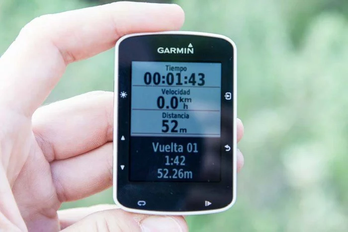
El que se encuentra a su lado servirá para marcar vueltas de forma manual, si te interesa medir tramos específicos en tu ruta (por ejemplo, la parte principal de la subida del puerto). En caso de que hayas establecido en los campos de datos tiempo en vuelta, velocidad en vuelta, distancia en vuelta, etc. podrás ver cuánto tiempo (o distancia) ha transcurrido desde que presionaste el botón, y por tanto cuánto llevas recorrido, ascendido, etc.
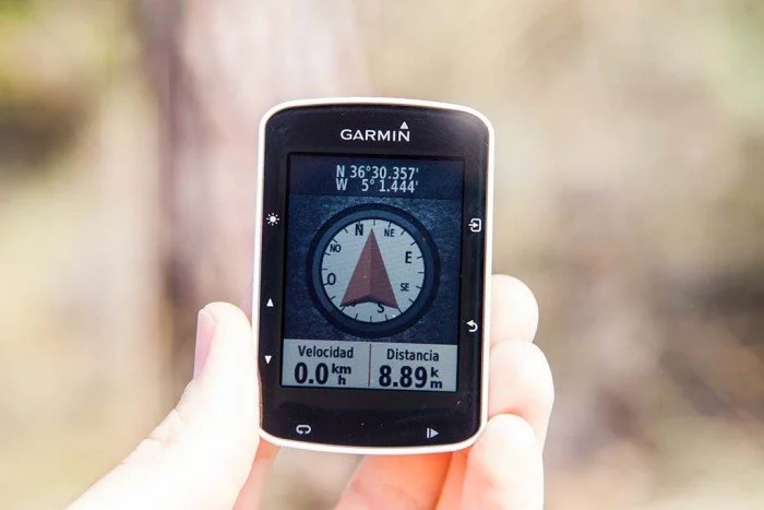
Por supuesto también puedes activar las vueltas de forma automática, como verás más adelante. En cuanto a las páginas de datos, puedes ir alternando entre las diferentes que hayas configurado con los botones de desplazamiento izquierdos, incluyendo las especiales que hayas activado, como la brújula.
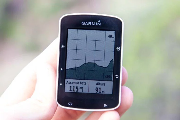
El perfil de altitud de tu recorrido.
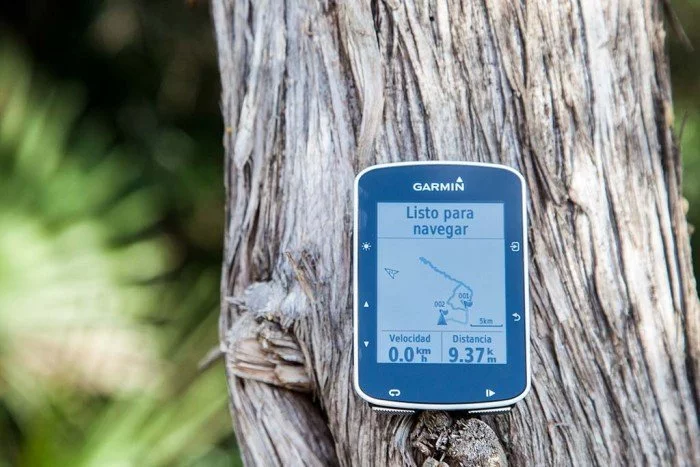
O el mapa.
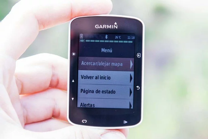
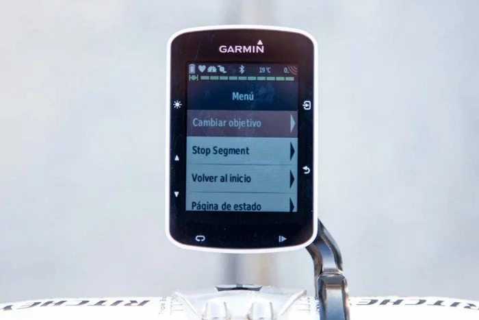
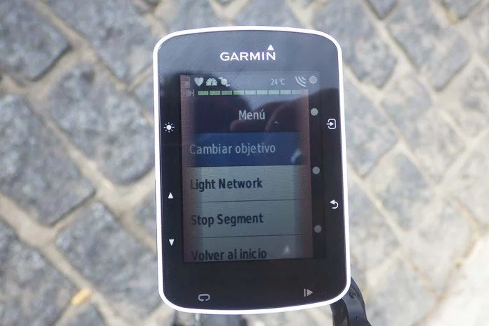
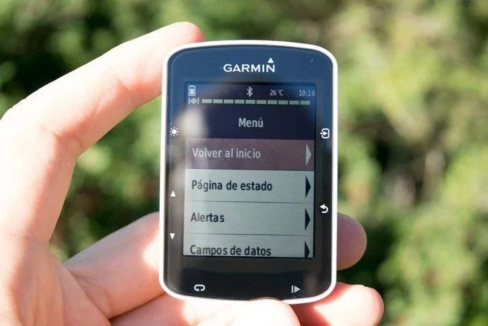
Estando dentro de la actividad puedes acceder al menú avanzado, donde podrás realizar no sólo cambios en la configuración del perfil (alertas o campos de datos), también usar opciones específicas de navegación y posicionamiento.
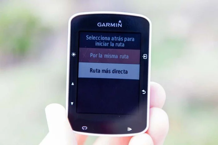
Puedes pulsar en volver a inicio para obtener un mapa de retorno desde tu ubicación al punto donde comenzaste la ruta, en caso de haberte perdido. Podrás seleccionar volver por la misma ruta o la ruta más directa. La primera opción te llevará por los mismos caminos que has usado para conseguir perderte, mientras que la segunda te trazará un camino en línea recta, perfecto por si te crecen las alas y echas a volar.
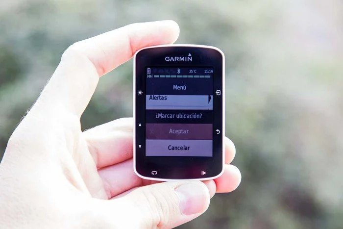
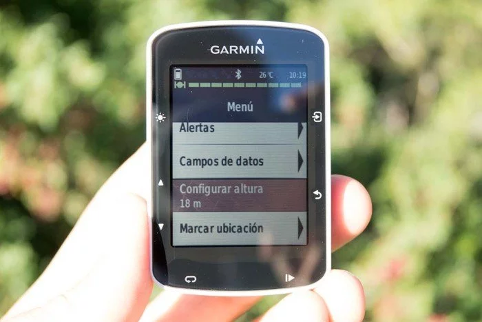
También puedes configurar la altura (si estás, por ejemplo, en la parte más alta de un puerto donde la altura se especifica de forma clara) o marcar una ubicación, para que puedas navegar a ese punto más tarde.
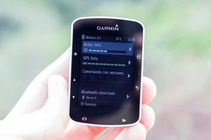
También puedes entrar a la pantalla de estado, la misma a la que accedes desde la pantalla principal presionando hacia arriba, donde se indica el estado básico del dispositivo. Brillo de la pantalla, estado de GPS y sensores, el Bluetooth o el estado del tiempo.
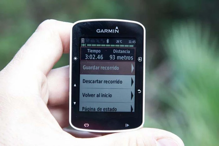
Por último, cuando hayas terminado tu ruta, simplemente debes pulsar el botón de pausa y aparecerá la pantalla de fin de actividad. Básicamente es la misma pantalla de menú avanzado, pero se añade en la parte superior algunos datos de tu entrenamiento y la posibilidad de guardar o descartar el recorrido.
Y tras guardar la actividad podrás ver el resumen de todo tu entrenamiento, y en caso de haber batido algún récord personal te premiara con un mensaje en pantalla.
Entrenamientos avanzados
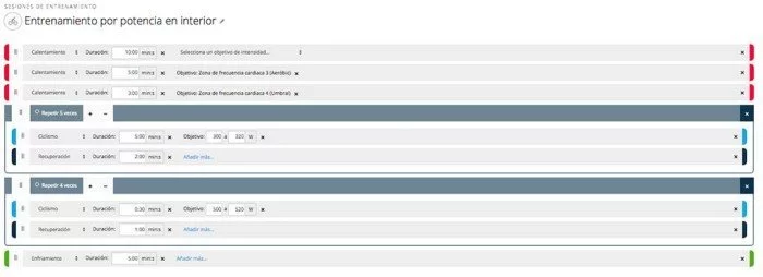
Como buen dispositivo de entrenamiento que es, en el Garmin Edge 520 no podía faltar la posibilidad de crear entrenamientos avanzados. Para ello no tienes más que entrar en Garmin Connect y crear la sesión de entrenamiento que tú o tu entrenador fijen para un día en concreto. Puedes hacer desde entrenamientos sencillos en los que simplemente establezcas periodos de zonas de trabajo con un tramo central más exigente.
Como sesiones más específicas con diferentes objetivos. Y no sólo para realizar en exterior, sino también en interior sobre un rodillo.
Cuando realices alguno de estos entrenamientos, en la pantalla del Edge 520 te irá marcando cada parte del entrenamiento en el que estés, recordándote así mismo el objetivo del mismo. Puedes crear fases de entrenamiento basados en tiempo, distancia, calorías, frecuencia cardíaca (hasta alcanzar unas pulsaciones determinadas), potencia (hasta alcanzar una cifra de potencia determinada) o bien simplemente presionando el botón de lap para pasar a la siguiente fase.
En cuanto a los objetivos de cada una de estas fases, podrá ser de velocidad, cadencia o zonas de FC o potencia (zonas predeterminadas o creadas manualmente). Por tanto puedes crear una fase de entrenamiento de 10 minutos con una potencia entre 300W y 310W, recibiendo un aviso si te sales de alguno de esos dos rangos, tanto por encima como por debajo.
Virtual partner
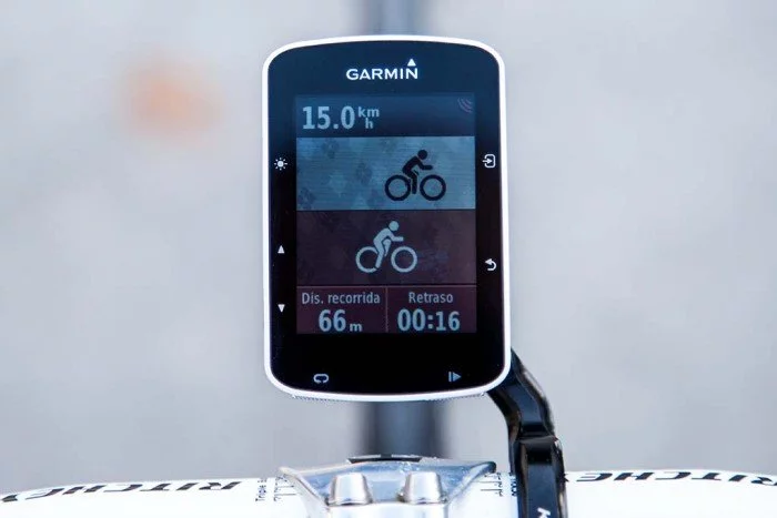
Otra opción de entrenamiento clásica que encontrarás en el Edge 520 es el Virtual Partner. Es una opción ya conocida más que de sobra, pero no por vieja deja de tener utilidad. Te permite enfrentarte a un rival imaginario al que previamente programes para una velocidad media.
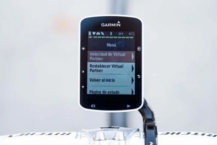
Además de realizar la programación directamente desde el menú del dispositivo, también podrás tenerlo si creas un trayecto y seleccionas una velocidad media para dicha ruta. Una vez activado te creará una página de datos adicional donde podrás ver el retraso o ventaja que llevas con respecto a tu rival virtual, así como la distancia recorrida.
Si en algún momento quieres variar la velocidad de tu rival no tendrás más que entrar al menú y modificarlo. También te permite restablecer a tu virtual partner y volverlo a poner a la par, si es que le has sacado demasiada distancia o te has parado a tomar una cerveza y se te ha olvidado detener la actividad.
Es una forma muy gráfica de entrenar con respecto a un objetivo. Y no sólo entrenar, ya que también lo podrás usar en una carrera y poder comprobar, de un vistazo rápido, cómo estás con respecto al objetivo que te has marcado antes de iniciar la competición.
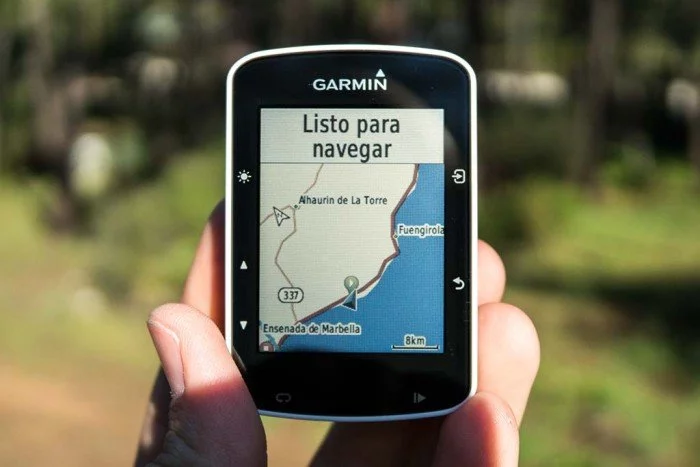
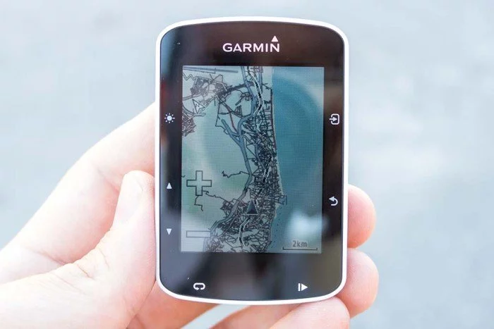
El Edge 520 incluye un mapa base mundial. Ese mapa es prácticamente inútil y su única utilidad es saber si ya has llegado a la playa o todavía te queda algo de distancia por recorrer.
Pero ahora te doy las buenas noticias, y es que puedes cambiar ese mapa por uno de tu elección. No obstante, como no cuenta con la posibilidad de ampliar la memoria a través de tarjeta (algo reservado a modelos superiores), debes acomodar el mapa en el espacio que queda libre tras eliminar el mapa base. Alrededor de 100MB.
Pero tampoco quieres tener un mapa de ese tamaño, ya que también hay que dejar espacio suficiente para los archivos de actividad, segmentos de Strava y rutas que vayas grabando con el tiempo. La forma más rápida y sencilla de añadir unos mapas más completos es a través de OpenStreetMaps, mapas creados por la comunidad. Hay otros mapas, tal vez más completos o detallados, pero ésta que cubro a continuación es la forma más rápida y sencilla de hacerlo.
Paso 1. Descargar el mapa
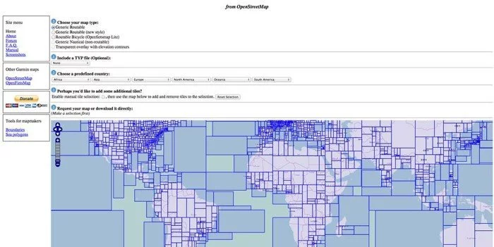
Para descargar tu mapa lo primero que debes hacer es dirigirte a esta página. Esta es la página que verás (o que se ve en el momento de escribir estas líneas, es posible que cambie el diseño con el tiempo).
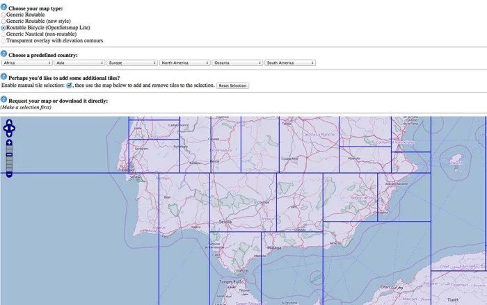
La parte más importante es seleccionar en la primera opción el tipo de mapa que quieres descargar, en este caso «Routable Bicycle». Una vez seleccionado qué tipo de mapa necesitas, lo siguiente es hacer zoom y seleccionar las zonas por las que te vas a mover. Lo suyo sería seleccionar el país completo y olvidarte, pero te recuerdo que el espacio de almacenamiento es limitado, así que mejor selecciona la parte donde vayas a realizar tus rutas. Para ello, primero haz zoom sobre la zona en cuestión y después activa la opción de «Enable manual tile selection».
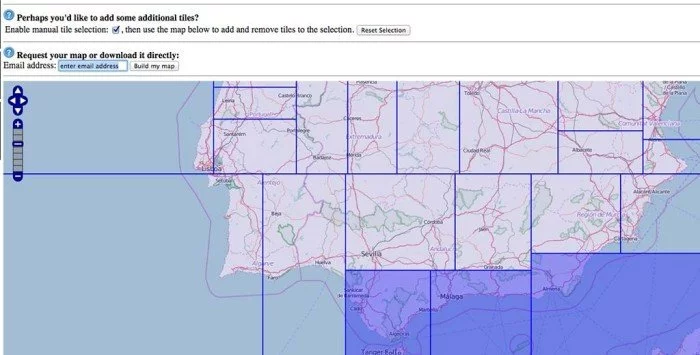
Ahora pincha en cada recuadro que sea de tu interés. En mi caso, la zona que cubre la costa de Málaga, por tanto selecciono esas casillas. Sólo te queda introducir tu dirección de correo electrónico y presionar el botón de «Build my map».
Recibirás dos correos. El primero indicará que tu solicitud está en cola, es una notificación automática. En segundo lugar y dependiendo de la carga de trabajo del servidor de OpenStreetMaps (a mi me suelen llegar inmediatamente después del primero) recibirás el correo con el enlace de descarga.
Y al pinchar sobre el enlace accederás a la página de descarga de tu mapa. El archivo que te interesa es el que he señalado.
Descarga el archivo, descomprímelo y ponlo en un lugar accesible (por ejemplo en el escritorio), porque lo vamos a usar a continuación.
Paso 2. Instalar el mapa
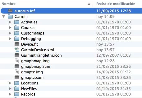
Ya tienes tu mapa descargado, descomprimido y a mano en el escritorio. Lo primero que debes hacer es cambiar el nombre de «gmapsupp.img» a «gmapbmap.img», pues es el archivo que buscará en la memoria el Edge 520. Si no ves la extensión de archivo no te preocupes, sólo debes cambiar el nombre del archivo. A continuación conecta el dispositivo al ordenador con el cable USB y accede a la carpeta Garmin, donde vas a encontrar el gmapbmap.img original.
Debes borrar el archivo original, aunque lo más recomendable es que antes le hagas una copia y lo guardes (nunca sabes para qué puede hacerte falta). Tras borrarlo, si estás en mac debes vaciar la papelera de reciclaje antes de desconectar el Edge 520 para que ese espacio se libere de forma efectiva (paso muy importante). Esto en Windows no es necesario. Copia el archivo que has descargado al dispositivo y habrás terminado.
Resumiendo, y por ponerte la guía de forma clara, estos son los pasos que debes seguir
- Descargar el mapa que necesites desde garmin.openstreetmap.nl
- Descomprime el archivo y cambia su nombre a gmapbmap.img
- Conecta el Edge 520 al ordenador
- En la carpeta Garmin, busca el archivo gmapbmap.img y guarda una copia de seguridad. A continuación bórralo (y si usas Mac, vacía la papelera de reciclaje)
- Copia el archivo que has descargado y renombrado a esa misma ubicación
- Desconecta el Edge 520 del ordenador y sal a dar pedales
Como puedes comprobar, la diferencia en la información presente en el mapa es bastante notable.
Bien, una cosa que debes tener clara es que a pesar de disponer de mapas, no hay navegación de un punto a otro, como puede ser con un GPS de coche. Por tanto no puedes estar en mitad de la nada y pedirle al Edge 520 que te lleve a casa y que te calcule la ruta más rápida para llegar, indicando el cruce en cada calle o carretera para llegar.
En su lugar lo que tenemos son rutas de punto a punto. Por tanto, un punto en cada cruce, que te indicará cuándo debes girar (pero sin especificar si es la calle A o la calle B). Y evidentemente, esta ruta deberás crearla antes en de salir en Garmin Connect. El mapa es un «apoyo logístico» que te puede servir para usarlo de referencia. Si quieres opciones de navegación más avanzadas deberás mirar los Edge 810 o Edge 1000 (o Edge Explore 1000).
Y si el día de mañana vas a navegar en otra ubicación, el procedimiento es el mismo. Sustituye el mapa que acabas de instalar por el nuevo que descargues y listo.
Strava
Sin duda la novedad más importante del Garmin Edge 520 ha sido la llegada de los segmentos Strava en vivo al ordenador de ciclismo. Hasta este momento los segmentos de Garmin ya estaban disponibles en muchos de sus dispositivos pero no tienen, ni de cerca, un seguimiento como pueden tener los segmentos de Strava.
Y es que en esta red social deportiva los piques están a la orden del día. Ese KOM que te han quitado hace una semana y que tanto trabajo te costó conseguir. Ser el primero de tus amigos en un segmento determinado. O simplemente, batir tu record anterior en un determinado segmento, como el ascenso hasta el pico de tu pueblo.
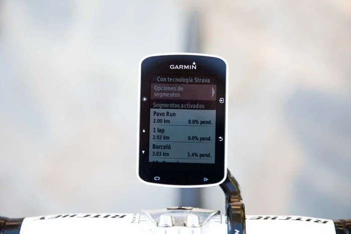
Esta nueva opción permite que compitas contra segmentos de Strava que previamente hayas marcado como favoritos, para los que tengas un objetivo establecido o, simplemente, que Strava piense que puedan ser de tu interés. Eso si, para que la actualización de datos sea constante debes tener una suscripción de Strava Premium vigente. Al comprar el Edge 520 tienes derecho a 3 meses de uso sin coste.
Los segmentos de Strava de la A a la Z
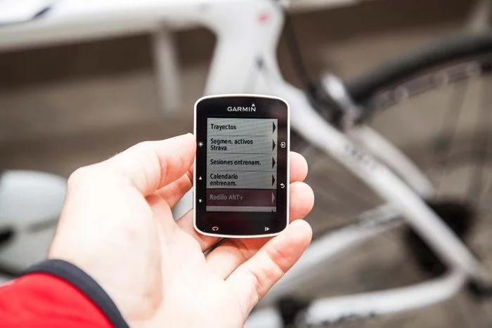
Lo primero que debes saber es cómo hacer llegar los segmentos de Strava a tu dispositivo. Hay tres formas de que esos segmentos aparezcan
- La más directa, marcarlos directamente como favoritos (la estrella que puedes encontrar en un segmento determinado)
- Esos segmentos en los que te hayas marcado un objetivo
- Por último, segmentos que Strava puede seleccionar aleatoriamente en tu zona y que puede estimar que sean de tu interés
Los dos primeros casos son bastante obvios. Para el tercer caso tiene que actuar la magia de Strava; aunque en mi caso esa magia ha quedado un poco apagada, ya que ha seleccionado algunos segmentos que dudo mucho que visite. Sí, están relativamente cerca, pero no en rutas que sean de mi interés.
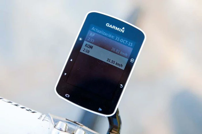
Estos segmentos seleccionados se actualizarán cada vez que conectes tu dispositivo por USB o cada vez que hagas una sincronización por Bluetooth con tu teléfono móvil. Además de recibir la información relevante de ese segmento en particular (datos como distancias, localización, elevación, etc), obtendrá también la lista actualizada de los tiempos en ese preciso instante.
Es decir, incluirá las últimas actualizaciones existentes. Si un amigo tuyo actualiza su tiempo desde que tu has hecho la última sincronización hasta que completas el segmento, a ti aún te aparecerá el tiempo anterior, ya que la actualización de datos no es constante.
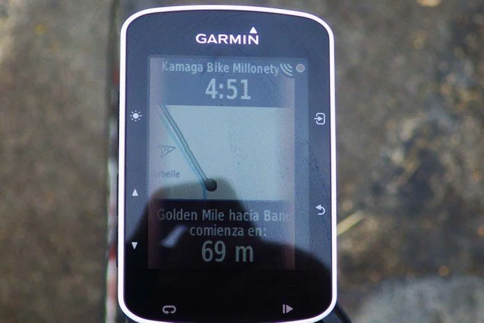
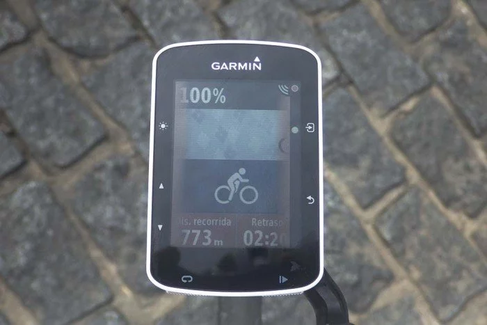
Cuando estés realizando tu entrenamiento, recibirás un aviso cuando estés a punto de acercarte a un segmento que tengas marcado como de interés. Y te marcará la distancia que te queda hasta llegar a él, para que puedas ir preparándote para machacar ese tiempo (evidentemente, ganar velocidad antes de comenzar el segmento).
En la parte superior verás información del tiempo objetivo (que puede ser el líder de tu lista de contactos, tu récord personal o el récord absoluto para el segmento), mientras que en la parte inferior se irá descontando la distancia restante hasta el punto de inicio.
Este objetivo podrás seleccionarlo entrando a las opciones a través del botón de menú, bien antes de iniciar el segmento o mientras que lo estés realizando.
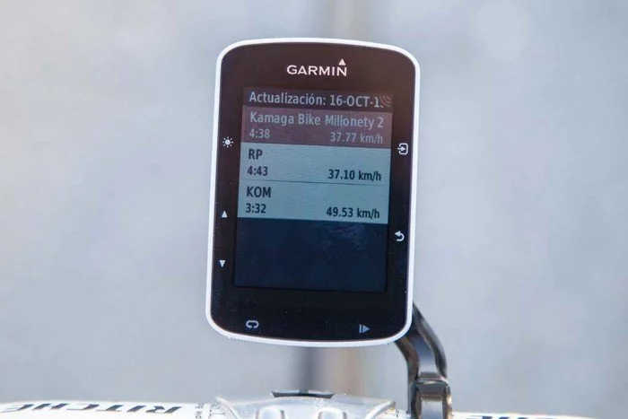
También puedes consultar cuál es el tiempo objetivo y velocidad media para cada uno de esos objetivos.
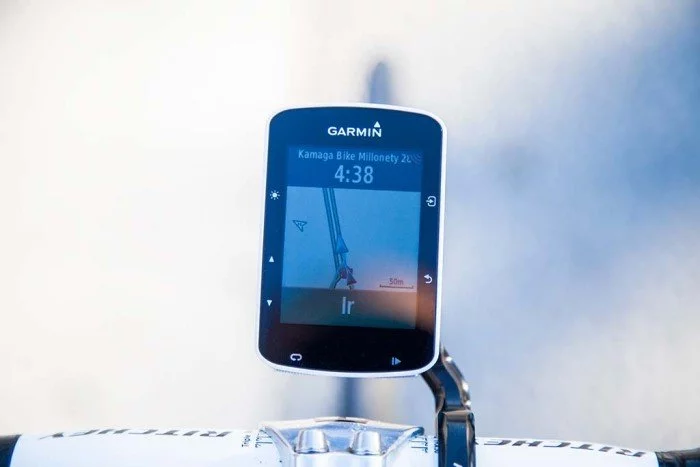
En cuanto llegues al inicio del segmento aparecerá la indicación en pantalla para que puedas comenzar a darlo todo.
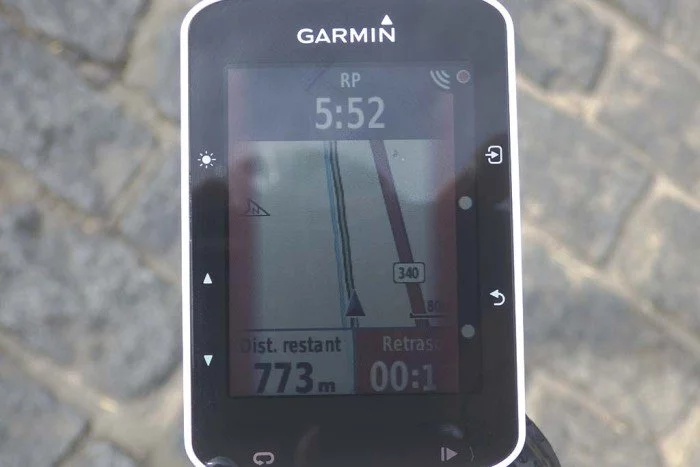
A medida que vayas avanzando en el segmento se irá actualizando la información indicándote cuál es la distancia restante y cómo te encuentras con respecto a tu objetivo, por detrás o por delante, y en cuánto tiempo.
También existe la posibilidad de no hacer el seguimiento de ruta con el mapa, y simplemente cambiar la pantalla de datos a otra de Virtual Partner, probablemente más representativa para ver cómo te encuentras con respecto a tu objetivo.
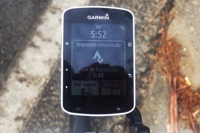
Cuando llegas al final del segmento te indicará tu tiempo final así como si has conseguido algún record en particular o, como en el caso a continuación, ha sido bastante lamentable.
Segmento completado y resultados obtenidos. Ahora puedes ir a por otro o, si crees que puedes mejorarlo, dar la vuelta e intentarlo de nuevo. Estos resultados no están disponibles en Strava en el preciso instante en que completes el segmento. Lo harán tan pronto termines tu entrenamiento actual y realices la sincronización de tu actividad
Entrenamiento en interior ANT+FE-C
Otra de las novedades que recibe el Garmin Edge 520 es el soporte para el estándar FE-C de ANT+. ¿Y qué es esto? El perfil FE-C (Fitness Equipment Control) permite que diferentes dispositivos controlen la resistencia de rodillos inteligentes que, obviamente, también tienen que soportar esta función. Esto permite usar aplicaciones como Zwift, el simulador de BKool, los entrenamientos avanzados de Trainer Road, etc.
Es decir, la aplicación controla la resistencia del rodillo para simular subidas o bajadas, o bien para establecer objetivos de entrenamiento por watios. El Edge 520 permite conectarse también a este tipo de rodillos inteligentes y que sea nuestro ordenador el que los controle de diversas maneras. Por ejemplo, de alguna de estas maneras:
- Establecer unos watios como objetivo, por ejemplo 275w. El Edge 520 le indicará al rodillo que ese es nuestro objetivo y mantendrá la resistencia necesaria para trabajar esa intensidad.
- Seguir un entrenamiento creado en Garmin Connect. Puedes acceder a la sección de sesiones de entrenamientos de Connect y diseñar un entrenamiento o programar el que te indique tu entrenador. Tras hacerlo el Edge 520 irá enviando al rodillo la información de resistencia adecuada a cada una de las fases del entrenamiento.
- Repetir una actividad que ya hayas realizado, por ejemplo la última salida que hayas realizado en exterior. Reproducirá los puntos de inclinación de la misma manera que lo hayas realizado con anterioridad.
- Seguimiento de trayectos. Te permite crear un trayecto en el mapa y reproducir las inclinaciones presentes en el recorrido. Por tanto puedes realizar el trazado de alguna carrera, como por ejemplo la etapa reina del Tour de Francia.
Son opciones realmente interesantes, especialmente a la hora de poder realizar el recorrido de una carrera que vayas a realizar. De esa manera puedes ver de forma previa el esfuerzo necesario para cada punto de la carrera y así establecer una pauta de ritmos a seguir.
Historial, estadísticas y records
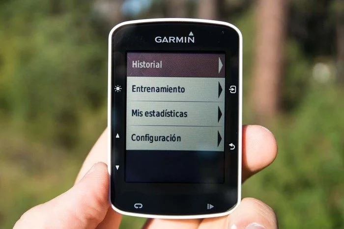
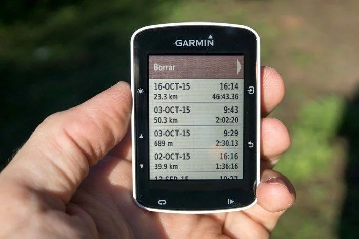
La unidad te permite acceder a todo tu historial de entrenamientos directamente en la pantalla del dispositivo, si es que no tienes acceso en ese momento al ordenador o teléfono para consultar los datos en Garmin Connect.
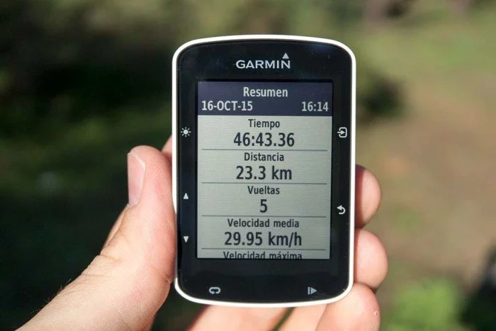
Puedes volver a revisar los datos de la actividad.
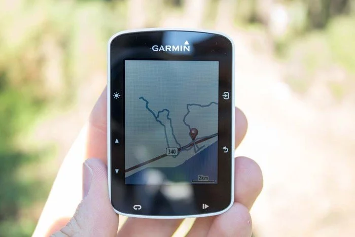
Ver el mapa de tu recorrido.
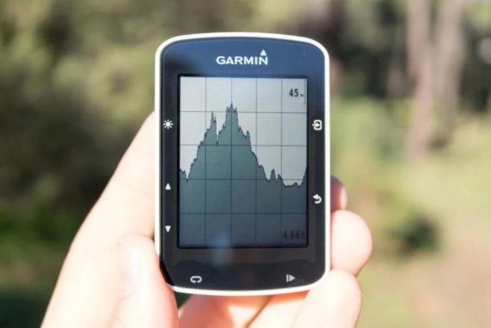
El perfil de altura de la actividad.
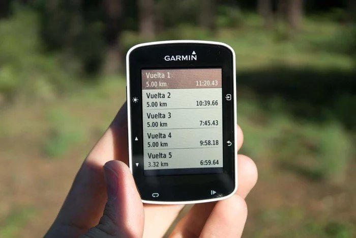
Detalle de tiempo por vueltas marcadas de forma manual o automática.
Y en cada una de estas vueltas, puedes ver los detalles específicos de la vuelta marcada.
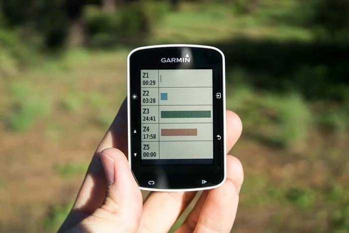
El tiempo en cada zona de frecuencia cardíaca.
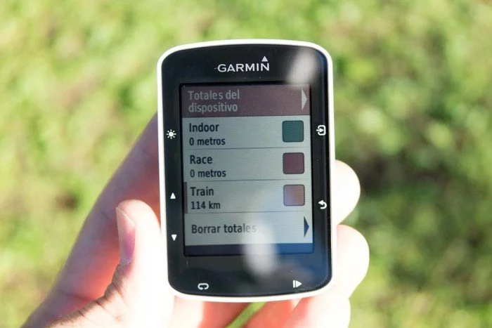
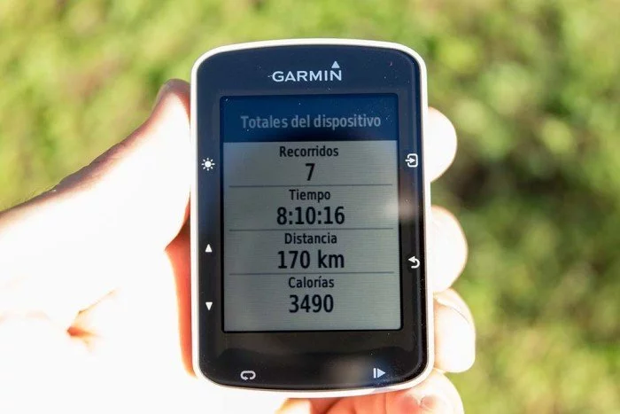
También te ofrece la posibilidad de crear un trayecto a partir de esa actividad, en caso de querer recorrerla otro día. No sólo hay información de cada una de las actividades en detalle, sino que te ofrecerá datos totales de todas tus actividades, desglosando además las distancias recorridas en cada uno de los perfiles que tengas creados.
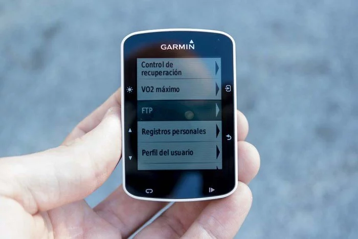
Entre las estadísticas personales puedes encontrar valores de VO2 máximo en ciclismo y tu FTP. Para ambos valores es necesario disponer de un medidor de potencia. El VO2 es el máximo volumen de oxígeno que puedes consumir por minuto por cada kilo de masa corporal. Es decir, cuanto mayor sea ese valor, mayor será tu capacidad atlética. La teoría es que este valor aumentará a medida que tu condición física mejora, por lo que permite hacer un seguimiento de cómo estás mejorando.
Como es lógico, si estás comenzando a practicar deporte este dato aumentará rápidamente en cuestión de meses. Pero cuando ya llevas practicando deporte durante años es bastante más complicado ver variaciones en este dato. Yo suelo moverme entre 57 y 58, pero no suelo salir de estos valores. Al principio es posible que varíen de forma significativa, pues el algoritmo necesita unos cuantos entrenamientos para conocerte mejor como atleta, por lo que debes dar un plazo de tiempo de unas 5-7 salidas para que este dato se estabilice. Recuerda, es una mera aproximación, nunca podrá sustituir a una verdadera prueba de esfuerzo donde tu VO2max se medirá de forma precisa con un espirómetro.
El FTP (Functional Thresold Power, o umbral de potencia funcional en el idioma de Cervantes) es un valor cada día más importante en el ciclismo. Es la cifra de potencia que un ciclista puede mantener en una hora de esfuerzo (o durante 40km). Su importancia radica en que establece un umbral de potencia. Si realizamos un esfuerzo continuado por encima de esa cifra terminaremos por agotarnos. Muy importante en pruebas de triatlón (donde después de la bici tienes que correr) o en largas pruebas ciclistas donde todavía pueden quedarte horas por delante.
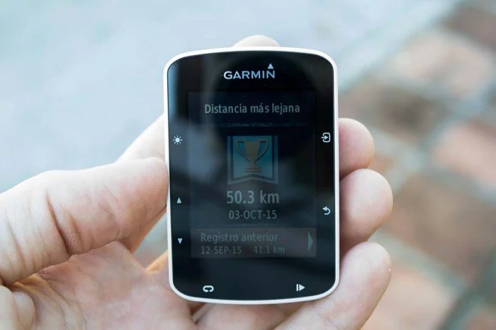
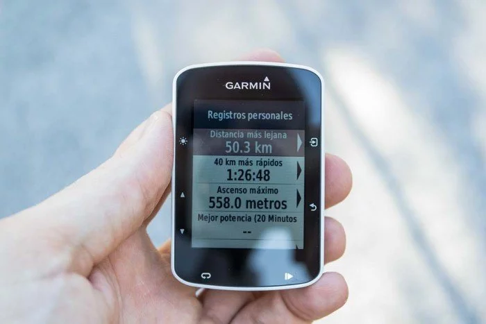
Por último, el Edge 520 guarda un registro de tus records personales, como distancia más lejana, los 40K más rápidos, la máxima potencia mantenida durante 20 minutos o el máximo ascenso
Estos records no sólo los indica en el menú de estadísticas, también aparecen en pantalla al terminar la actividad si superas alguno de ellos. Los registros son específicos del dispositivo, por lo que si tienes mejores registros almacenados en Garmin Connect deberás ir a la sección correspondiente e indicar que quieres sincronizar esos valores con tu nuevo Edge 520.
Compatibilidad con luces Varia y Varia Radar
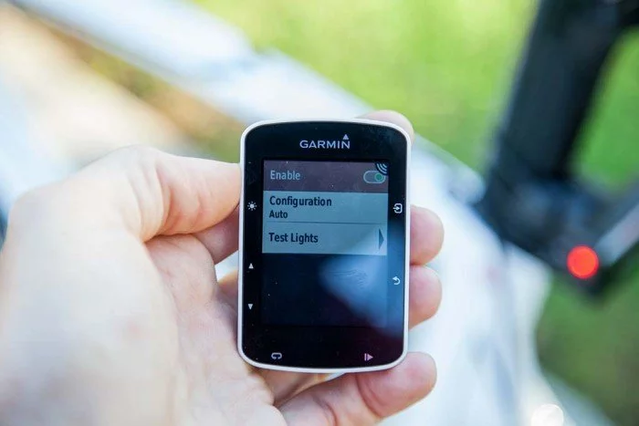
Tras la actualización de firmware a la versión 3.0 el Garmin Edge 520 recibió el soporte para poder conectarse con las luces Garmin Varia y el sistema de detección de vehículos traseros Varia Radar.
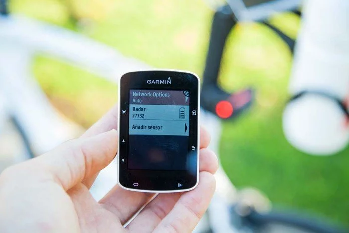
La forma de conectarse con estos dispositivos es algo diferente a un sensor tradicional. Los dispositivos de radar e iluminación no se conectan directamente y por separado con el Garmin Edge, sino que primero forman una red entre ellos. Esto permite que el Edge use un sólo canal ANT+ (ya que están limitados) para comunicarse con todas las luces, en lugar de tener que usar uno para cada luz.
Pero esto es de cara a funcionamiento interno, tu no verás nada de esto en tu uso día a día. En lo único que notarás que la conexión es algo especial es que ahora encontrarás un menú en el Edge 520 donde podrás ver qué luces has conectado y podrás cambiar algunas opciones de su funcionamiento.
Con el radar ya emparejado recibirás alertas en pantalla de vehículos que se aproximen, tanto por los colores en los que se iluminarán los bordes de la pantalla como por una línea en la parte derecha, donde habrá un punto por cada vehículo que circule detrás de ti.
Pero de éste ya hablaré más adelante en la prueba específica del radar.
Autonomía
Ya es la segunda vez que me ocurre, y en ambos casos con unidades de ciclismo. El primero fue el Garmin Edge 25, y ahora con este 520. Y es que de las cifras de autonomía anunciadas de forma oficial a la cifra real dista mucho. Pero en sentido positivo (bastante más duración de batería de lo que se suponía).
En el caso del Edge 520, Garmin indica que la duración de la batería es de «hasta 15 horas». Pues bien, tras someter al Edge 520 a mi prueba de autonomía habitual (cargar el dispositivo, comenzar una actividad y esperar que se agote la batería), éste es el resultado de la misma.
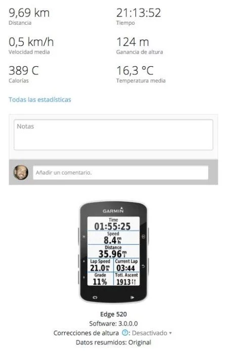
Más de 21 horas de duración total, incluso con la opción de GPS + GLONASS activada (que aumenta el consumo de batería). Bien es cierto que la prueba la realizo sin sensores ANT+ o teléfono conectados (pero sí el Bluetooth activado), pero desde luego no tienen un impacto tan elevado en la duración de batería. Sin duda un resultado sobresaliente, pero me cuesta comprender por qué Garmin sólo anuncia un máximo de 15 horas de autonomía cuando pasa holgadamente de esa duración.
Sensores internos y externos
Cuando hablamos de sensores tenemos que diferenciar de los sensores integrados en el propio dispositivo y de los sensores externos. Los primeros son los que tiene el Edge 520 en su interior, y los segundos son los sensores a los que el dispositivo se puede conectar. El Garmin Edge 520 tiene, evidentemente, GPS. Lo que sí que hay que reseñar es que está equipado con GLONASS, por lo que también puede recibir información de la red de satélites rusos. Esto aumenta la precisión de localización y la velocidad a la hora de establecer posición inicial, a costa de algo más de consumo de batería, en torno al 15%.
No menos importante es el altímetro barométrico, que podrás usar para conocer la elevación. Pero no como un valor absoluto, ya que depende de la presión atmosférica. Lo que sí permitirá será el cómputo de metros de ascenso y descenso de forma bastante precisa. Por defecto el altímetro se calibrará automáticamente al iniciar una actividad, a través de los datos de GPS.
Si quieres tener datos precisos de altitud durante toda tu ruta, puedes conseguirlos si haces una calibración manual en algún punto donde se especifique la altitud con total exactitud (por ejemplo, la parte más alta de un puerto de montaña). Esto se puede hacer desde el menú dentro de una actividad.
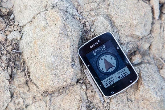
La brújula que podemos encontrar no es magnética, sino que es a través de GPS. Por tanto mientras estamos en movimiento la indicación de la dirección será precisa (porque nos movemos en una dirección), pero si nos detenemos no podrá determinar hacia dónde estamos mirando.
Ésto puede presentar un problema si estás navegando en una ruta y tratas de decidir cuál de los dos caminos es el que debes elegir, porque el mapa comenzará a girar sobre si mismo ya que no puede identificar cuál es tu orientación. Esta brújula magnética sí se encuentra presente en los relojes, pero no en los ordenadores de ciclismo, y desde luego no es algo que deje de echar de menos (sobre todo para rutas más complicadas como las realizadas por montaña).
Por último otro sensor integrado dentro del aparato es el termómetro. Al igual que la brújula, también hay relojes en los que es posible encontrar este sensor de temperatura, pero aquí sí cobra lógica. Y es que mientras en el reloj el sensor se ve afectado por nuestra temperatura corporal; en el Edge 520, al ir montado en el manillar, sí ofrecerá una temperatura correcta.
La temperatura se mostrará en la pantalla principal, en la parte superior junto a la hora, o bien durante la actividad entrando a las opciones de menú (pulsando el botón superior derecho) para que aparezca la barra de estado superior. Aunque también puedes añadir un campo de datos de temperatura.
Como digo, esos son los sensores integrados en el dispositivo. Pero gracias a la conectividad ANT+ podemos conectar con un montón de sensores externos:
- Sensor de pulso
- Sensor de velocidad y/o cadencia
- Medidores de potencia
- Luces ANT+ (como Garmin Varia o las luces ANT+ de Bontrager)
- Radar de aproximación Garmin Varia Radar
- Rodillos ANT+, recibiendo datos de potencia y velocidad
- Rodillos ANT+ FE-C, controlando la resistencia de los mismos (y por supuesto recibiendo información de ellos, si lo soportan)
- Cámaras Garmin VIRB
- Báscula ANT+
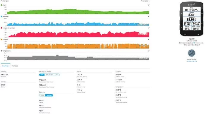
Al conectar con estos sensores no sólo podrás ver la información que faciliten en la pantalla del dispositivo, sino que también se guardarán en el archivo FIT de la actividad, por lo que al terminar y sincronizar podrás revisar todos los datos en Garmin Connect.
Conectividad
Con el Edge 520 te puedes conectar a dos tipos de dispositivos de forma inalámbrica, gracias a ANT+ y a Bluetooth Smart. En el caso de ANT+ puedes conectar con los sensores externos o con rodillos de entrenamiento como he tratado en el punto anterior. Es decir, es capaz de conectar con todos los sensores que podemos esperar de un dispositivo de gama alta de ciclismo, con la inclusión del nuevo perfil ANT+ FE-C que se estrena con el 520. Al igual que en el Garmin Edge 1000, el Edge 520 también tiene conectividad Bluetooth para emparejarse con tu teléfono móvil. Ésta sincronización te ofrece diferentes funciones.
En primer lugar y siendo ya un clásico en la serie Edge encontramos el LiveTrack. Permite transmitir tu posición en tiempo real. Y lo hace junto con datos de velocidad, pulsaciones, cadencia, etc. El seguimiento se puede realizar a través de la web de Garmin. Para iniciar la sesión deberás hacerlo a través de la aplicación del teléfono, y por supuesto deberás llevarlo contigo mientras entrenas, ya que es el que se encarga de enviar los datos al servidor.
Podrá seguir tu entrenamiento todo aquel a quien hagas llegar el enlace que facilita la aplicación. Es una forma muy útil de que tu familia esté tranquila sabiendo que no te ha pasado nada grave, aunque es un arma de doble filo. Ahora sabrán que el motivo de salir con la bici no es ir a entrenar, sino irte a tomar cervezas.
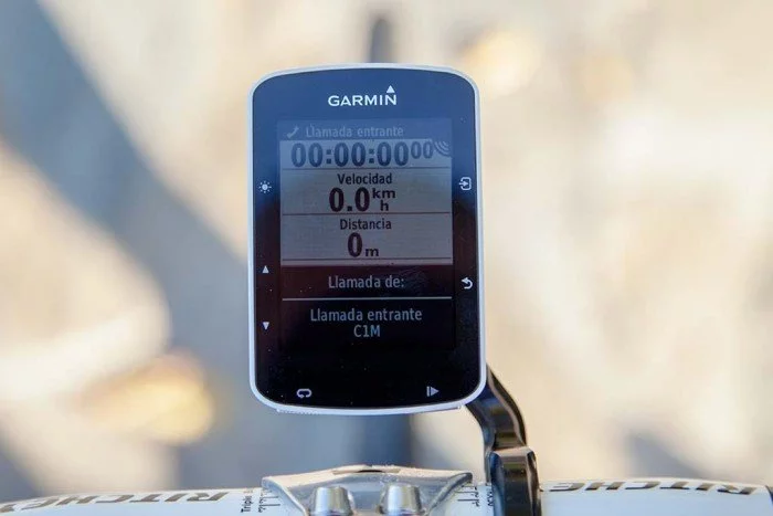
En la pantalla del Edge 520 también recibirás notificaciones de tu teléfono móvil, pero el servicio no es tan amplio como en el caso de los relojes. En los ordenadores de ciclismo sólo vamos a recibir avisos de llamadas (tanto llamadas en curso como llamadas perdidas) y mensajes SMS. Por lo tanto no recibirás avisos de mensajes de redes sociales, e-mail o WhatsApp. Y tiene bastante lógica, porque la idea es que vayas pendiente de la carretera y no del último chiste en el chat de grupo.
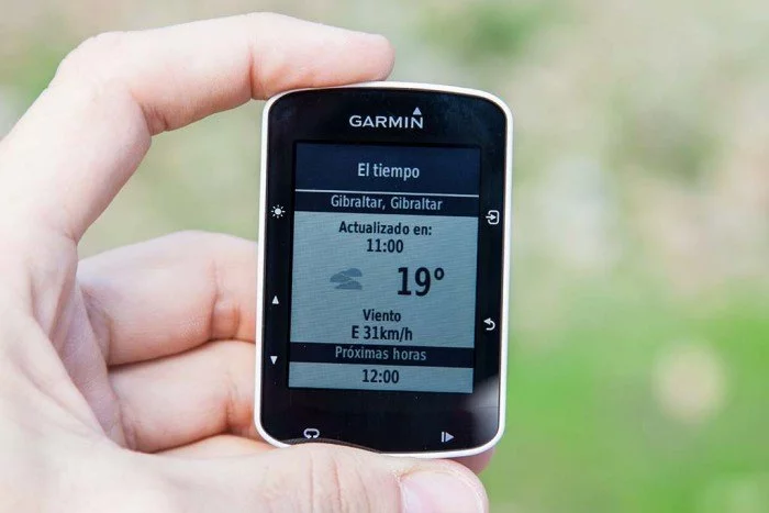
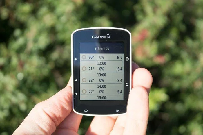
Dentro de las opciones que ofrece Garmin Connect está la de actualizar los datos del tiempo para tu zona. Y cuando digo zona, se trata de un área muy grande. Por ejemplo, en mi caso el tiempo facilitado es para Gibraltar, pues debe tratarse de la estación meteorológica más cercana a mi ubicación real (Marbella).
Desplazando la pantalla hacia abajo podemos acceder al pronóstico para las próximas horas.
Junto con la información del tiempo se ofrecen alertas, algo que sólo funciona en algunos casos y supongo que dependerá específicamente de si la estación meteorológica de la que esté obteniendo datos envíe este tipo de alertas.
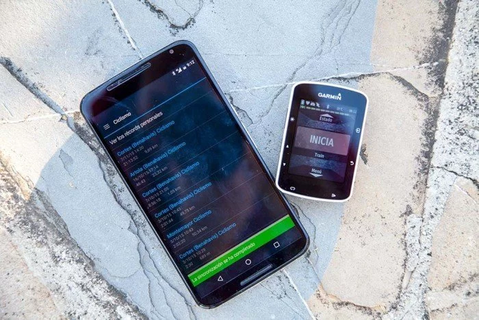
Por último, gracias a la conexión Bluetooth también sincronizaremos las actividades de forma automática tan pronto la finalices, por lo que no tendrás que conectar el Edge 520 a tu ordenador para transmitir los datos. Esta sincronización es bidireccional, por lo que cuando el Edge 520 se conecte con el teléfono también recibirá actualización de datos de caché de satélites, cambios de tiempos en los segmentos Strava, sesiones de entrenamiento o rutas creadas.
En esta ocasión Garmin no ha incluido la conectividad WiFi en el Edge 520, algo que sí tiene el Edge 1000. Y algo que Garmin ya ha anunciado es la llegada de la plataforma Connect IQ a los dispositivos Edge, lo que permitirá instalar aplicaciones y campos de datos no sólo en los relojes, sino a partir del primer trimestre de 2016 en alguno de sus ordenadores de ciclismo, comenzando por este Edge 520.
Mi opinión
Como unidad de entrenamiento, el Garmin Edge 520 cumple con lo prometido. Y lo hace con muy buena nota. Este dispositivo tiene absolutamente todo lo que puedes buscar en un ordenador de ciclismo que vayas a utilizar para entrenar, y para algo más. Pese a su pequeño tamaño viene cargado con todas las opciones de entrenamiento ya vistas en el resto de la gama, y hay novedades exclusivas como el control de rodillos ANT+ FE-C.
Habrá algunas características que algunos de vosotros podéis echar en falta, como la ausencia de pantalla táctil, el no poder introducir una tarjeta de memoria para poder instalar mapas de mayor tamaño o que la navegación sea demasiado sencilla. También es de destacar la ausencia de WiFi, no por su utilidad en sí sino simplemente por ser algo que estamos viendo como habitual. Pero es evidente que algo hay que dejar para modelos futuros de gamas superiores (por ejemplo, cuando se presente sustituto para el Edge 810).
Personalmente la única pega que puedo ponerle es que en ocasiones se muestra algo torpe en cuanto a procesador. Pasar de una página de datos al mapa, y después a otra página de datos hace que se quede congelado durante un instante. El problema es que no hay indicación en pantalla de que esté trabajando, por lo que da la sensación de cuelgue, y vuelves a presionar el botón por si lo que pasa es que no lo has presionado bien la vez anterior. Pero más que defecto del dispositivo, es deformación del hecho de usar teléfonos tremendamente potentes (y con mucha menos autonomía), y queremos que todo funcione igual de rápido.
Si estás buscando un compañero de entrenamiento, en el Garmin Edge 520 encontrarás uno con el que te puedes compenetrar a la perfección. A los únicos que no recomendaré el Edge 520 es a aquellos que realicen muchas rutas de navegación, pues es en el único punto donde este Edge flojea.
¿Te ha gustado la prueba?
Espero que esta prueba te ayude a decidir en tu próxima compra. Como ya sabes, realizar cada uno de los análisis que puedes leer en la web precisa de muchas horas de esfuerzo. Si te gusta el trabajo que hago y quieres echar una mano y apoyar la página puedes comprar el Edge (o cualquier otro artículo) a través de los enlaces que encontrarás más abajo. Tu consigues un muy buen precio y además retornan una pequeña comisión que es de gran ayuda. Todo sin coste alguno para ti.
Como ya sabes, si tienes cualquier duda o crees que debería haber comentado algo más, puedes dejar un comentario y te contestaré lo antes posible. Comparte esta prueba con tus amigos, no seas egoísta, seguro que a ellos también les gusta. Puedes hacerlo a través de redes sociales o, como lo hemos hecho toda la vida, por boca a boca.
Comprar Garmin Edge 520
Hay dos versiones disponibles para el Garmin Edge 520. Por un lado la versión estándar, más económica, que es la que yo he probado. Pero también hay una versión pack, que incluye los sensores de pulso, velocidad y cadencia. Si no tienes ninguno de ellos, es una muy buena oportunidad para conseguirlos. A continuación te facilito enlaces con buenas ofertas.
[/box]https://www.amazon.es/dp/B010SDBGQU&tag=c1mes-21
https://www.amazon.es/dp/B010SDBFIE&tag=c1mes-21









Hola, soy Joaquín. En primer lugar muchas gracias por el analisis tan completo y detallado. Me gustaría preguntarte una sola cuestión. Has comentado que tiene hasta cinco pantallas diferentes. Ahora bien, ¿es fácil pasar de una pantalla a otra?
Hola Joaquín
Si, simplemente hay que presionar el botón de desplazamiento superior o inferior para pasar de una a otra. O activar la opción de desplazamiento automático para que vaya alternando la pantalla.
Eso si, si tiene que pasar por alguna pantalla pesada, como el mapa, ralentiza un poco.
Hola soy José Antonio. Gracias por tu ayuda y mi pregunta es si el 520 puede conectarse con sensores bluetooth de velocidad, cadencia, pulso?
Los sensores a los que se puede conectar deben ser ANT+. La conexión Bluetooth es sólo para el teléfono
Hola Eduardo, tengo entendido que se puede conectar por Bluetooth con la Specialized Turbo Levo y su aplicación Mission Control.
Sí, hay aplicación de Connect IQ para la Specialized. La conexión se realiza a través de ANT+
Hola Eduardo estoy pensando en conprar un Garmin edge 520 o 810 y me gustaría que me dieras tu opinión.
Yo realizó ciclismo de montaña y carretera a nivel cicloturista pero con entrenador personal y mi duda es comprar un Garmin y que después me de problemas de software o que no tenga buena conectividad, etc.
Cual me aconsejas?
Si lo quieres para entrenar principalmente, aunque con posibilidades de navegación, sin duda el Edge 520, y más con el precio que tiene ahora en Amazon.
Si le das más importancia a la navegación, entonces el 810 es mejor opción.
Es principalmente para entrenar.
Gracias por todo.
Hola, me llamo Vicente, gracias por la prueba, es fantástica y me ha sacado de dudas, solo una pregunta, sabes si la conexión con Bluetooth con un teléfono IPhone la hace correctamente?, los IPhone con los Bluetooth son un poco puñeteros, gracias y un saludo.
Hola Vicente
Si, funciona correctamente, tanto para realizar la sincronización de datos constante como para mostrar las notificaciones de llamadas y SMS.
Hola,
Muy buen análisis. Sólo una duda, los sensores de velocidad y cadencia del 520 son idénticos a los del 810?
Gracias por tu atención,
Fernando.
Si, en ambos casos se conectan por ANT+ y son todos perfectamente compatibles.
Gracias por todo, Eduardo.
Hola buenas!! me he comprado el 520 y no se como conseguir los tres mese premiun de strava!!
Los tres meses de Strava se activan desde la pestaña segmentos de Garmin Connect. Ahí te indicará su quieres cambiar los segmentos de Garmin por los de Strava y te permitirá activar los meses gratuitos.
Hola Eduardo,
Magnifica prueba y gracias por tu tiempo.
Me gustaría saber si en el 520 se pueden descargar rutas directamente de wikiloc o de otras plataformas?
Si estas rutas están fuera de los mapas que tengo descargados en el 520 para poder seguirlas tendría que descargar el mapa de la zona?
Saludos.
Alfonso.
Gracias Alfonso
Si, en el Edge 520 puedes instalar rutas directamente desde la funcionalidad de Garmin de Wikiloc.
Las rutas son simplemente un track a seguir de punto a punto, indistintamente de los mapas. Si hay mapas se mostrará la ruta sobre ellos, si no lo hay simplemente se mostrará la ruta.
Hola, soy nuevo en esto y realmente no sé como usar un track descargado. Por ejemplo para la realización de una prueba me he descargado el track, pero no sé seguirlo…..Gracias por tu tiempo.
Si has descargado un archivo GPX debes introducirlo en la memoria, en la carpeta NewFiles. Tras desconectar y reiniciar el dispositivo podrás encontrarlo entre las opciones de destino para seguimiento de rutas.
Hola, de nuevo te consulto. Instale el mapa tal y como indicabas perfectamente en tu post, pero no consigo q aparezcan los mapas una vez estoy de ruta… algo estoy haciendo mal y se me escapa… veo mi camino… pero no mapas. A qué se puede deber??
Gracias por tu tiempo
Entonces hay algo que no está hecho correctamente, porque no hay que activar nada en el dispositivo. El mapa se debe cargar cada vez que inicias el Edge 520.
Buenos días,
gracias por la información facilitada. Una cuestión, en este hay la opción de poner las bicicletas que tienes para relacionar la actividad con la bicicleta que lo haces?
Muchas gracias de antemano y saludos cordiales.
No, en el caso del 520 no hay separación de bicicletas. Lo que hay es un conjunto de sensores independientes de la demarcación de una bicicleta. Es decir, puedes sincronizarlo con los sensores de más de una bicicleta sin tener que hacer el emparejamiento cada vez que cambies de bici, pero no puedes establecer varias bicicletas según el perfil.
Buenas tardes, nos haces un gran favor a los novatos en esto del GPS con tu análisis y consejos, siguiéndolos me he encontrado con que mi garmin no tiene el archivo gmapbmap.img, sino uno gmapbmap, de unas 50 megas, que supongo que será el mismo, y si es así, tengo que añadirle al mapa que me he descargado .img o no es necesario?? Otra pregunta es si al usarlo en bici de montaña hay que marcar la pestaña routable bycicle o no. Gracias por tu ayuda y sigue con este blog tan interesante. Un saludo
Si, el mismo archivo que tengas en memoria, lo nombras de la misma manera.
Para mtb no lo he probado, pero supongo que debes marcar las mismas opciones.
Gracias, ya lo he probado, los mapas solo indican caminos, incluso vías pecuarias, pero si vas por el monte están en blanco. Le meteré los topo hispania y arreglado, ahora q me has enseñado como. Un saludo
Hola Juanma/Eduardo,
me podeis explicar como se hace con el mapa de Topohsipania? no consiguo hacerlo con este mapa y es el mas completo para MTB.
Saludos y mil gracias
como se parte por comunidades el de Topohispania, no consigo hacerlo..
Saludos y gracias
Tendrías que instalarlo en Garmin BaseCamp y a partir de ahí pasarlo al dispositivo. Siento no poder darte más detalles.
En primer lugar felicitarte por el gran trabajo que haces, mi pregunta es la siguiente,
Tengoel potenciómetro en la biela izquierda, el stage, y cuando me lee los watios creo que no me calcula la media, y termina de leer y me indica error +1
Sabes como lo puedo solucionar?
Saludos
¿Te refieres a la hora de hacer la calibración? ¿O durante el uso?
La primera versión del Stages tenía un problema con la tapa de la batería, que hacía que hubiera problemas de desconexiones repentinas. Ese podría ser el problema. Te recomiendo que te pongas en contacto con el fabricante, porque se está sustituyendo en garantía.
Hola, es posible introducir tracks (wikiloc, …) para rutas de MTB en el Garmin Edge 520?? Y si es posible, como hay que realizarlo??
Saludos.
Se puede hacer, bien descargando la actividad o haciéndolo directamente desde wikiloc
Enhorabuena por tu analisis,despues de usarlo tengo una duda haber si tu me sacas de dudas,la pantalla de altitud,no se puede hacer zoom en el perfil?como en el 810,que podias poner mas altitud y mas distancia para ver el perfil completo,pues me salen valores pequeños y no se ve entero,no se si me habras entendido lo que te quiero decir
Un saludo
Ahora mismo no tengo el 520 a mano, pero diría que no es posible hacer lo que quieres.
Hola, en primer lugar daros la enhorabuena por el articulo, estoy pensando comprar el 520 y me ha resuelto muchas dudas, pero aun tengo una por si me la podeis aclarar. La idea es usarlo con 2 bicis, una Mtb y otra carretera y quisiera saber si en cuanto al contador de Kms. totales es decir el ODO, es uno independiente para cada bici o es único y suma todos juntos??. Muchas gracias.
No, es en conjunto para todo, ya que no se pueden configurar perfiles diferentes de bicicleta.
Pero en Garmin Connect sí puedes configurar dos bicicletas diferentes (en el equipo) y podrás seleccionar cuál has usado en cada salida, por lo que en la web podrás ir viendo el kilometraje de cada una de ellas.
Hola Eduardo. Te quiero felicitar por el análisis tan completo y las instrucciones tan claras. Estuve sufriendo una semana con el manual de usuario y tratando de adivinar cosas que por fin pude resolver gracias a tu ayuda. Me habría encantado leer esta reseña antes de hacer la compra de mi Edge 520, pues el vendedor de la tienda Garmin me dijo que entre el Edge 520 y el Edge 1000 sólo había de diferencia «la pantalla táctil y que en el 1000 se ve todo más bonito porque es a color». Para mí el tema de la navegación es muy importante, sobre todo porque quiero explorar caminos de montaña con la MTB y ya me doy cuenta que quizá no fue la mejor opción. Sin embargo, al leer todo lo que has escrito y ver todas las ventajas que sí tiene este gadget, pues entonces trataré de encontrarle el lado positivo y sacar lo mejor que pueda para mis entrenamientos. No me queda mucha más opción porque la compra está hecha y supongo que tampoco será tan mala la compra. Recibe un saludo y mi agradecimiento desde el norte de México.
Estoy descubriendo tu web y hay mucha información que andaba buscando hace tiempo! Hasta ahora usaba el movil en la bici, pero me miraré de probar el Garmin este. Un saludo!
Hola Eduardo, enhorabuena por el análisis del Edge 520. Decirte que ya lo he comprado y que es fantástico.
Todo así como los explicas en tu página ha ido perfecto, exceptuando una cosa:
No puedo hacer que el bluetooth se vincule con mi teléfono. He seguido los pasos y todos están bien. En mi teléfono, un BQ 5, donde pone «dispositivos sincronizados» me sale el Edge 520 le doy a aceptar, pero no hace referencia a nada mas.Lo único es que en el Edge 520 se encienda una figura de color verde y blanco que pone Esperando Bluetooth.
Pero eso es lo máximo a que he llagado.
Esperando tu valiosa respuesta.
Muchas gracias.
Hola Xavi
No te puedo ayudar con referencia a tu caso particular con BQ. Se que esa marca está teniendo algunos problemas con otros relojes (Polar, por ejemplo), por lo que no se si puede ser un problema referente a su software.
Muy interesante la prueba. Felicidades!!
Lamentablemente no consigo hacer aparecer el mensaje en la pantalla de inicio. Lo he probado todo!!! Ayuda….
Revisa bien el nombre del archivo y el formato, porque como ves en el artículo se puede hacer sin problemas.
Hola, estoy interesado en este ciclocomputador, pero antes de adquirirlo me gustaría saber si ocurre como con su hermano pequeño, el Edge 500, el cual, cuando estaba en medio de una ruta y quería recargar la batería, la ruta se cerraba y había que empezar una ruta nueva.
Desgraciadamente para algunas de mis rutas no es suficiente con una autonomía de 15 horas y necesito recargar la batería durante la ruta sin que esta se reinicie.
Nunca me ha ocurrido eso, pero hoy en día los Garmin cuando se quedan sin batería al volver a encender la actividad que estuviese en curso está pausada y se puede continuar, por lo que en el Edge 520 debería ocurrir lo mismo.
Hola, soy usuario del Edge 520 y me acaba de surgir una duda. Tengo un trayecto guardado a traves de wikiloc, es una carrera que consta de 2 vueltas pero solo han subido el recorrido de una vuelta (como es lógico), la dudas que tengo son: el día de la carrera cuando acabe la primera vuelta que indicará el Garmin? Tendré que darle al boton de empezar otra vez (con la consiguiente pérdida de tiempo)?
No se si me explicado bien…jj
Bueno, espero que me puedas ayudar… decirte que el análisis del Garmin 520 me ha servido de mucha ayuda, es de las méjores he podido leer… ENHORABUENA.
Te dirá que has completado la ruta. Seguirá grabando, pero son ruta. Puedes volver a iniciarla o la creas tu doble en Connect, pero haciéndolo a mano.
OK, la ruta la tengo en la sección actividades del Garmin Connect, pero.. ahora como «creo mi doble»??
La ruta la tienes que crear tu en la web de Garmin Connect.
Hola y enhorabuena por tu blog.
Tengo un rodillo compatible con ANT+FE-C y en estos momentos dispongo de un Fenix 3 y un eTrex 30 que no son compatibles con ellos.
He visto la prueba del 520 y estoy casi decidido por el. Tengo una pregunta, ¿dispones de algún fichero fit obtenido a partir de un entrenamiento con rodillo?, ¿podrías dejármelo para estudiarlo? y la otra pregunta ¿cuando entrenas con rodillo contra un trayecto o actividad anterior, el fichero fit generado muestra el mapa o se queda vacio como actividad indoor?
Gracias
No soy muy amigo de entrenar en interior, principalmente porque al vivir donde vivo no es necesario (puedo salir cualquier noche de invierno a entrenar sin mucho problema). Así que no tengo ningún archivo FIT.
El fichero FIT generado en un entrenamiento no incluye mapas de ningún tipo, ya que aunque se base en una actividad pasada, el dispositivo graba la actividad en curso (y se graba como actividad en interior). Es decir, en el archivo estarán todos los datos de pulso, potencia, etc., pero sin coordenadas ni nada por el estilo.
En mi caso no me queda más remedio que entrenar con rodillo entre semana por el horario de trabajo.
Gracias, los fit era para ver cada cuanto tiempo guarda los datos en interior, a veces estos terminales hacen picos muy grandes de tiempo.
Y lo del mapa, perfecto, no quería que saliera con mapa para evitar poner en Garmin Connect que es actividad indoor o lo que sea para diferenciarlas de las salidas a la calle… por ejemplo Bkool te mete el mapa cuando repito una actividad y es algo que no quiero ni necesito.
De momento para evitar eso estoy usando myetraining de Elite, exportar a TCX y luego garmin connect… perdida de tiempo, problemas al poner los ficheros, etc. etc. por eso he decidido ir a por el 520.
Un saludo.
Eduardo, buenísima prueba, como siempre. Una pregunta a ver si sabes algo. ¿Para cuando estarán disponible las aplicaciones ConnectIQ que tan buena pinta tienen en esta gama Edge?. Un saludo y enhorabuena por tu blog.
Las aplicaciones ya están listas (al menos la posibilidad por parte de los desarrolladores). Sólo queda que se lancen las correspondientes actualizaciones para los dispositivos. En principio Garmin estableció el primer trimestre, así que no debería tardar mucho.
Te felicito por tu más que interesante artículo.
Me gustaría saber si cada vez que pongo un lap y se guarda empieza otra vez de cero a contar.Lo digo por que me interesa hacer series y quiero que se ponga a cero el contador sin necesidad de acabar reiniciando todo
Si, el contador de vuelta se pone a 0, pero sólo para esa vuelta no para todo el entrenamiento.
Hola soy Manolo y soy poseedor de este bicharraco.Una pregunta,sólo me sale el perfil dela actividad cuando la terrmino,pero no me sale DURANTE la actividad,parece que el zoom esta demasiado cerca,no se si será así o por lo contrario estoy haciendo algo mal,gracias y un saludo.
Pues no te puedo decir lo que estás haciendo mal, pero si incluyes esa pantalla debe aparecer.
Hola tengo el 810 y estoy viendo de cambiarlo al 520, crees que merece la pena?
Afecta que el 520 tenga el glonass para la exactitud de la altitud y de los porcentajes de desnivel?
Muchas gracias.
Pues salvo que tengas un rodillo con tecnología ANT+ FE-C, no vas a tener ningún otro beneficio. No creo que te merezca la pena. Para el cálculo de altitud lo que se usa es el altímetro barométrico, ahí GLONASS no influye.
Muchas gracias, me voy a quedar con el 810. Un saludo y enhorabuena por tus comentarios. Enviado desde movil Huawei Asunto: Eduardo ha respondido a Gabriel en «Garmin Edge 520, ordenador de ciclismo con GPS | Análisis completo».
Hola , he estado mirando y no encuentro la opcion para ver el tiempo de mi ubicación , y veo que a ti en gibraltar si que sale , donde esta esa opcion . ya lo he activado en garmin conect pero en el 520 no se donde puedo verlo . Gracias de antemano
Aparece en la pantalla de estado, pero sólo cuando tengas señal GPS
Hola!
Acabo de comprar este modelo 520 de Garmin y aun estoy estudiando el manual. Me ha encantado pero hecho en falta un odometro absoluto. Esto es que cuente todos los kms de la bici y también que pueda ajustar a un valor colo ocurre con los ciclocomputadores más básicos.
Gracias y un saludo
Mgrau
Eso lo puedes hacer desde Garmin Connect, a través de la pestaña equipo.
Hola, felicidades por estos analisis, mas utiles k las propias instrucciones. Me gustaria saber si sirve para rutas por etapas, que registre el track entero y las etapas por separado, gracias
Se podría hacer pausando y después reanudando, pero personalmente creo que no tiene sentido. Sería mejor realizar una actividad para cada día y separar los datos de cada uno de ellos.
Hola, muy bueno el articulo.
Estoy valorando comprarme este modelo. Vengo de un dakota 20.
Una detalle al que le doy mucha importancia es el perfil de altimetria de un track cargado previamente en el gps.
Te marca tu posicion? Para poder ver lo que te queda x subir….o bajar….o llanear. O simplemente es el perfil es una «foto» que no indica nada salvo eso…el perfil.
Gracias.
Si, en la gráfica de altimetría hay un punto que representa en qué punto de la ruta te encuentras.
Hola. Soy Alberto. Muchas gracias por el analisis la verdad que muy elaborado y de gran utilidad. Quería realizarte una consulta, estoy pensando en adquirir el 520 o el 1000,mis dudas van en relacion a los mapas. normalmente ando en carretera pero para cuando ande en monte o proximamente en el camino a santiago me gustaria guiarme con mapas descargados y guiarme con ellos en mis diferente rutas. Como ves uno y otro? ya he leido comentarios, pero me parece que el 520 quizas se quede un poco pobre no? Gracias de antemano por tu respuesta.
Si vas a navegar con frecuencia, el Edge 1000 es bastante mejor opción.
Además del tamaño de pantalla (y el que sea táctil), lo que diferencia ambos dispositivos es el seguimiento de rutas, de mucha más calidad en el caso del Edge 1000.
Buenas.
En primer lugar felicitarte por el articulo, muy muy completo.
Estoy teniendo problemas al volcar segmentos al 520. Desde Strava tengo entendido que no funciona si no eres Premiun, pero desde Garmin Connect tampoco funciona. En Garmin los marco como favoritos pero no los pasa. ¿me puedes ayudar?
Muchas gracaias
Gracias Luis
Si has activado los segmentos Strava, lo que ha ocurrido es que has desactivado los de Garmin. No puedes tener ambas opciones de forma simultánea, o unos u otros.
Los segmentos de Garmin se «trabajan» a través de la creación de rutas de navegación en trayectos. Tienes que activar la opción de segmentos de ciclismo y guardar la ruta. Y no te olvides de activar la opción de segmentos en el Edge 520.
hola gracias por la info, tengo un problema y esn q los datos del tanto por ciento del máximo de mi rmc no me salen, salen dos rayas , a que es debido???
¿A qué te refieres con rmc?
Eduardo. Antes de nada felicidades por el tu trabajo. ¿Tendrías una versión imprimible?, gracias
No, no tengo versión imprimible, pero puedes hacerlo desde el navegador.
Asegúrate de cargar todas las imágenes desplazándote hasta la parte inferior de la prueba (hasta los comentarios)
Hola!!!
Me ha parecido una analisis increible con diferencia el mejor que he visto de todos, estoy dudando entre el Polar V650 o el garmin 520, cual me aconsejarias para seguir track, que diferencias entre ambos, el polar es sustancialmente mas barato 100 euritos, merece la pena la diferencia.
Un saludo y gracias
De momento la navegación de rutas de Polar, de forma oficial, es muy limitada. No puedes realizar rutas nuevas, sólo las que ya hayas realizado o que otros usuarios de Polar Flow hayan hecho, pero no es posible subir una nueva o crear algo desde un plano. Hay trucos ( https://www.correrunamaraton.com/importar_rutas_polar/), pero si la finalidad principal es navegar con el dispositivo no me parece la mejor opción.
Si con la navegación del 520 te vale (seguimiento de track, no navegación de punto a punto), es perfecto. Si necesitas navegación con indicaciones (como un navegador de coche) tendrías que optar por el Edge 810 o Edge 1000.
Enhorabuena por el artículo, me ha parecido muy completo y de gran ayuda para los que nos estamos iniciando en este mundillo.
El único punto que creo que te has dejado es cómo conectarlo a un cambio electrónico, por ejemplo al Di2 de Shimano. He leído que hay que comprar el siguiente dispositivo «Unidad inalámbrica Shimano – SM-EWW01 para E-tube Di2» (no sé si esta es la última versión) y un cable (Cable individual Shimano Di2 E-Tube) que no viene incluido en el dispositivo y es necesario para su instalación.
Mi pregunta es, ¿sabes qué largo tiene que tener este cable para una bici de talla 54?. He visto que está en las siguientes medidas 150, 200 y 250mm.
Muchas gracias y enhorabuena otra vez!
Gracias Carlos
Con el Di2 no te puedo ofrecer mucha ayuda, ya que no uso cambio electrónico. Pero confirmarte que, en efecto, necesitas ese SM-EWW01 que es el que enviará la señal al Edge. En cuanto a la longitud del cable, más que la talla del cuadro depende del diseño de las vainas traseras. Aquí tienes el manual donde verás cómo se conecta. En la mayoría de las ocasiones supongo que con el cable de 150mm será más que suficiente.
http://si.shimano.com/php/download.php?file=pdf/dm/DM-WU0001-00-ENG.pdf
Muchas gracias por la respuesta tan rápida Eduardo. Echaré un ojo al manual que me has pasado. Y sabes si el «SM-EWW01» es el último modelo de Shimano?
Sí, es el único modelo que se ha lanzado que haga esa función
Perfecto, muchas gracias por la ayuda Eduardo.
Hola Eduardo,
enhorabuena por la prueba, más no se puede pedir.
Yo soy uno de esos que está entre 520 y 810. Ando en carretera y en mpntaña y quiero algo que me valga para ambas actividades.
Vengo de un 500 y para carretera tenía todo lo que podía necesitar, no entreno haciendo series ni necesito algo muy sofisticado en cuestión de entrenos, ni sigo tracks con la flaca.
Lo que si quería era algo mejor para MTB, salimos un grupo numerosos con el track cargado en el GPS para seguir la ruta. Me interesa de la navegación, aparte del seguimiento del track, los desvios a sendas, cruces, etc, que la pantalla del altímetro se pueda ir variando para ver más o menos zona que la que te limitaba en el 500.
Después de haber leido todas tus respuestas al respecto tengo una duda. Aparte de la capacidad de memoria para cargar mapas, algo que es secundario ya que creo que en el 520 me cabe toda la comunidad donde vivo, que diferencias hay en cuestión de navegación con el 810?.
Creía que el sistema de navegación sobre el mapa era el mismo para ambos.
Gracias.
Un saludo.
El Edge 520 tiene seguimiento de ruta por puntos. Es decir, un listado de puntos tipo migas de pan. La navegación del Edge 810 es más completa, estilo a la de los navegadores de coche, y es capaz de indicarte si te pasas un desvío de qué camino debes tomar a continuación.
Muchas gracias Eduardo.
Una vez aclaradas las dudas ya se que el modelo que mas se acopla a mis necesidades es el Edge 810. También he visto que en la pantalla de altimetrías se puede hacer zoom y ajustarla a tu gusto.
Un saludo.
Hola Eduardo, disculpa por molestarte una vez más, pero me ha surgido una duda de última hora respecto a la navegación, parece que sobre este tema no lo tengo totalmente claro.
Ya me has aclarado que el 520 no tiene navegación en sí, que no puedes decirle que te lleve a un punto en concreto para él calcular la ruta,. Pero para seguir un track por pistas y sendas de montaña, que previamente has cargado en el dispositivo, donde no hay calles ni avenidas, etc, obtendría el mismo rendimiento en ambos dispositivos?.
Me gustaría poder comprender que ventajas obtendría entre uno y otro dispositivo en este aspecto en concreto, es lo que hago el 95% de mis salidas, seguir un track previamente cargado. Aparte de las salidas de carretera donde no uso prácticamente el GPS,. Por ejemplo, si te sales del trayecto te indica si estás desviado tantos metros en una dirección, si te marca los desvios a la entrada de una senda, etc. Que cosas si que haría el 810 y no el 520 y viceversa. Cual piensas que se adaptaría mejor a mis necesidades?.
Disculpa el rollo, no quiero meter la pata y más cuando en alguna tienda me han dicho que el 810 deja de fabricarse y en Garmin USA, aunque aun lo venden porque tendrán stock, en la presentación de los dispositivos creo que ya no aparece.
Gracias de antemano.
Un saludo.
Para navegación en pistas y senderos con ambos dispositivos vas a tener similares prestaciones, no obstante no he realizado muchas rutas de navegación con el 810 por lo que no te puedo comparar al 100%.
Garmin no está pensando en descontinuarlo y <a href="
https://www.amazon.es/Garmin-Edge-Pack-navegación-performance/dp/B00B06K5UI/ref=sr_1_3?ie=UTF8&tag=c1mes-21&qid=1464182328&sr=8-3&keywords=garmin+edge+810 «>se puede encontrar sin problemas.
Ok Eduardo, muchas gracias.
Ya me ha quedado claro el concepto de ruteable/no ruteable y que es lo que más se acopla a mis necesidades.
Un saludo.
Pablo.
Uau, brutal artículo, lo he encontrado de casualidad y ahora ya tengo ganas de comprarme un edge 520, madre mía…
Hay algo que no me queda muy claro y eso que he buscado tanto en internet como en youtube. Me gustaría cargar un track de algún entrenamiento mío o de wikiloc. Y me gustaría que esa fuera mi Virtual Partner para ver si voy mejorando o no. Eso es posible verdad?
Por otro lado, también cargando un track al dispositivo, ¿se puede hacer un seguimiento del mismo en tiempo real a través de la pantalla del perfil o altimetrías? Es decir, saber cuántos puertos me quedan por subir etc… ¿Se podría también usar esta pantalla de altimetrías para usar el Virtual Partner?
Muchas dudas ya lo se, pero es para lo que quiero este cacharro… Si alguien me pudiera echar un cable se lo agradecería mucho!!!!
Si, el virtual partner se puede configurar a la velocidad o tiempo que tu elijas para poder tratar de vencerlo en sucesivos entrenamientos.
Puedes tener pantalla de altimetría, pero no se puede no acercar ni alejar el zoom. Si no recuerdo mal salen los 400m siguientes, pero no puedes ver lo que queda por delante en la ruta.
Gracias Eduardo!!! No me interesaría configurar el Virtual Partner con un tiempo o una velocidad, sino a los resultados que hice hace una semana por ejemplo… Es decir, al km10 iba 2min por delante hace una semana. Entiendo que si pero antes de comprar a ciegas…
Ok con la altimetría, gracias!!!!
Si, tienes una opción para competir contra una actividad ya grabada con anterioridad.
Hola Eduardo;
Un gran trabajo, y te aseguro que he buscado info en varios sitios e idiomas. Creo que lo fundamental es que las pruebas son reales y desde luego la experiencia es un grado.
Estoy decidido a dar el paso de Polar CS500 y RCX3 con GPS, a Garming en principio un FENIX3 y quería completarlo con algo más específico para las bicis, posiblemente un 520.
*) Ves apropiada esa combinación?
*) Entiendo que ambos Fenix 3 y 520 pueden ir concetados a un único sensor (velocidad, banda HR…) a la vez… así consigo que el manillar de la bice parezca el de un avión 😉
*) Por otro lado pienso que tanto solo uno será el que vuelque los datos, y deberá ser el el Fenix 3 ya que será el único que me pueda dar servicio corriendo y en bici… con esto me pierdo algo de info?
Gracias!!!
Si, la combinación funciona perfectamente (de hecho es lo que yo suelo utilizar cuando no estoy probando otras cosas).
Como dices, ANT+ permite conectar un sensor con diversos dispositivos, por lo que podrá estar conectado de forma simultánea a Fenix 3 y Edge 520. No perderías nada de información.
Hola he seleccionado las zonas que quería descargarme me han enviado los de los mapas la parte seleccionada ,pero no tengo ningún archivo a descomprimir . Me he quedado bloqueado en este paso, sólo tengo cinco carpetas y ninguna con archivos para descomprimir. Muchas gracias muy buen análisis
Revisa el procedimiento y que has marcado las mismas opciones que se ven en las imágenes, porque acabo de realizarlo y funciona como se especifica en las instrucciones.
A mi al meter el mapa, me dice que Garmin no lo puede desbloquear.
Revisa el procedimiento. Yo tengo un Edge 520 con el mapa metido de la misma manera sin ningún error.
Hola me gustaría saber si en la pntalla de altitud se puede poner la distancia y ver más recorrido . Gracias
No, la pantalla de altitud no permite variar el «zoom»
Hola Eduardo, enhorabuena por este fantástico articulo, quiero meter tracks en el edge 520, sin crear una actividad, para poder seguir la ruta en mis salidas. Uso una web llamada cronoescalada que da enlace directo para descargar al garmin pero no acaba de funcionar bien o algo hago mal. ¿Hay otras opciones para cargar tracks.? Gracias de antemano.
Conseguido, con wikiloc, pero OJO no con navegador Chrome, mejor internet explorer por problemas con los plugins. Otras opciones es mediante Garmin Training Center.
Un saludo zagales
Gracias Javi por compartir tu experiencia
Un análisis muy completo. Tengo un par de «problemas» que consultarte. Teniendo activos los segmentos de strava, en opciones de segmentos no me aparece la pestaña para activar la indicación de giros. El otro problema es que los trayectos,aunque tenga activada la indicación de giros, no me los indica. Como lo soluciono?. Gracias.
No sé a qué te refieres con tu primera pregunta.
En cuanto a la segunda, creando la ruta desde Garmin Connect no se incluyen avisos de giro. Para tenerlo, habría que crear la ruta en otras aplicaciones, como RideWithGPS.
Hola Eduardo, gracias por tu respuesta. En la 1ª pregunta, me refiero a que en opciones de segmentos, no me sale la pestaña de opción de indicación de giros, cuando según el manual, me tendría que venir esa opción. Solo sale Buscar, Activar/Desactivar y Borrar. Muchas gracias
Pues lo cierto es que no suelo trastear mucho con los segmentos, y ahora mismo no tengo un Edge a mano. Pero no sería la primera vez que algo que aparece en las instrucciones (o descripción de la web) no está en el dispositivo.
Hola
Muy buen artículo!!!!!!,Tengo una duda sobre los segmentos de strava,cuando empiezas uno y durante el mismo te pone a tiempo real al tiempo q vas de tu record personal(q ya has echo con anterioridad)tanto por arriba como por abajo del mismo o sólo te lo pone cuando acabas el segmento?
Gracias por adelanto
Es a tiempo real, va actualizando constantemente el registro.
Hola!, muy buen análisis del equipo, lo tengo hace un par de meses y funciona perfecto. El dato de los mapas me fue muy útil. De todas formas extrañé que comentaras respecto del modo «recuperación» que trae en 520…una vez finalizada la sesión de entreno te manda un cálculo del tiempo de recuperación (en horas) que deberías respetar para una próxima sesión. Es este tema el que me ha traído a la página, te agradecería si tuvieras info al respecto (cómo funciona, si es configurable o no, u otros tips).
Saludos, Miguel
Es similar a las mismas funciones que se encuentran en los relojes de Garmin (seguro que en más de una prueba he hablado ya de ello, pero ahora de memoria no soy capaz de decirte en cual).
Es simplemente un indicador para evitar el sobre entrenamiento. No quiere decir que no puedas volver a hacer ejercicio en X horas, simplemente que no es recomendable que vuelvas a hacer un entrenamiento de alta intensidad en ese plazo de tiempo. Es decir, no hacer entrenamientos de mucha potencia o de intervalos en días consecutivos.
Gracias por la respuesta Eduardo, saludos.
Sin otro particular, atentamente, Miguel Ojeda P.
Arquitecto (9) 9 123 82 50
Estimado; estoy partiendo con el Garmin 520; sin duda me queda un largo camino por avanzar. Ayer lo probe en ciclismo y estoy quedando del todo satisfecho. Agradeceré me ayudes respecto a cómo probarlo en Spinning también; lo comparto con mi esposa, y nos interesa manejar la frecuencia cardiaca del Garmin para Spinning; cual es la mejor forma de utilizar?? Indoor ¿? Con alguna APP que reconozca el monitor cardiaco….mucho agradeceré tu opinión
Se puede usar en el modo indoor conectado a un sensor de pulso, pero si la bicicleta no tiene ningún tipo de sensor no habrá información de distancia o velocidades.
ATENCIÓN
Sólo hoy 8 de septiembre hasta las 15:00, el Garmin Edge 520 está en promoción del día en Amazon rebajado hasta 209€. Si todavía estás dudando, es el momento más apropiado para hacerte con él: http://amzn.to/2c0PxV9
Hola Eduardo. Me llamo Joaquín. Gracias por tus magníficas explicaciones. Ahora comienzo la temporada, necesito poner mis marcadores a cero. ¿Como lo tengo que hacer? No encuentro la manera de hacerlo. Muchas gracias por tu ayuda.
¿A qué te refieres con poner los marcadores a cero?
Quiero diferenciar los datos de una temporada y otra. Seguro que es muy sencillo pero no se hacerlo. En el dispositivo me da la opcion borrar totales del dispositivo y del perfil de actividad es aqui? Gracias
No puedes tener «temporadas». Lo único que puedes hacer es eliminar registros (records, FTP, etc). Pero una vez borrado, desaparece.
hola, genial tutorial y genial equipo. lo tengo hace un año y estoy muy contento. El problema es que programo una pantalla para controlar un trayecto que previamente he introducido, y el garmin no me da los datos correctamente. Pense que en posteriores actualizaciones se solucionaria pero sigue igual. Es un problema comun? Saludos
Sinceramente, no tengo ni idea de a qué te refieres
Hola Eduardo, mi nombre es Jorge. He comprado el dispositivo hoy y mañana ya lo tendré en casa.
He intentado descargar desde la web que indicas el mapa más detallado (en mi caso, la Comunidad Valenciana) pero al abrir el correo con el link de descarga no me aparece el que has señalado en el artículo (el de la micro SD), me aparece un .zip con el icono de un pingüino… no sé si será ese… lo he probado varias veces y nada… A ver si me puedes resolver la duda.
Gracias por este gran artículo y tu ayuda, un saludo!!
Hola !! Para empezar muchas gracias por los ‘peazo’ de test que haces. Tengo una duda y es que tengo que hacer un tramo de noche con mi 520 y el otro día estuve probado de seguir un track de noche, resulta que la pantalla se apaga al pasar los esos 4 – 5 segundos. Hay algún modo que la pantalla se quede encendida todo el rato? Gracias !
Sí, puedes dejarla siempre activada (es lo que yo hago regularmente cuando entreno por la noche, que es casi siempre). En la configuración del brillo, tienes una opción de duración en la que puedes marcar que permanezca siempre encendida.
Hola Eduardo,
Primeramente, gran entrada, la más completa que he visto. He estado repasando las características de la conectividad con el móvil y creo que no se incluye la siguiente:
«Conectar el móvil al gps para poder enviarle las rutas (gpx)»
Esto viene bien para cuando te vas de viaje y no tienes el ordenador envima para poder meterle el track.
Sí he visto que para algún modelo es posible comprar un cable OTA (usb macho) para hacer que el móvil se comporte como un pc y poder ver las carpetas del gps para meterle el fichero gpx.
¿Sabes algo de esto?
Gracias de antemano.
Si, sería posible. El Edge se pondría en modo USB y desde el teléfono se podría acceder a toda su memoria.
Buenos días.
Lo primero dar la enhorabuena por el tutorial, para mi el más completo que se puede encontrar.
Me gustaría contar con vuestra experiencia para intentar resolver una cuestión que no encuentro por ningún lado, por más que he buscado. Me he comprado una unidad aprovechando los descuentos del black friday, y al iniciar el gps NO PUEDO PONERLO EN ESPAÑOL. He pasado mil y una veces todos los idiomas de los que dispone el equipo, pensando de primeras que estaba loco y no conseguía verlo… pero en efecto, NO VIENE EN ESPAÑOL. Es normal tratándose de un aparato que trae las instrucciones en español?
Alguien sabe si tiene alguna solución tipo actualizar la última versión o algo así?
Un saludo y muchísimas gracias
Conecta el Edge 520 al equipo y revisa qué idiomas tienes instalados en la carpeta «Text». Ahí deberían estar todos.
Hola Eduardo, como siempre siguiendo tu Blog con las mejores explicaciones de Edge 520. Cada dia que lo uso, creo que es una compra totalmente acertada. Ahora, aprovechando los 60 días de Premium en Strava, tengo dos dudas de los segmentos:
1) Cuando un gran tramo, llamémosle desde puntos A-C, tiene un punto intermedio B. ¿ Como se hace para que Garmin detecte ambos segmentos(A-B, luego A-C) , es esto posible,o solamente debo desactivar un segmento para poder ejecutar uno a la vez.
2) Un segmento de montaña. Solo tiene una pantalla de visualización, o tambien existe alguna vista de Mapa de este segmento(ver distancia y altura recorrida v/s distancia y altura restante).
Espero sus noticias, y saludos nuevamente
Sólo muestra un segmento. Y será el que primero empiece, así que si hay uno de 1km y a mitad comienza otro de 10km, tampoco te lo mostrará (salvo que descartes el primero antes del inicio del segundo)
Hola Eduardo.
He comprobado la carpeta «Text» como me indicas, y no viene archivo de Castellano o Español. Hay alguna manera de descargarlo e introducirlo o qué otra solución puede haber?
Es normal que no venga?
No, normal no es…
Cuando eche mano del Edge 520 lo conecto al ordenador y te enviaré el archivo de texto con el idioma. Simplemente tendrás que meterlo en la carpeta en cuestión
Gracias Eduardo.
¿Cómo puedo facilitarte mi dirección de correo electrónico?
Necesito el gps para la semana que viene, no sé si te sería posible sacar un segundín en algún momento para enviármelo.
Muchísimas gracias de nuevo, da gusto poder contar con conocimiento y siempre dispuesta a echar un cable a los menos expertos.
Un saludo
Tengo tu correo, con el que has dejado el comentario. A ver si puedo hacerlo hoy por la noche, ahora mismo estoy fuera.
Te he enviado el archivo de idioma al correo. Tienes que descomprimirlo y poner el archivo gtt en la carpeta Text del Edge 520.
Si con eso no lo solucionas, puedes forzar una actualización manual de la siguiente manera: https://www.correrunamaraton.com/actualizar-garmin-manual/
buenos días Eduardo, enhorabuena por el trabajo que nos presentas, yo me pasé 15 días «jugando» con el 520 hasta conocerlo,
una duda simple : es posible calibrar la temperatura ambiente ? creo que me da un par de grados por debajo de la tempe real,
muchas gracias y un saludo,
No, la temperatura viene exclusivamente del sensor interno. Y como en todo termómetro, también depende de si le da el sol, si se «refresca» por el viento, etc.
Un par de consultas. Dónde se encuentra el «sensor» de temperatura?…hay quien dice que está donde está el número de serie, el agujero que se ve ahí.
Y segunda consulta, os pasa a vosotros que con el auto pause activado sufrís cortes (pausas) estando en plena velocidad de crucero?.
Ese agujero es para el sensor de presión atmosférica, para el altímetro. El termómetro se encuentra dentro del dispositivo, no necesita una toma «exterior».
Hola Eduardo,
Muchas gracias por los análisis tan completos que haces, resultan de una tremenda utilidad.
Los pasados Reyes me regalaron el Edge 520. Con el dispositivo en cuestión todo perfecto, sin embargo tengo problemas para usar la aplicación de Garmin Connect, no sé si me podrás ayudar en esto.
La tarde del 6 me descargué la App, entré y le dí varias veces a la opción ‘crear cuenta’ y accedí a la parte donde debo rellenar los datos. Entre que daba con el nombre de usuario adecuado y lo distraído que estaba, pasó el día, no me llegué a crear la cuenta y lo dejé para el día siguiente.
Pues bien, desde el día 7, cuando vuelvo a entrar en la App y luego le doy a ‘crear cuenta’ sólo me lleva a una página con fondo azul oscuro sin posibilidad de rellenar ningún tipo de información. Igual me pasa si le doy a la opción ‘iniciar sesión’.
Dada la situación, me creé la cuenta vía web, pero de poco me sirve porque sigo sin poder pasar de ‘crear cuenta’ o ‘iniciar sesión’ ya que, como digo, todo lo que aparece después es una pantalla azul oscuro y vacía. La he desinstalado y vuelto a instalar varias veces y nada. Tengo un Sony Xperia Z3 (de junio 2015) por si este detalle sirve de algo. Espero des con la clave y me puedas ayudar ya que el uso de la App junto con el dispositivo resulta bastante importante.
Muchísimas gracias de antemano.
Un saludo,
Tomás
Poco te puedo decir… Te recomiendo que contactes con Garmin.
Hola Eduardo: creo haber tenido el mismo problema al crear la cuenta en Garmin APP. Para esto, solo se debe crear la cuenta en la pagina web de Garmin(no en la App), y caso resuelto. Fvr probar en el siguiete link: https://connect.garmin.com/es-ES/signin
Hola Claudio,
Gracias por tu comentario. En cualquier caso, la solución no era lo que propusiste ya que precisamente sí me pude crear la cuenta vía web. Pero, una vez creada, al acceder a la App y despúes de seleccionar ‘crear cuenta’ o ‘iniciar sesión’ indistintamente, me llevaba a una página vacía con fondo azul oscuro y sin ninguna posibilidad de hacer nada, excepto volver atrás. En mi primer comentario detallo el problema y en el segundo, en el que contesto a Eduardo, menciono la solución que me dieron desde Garmin, por si sirve de ayuda a alguien.
Hola Eduardo,
Te agradezco que tomaras el tiempo necesario en leer mi comentario. Finalmente Garmin contestó y me solucionaron el problema. Comparto la solución que me dieron en caso haya alguien que tenga el mismo inconveniente, ya que, por lo que ví en los comentarios sobre la App dentro de ‘Play Store’ había mucha gente en mi misma situación. En definitiva, sólo hay que actualizar la aplicación ‘Android System Webview’ que ya viene de serie en los terminales Android y posteriormente reiniciar el dispositivo. Una vez hecho, se debe acceder a Garmin Connect sin problema, ya sea para crearse una cuenta o iniciar sesión.
Hola Eduardo, otra vez muchas gracias por tu magnífico análisis.
Me podrías decir, si hay alguna página o sitio, donde puedo encontrar información sobre que significan los datos que hay en cada pantalla?
Hay la mitad que no sé lo que significan.
Potencia – IF
Potencia – kJ
Potencia máxima
Potencia media
Potencia – NP
Potencia – TSS
Etc.
Muchísimas gracias y enhorabuena.
aquí mismo: https://www.correrunamaraton.com/garmin-connect-guia-completa/
Hola buenos días enhorabuena por la web y en especial por este análisis, nunca he visto algo tan concienzudo. Mi duda es acerca de instalar los mapas a través de openstreetmaps.Vivo en Madrid y frecuento la sierra norte, sigo todas tus instrucciones, pero a la hora de introducir el archivo en el edge 520, pesa más de 400 megas y me dice que no hay espacio, que estoy haciendo mal? Gracias
Pues lo que estás haciendo mal es un mapa demasiado grande… :-). El tamaño máximo de archivo que puedes introducir ronda los 70MB
Hola Eduardo y enhorabuena de antemano y gracias.
Me he comprado el 520, y al encenderlo me sale todo el rato como que esta buscando satélies. Nada de esos 30 seg que te tarda a ti. Hay que configurar algo o es simplemente que esta en mal estado??
Gracias otra vez.
La primera vez siempre estará más lento.
Hola Buenos días, en primer lugar enhorabuena por la revisión, es un gran trabajo. Mejor incluso que la ayuda en la Web de Garmin. Tenía 2 preguntas:
1- Al tratar de descargar los mapas de mi zona como indicas, me dice que el peso del archivo es más grande que la memoria y no puedo pasarlo, alguna solución?
2- como puedo hacer valer los 3 meses de strava premium?
Muchas gracias
Estás intentando descargar un mapa demasiado grande, selecciona menos campos.
Cuando sincronizas Strava con Connect debería aparecer la opción en el dashboard. Si no aparece, ponte en contacto con Strava.
Buenas tardes Eduardo, enhorabuena, es la mejor review que he visto hasta el momento. Tengo un problema a ver si tendrías la solucion. Cuando hago un entreno programado en la web de garmin a través del 520 y el rodillo bkool, ajusto la resistencia del rodillo por ejemplo al 10%, pero cuando pasa al siguiente paso me quita la resistencia y me la pone a 0, ya he buscado y rebuscado y lo veo nada.
Muchas gracias
Deberías contactar con Bkool en info@bkool.com y plantearles el problema, pues es algo más relacionado con el rodillo que con el Garmin, que en definitiva lo único que hace es enviar comandos.
Yo uso habitualmente el 520 con un rodillo de Tacx sin ningún tipo de problema.
Muchas gracias por la respuesta
Hola Eduardo, acabo de comprarme un 520 Pack y tengo dudas en cuanto a la importancia del sensor de velocidad; es realmente necesario para uso exclusivamente en carretera?
Hoy he estrenado el 520 sin el sensor de velocidad y me ha medido en todo momento bien la velocidad y la distancia (comparando con un compañero que iba con el sensor en el buje)
Recomiendas ponerlo o es un elemento prescindible?
Muchas gracias por tu atención.
Saludos
En carretera no es tan necesario, pero si ya lo tienes yo lo usaría. Túneles, puentes, zonas con árboles… en todo momento tendrás una velocidad real. El GPS normalmente te dará datos precisos, pero siempre habrá momentos en los que pueda fallar.
Gracias Eduardo. Yo creo que sí, me lo quedo al menos lo podré usar en zonas de montaña y arbolado con menos cobertura.
Muy amable. Gracias!
Hola de nuevo Eduardo, Una consulta; para poder visualizar en el Garmin los RP o mejor tiempo de un amigo cuando paso por un segmento que tengo marcado con la estrella de favorito en Strava, debo ser Premiun o hay algo que no he hecho bien?
No me aparece eso en ninguno de los segmentos por los que paso.
Gracias
Obtener Outlook para Android
Efectivamente, debes ser usuario Premium en Strava
Hola Eduardo Una última pregunta; ya soy premiun y cuando paso por un segmento y me activa la comparativa de tiempos, solo veo el diferencial positivo o negativo de tiempo y lo que queda de segmento.
No puedo poner en esa pantalla otros datos como el pulsometro?
Gracias
Obtener Outlook para Android
Hace tiempo que no le doy una vuelta a la configuración del Edge, pero creo recordar que Garmin no ha incorporado ningún cambio al respecto.
Hola Eduardo, el inclinometro me va con retraso con respecto a la realidad, quiero decir el % de desnivel no marca realmente por donde estas pasando, sino que va con unos segundos de retraso, estas bajando una cima, yo todavia me marca como que sigo ascendiendo, y el altimetro cada vez que lo enciendo se va de madre y me toca meterle la altitud a mano.
Un saludo y gracias de antemano
Es normal, no hay un inclinómetro, sino que tiene que pasar de A a B para interpretar los datos. Lo mismo con el altímetro, está basado en la presión atmosférica y no es una constante. Lo que mide es la variación de altitud, pero no es un radar.
Buenas tardes Eduardo:
Me gustaría ver en la parte inferior del campo de datos la gráfica de altitud, como en los polar. ¿Es posible conseguirlo con algún de los Garmin?. Se que es posible verlo a pantalla completa pero me resultaría más cómodo verlo todo en una sola pantalla.
Un saludo.
No, no hay posibilidad de usar gráficas en los apartados de campos de datos.
Buenos días, quería consultarte algo que a lo mejor parece de perogrullo, pero no he dado con la solución; cuando sigo una ruta en el mapa, que previamente he introducido, no he conseguido volver a la pantalla de datos sin interrumpirla, es decir, si sigo por ejemplo una ruta descargada de wikiloc, solo puedo usar el computador para seguir esta, y no puedo consultar la hora, kilómetros recorridos, pulsaciones, etc….. Gracias.
No entiendo cuál es el problema… en navegación simplemente se añaden las pantallas específicas, pulsando los botones de desplazamiento deberías tener la posibilidad de volver a tus pantallas de datos habituales.
Veo que me faltó indicarte que el problema surge cuando quito el zoom automático y lo paso a manual, ya que para seguir sendas y caminos en el monte, que es para lo que lo utililzo en modo gps, tengo que ampliar el zoom, y ya no se volver a la pantalla de datos. Probablemente no tenga solución ya que se anulan los botones de desplazamiento……
Claro, no estás en una pantalla, sino que estás modificando el zoom. Hasta que no selecciones el zoom que deseas ver, lógicamente no podrás ir a otra pantalla.
Solucionado¡¡¡¡ no había caido en seleccionar el zoom, muchas gracias por tu respuesta
Hola, en primer lugar agradecerte la prueba, despues, una duda que nos surge.
Tenemos tres 520 y nos hemos dado cuenta de que cuando salimos, nos da un acumulado diferente ( por ejemplo en 1000 metros puede variar 100) y nos preguntamos si la colocacion en el soporte adelantado tiene algo que ver ( si tiene que ver con alguna inclinacion del soporte). Gracias de nuevo
No, no tiene nada que ver. Simplemente es un altímetro barométrico y depende de la presión, de la calibración inicial y de cómo funcione el sensor en cada uno de ellas (suciedad en el puerto, etc)
Hola, espectacular el análisis!
Quería pedirte un consejo: tengo que cargar los tracks de una carrera en mi 520 y la organización nos da 2 opciones de archivos gpx: unos tracks completos de unos 700kb cada uno o la versión simplificada de unos 250Kb cada uno… con cuál crees que funcionará mejor el dispositivo? Puede ir más lento o colgarse si cargo los más pesados? (de memoria voy bien porque mis mapas son 45mb)
Gracias!!!
Es que dos veces me bajé rutas en formato gpx desde Strava (de tamaño 700-800Kb) y las dos veces el dispositivo se me colgó. En cambio con las que me he bajado de wikiloc 100-200Kb nunca he tenido ningún problema, no se si tiene algo que ver?
No deberías tener problema con los tracks completos. Los de puntos simplificados son para dispositivos más antiguos.
Gracias!! Dudaba porque dos veces me bajé rutas en formato gpx desde Strava (de tamaño 700-800Kb) y las dos veces el dispositivo se me colgó. En cambio con las que me he bajado de wikiloc 100-200Kb nunca he tenido ningún problema, pero supongo que fue algún problema de ese archivo de Strava en concreto. Un saludo y felicidades por tus análisis!!!
Hola Eduardo, muchas gracias por tu paciencia y amabilidad.
Hace tiempo compre un potenciometro de sólo la biela izquierda. En el G 520, en concreto en la pantalla de POTENCIA, hay varios grupos como el de Potencia 3s media, Potencia 10s media y Potencia 30s media. Cual seria el mejor para ver los watios, el de 3s,10s, ó 30s.
Ultima pregunta, para ver el % de fuerza que hago con la pierna izquierda, que pantalla he de poner? No sé si, equilibrio, efectividad del par, fluidez de pedaleo, etc.
Gracias, gracias, mil.
Un saludo, Xavi.
A mi personalmente me gusta llevar el de potencia media de 3s y el de 10s.
Potencia a 1s es demasiado variable como para aprovechar los datos y para medias de más tiempo, prefiero usar las medias por vuelta.
En cuanto a lo otro, ten en cuenta que tu medidor usa la potencia de la pierna izquierda y la multiplica por dos. Por tanto no hay ninguna posibilidad de obtener datos separados por pierna u otras métricas. Sólo potencia.
Muchísimas gracias. Me ha servido de mucha ayuda. Me he equivocado de Inpower, lo que necesitaba era que me marcara las dos piernas o una. El que me lo vendió me dijo que me marcaría la izquierda, y con esto ya me bastaba. Tengo osteomielitis y por dicha razón tiro más de una pierna que de otra. Lo que quiero es corregir constantemente, para hacer fuerza con la pierna poco desarrollada.
Muchas gracias, por tu paciencia y sobre todo amabilidad.
Xavi.
Hola Buenas mi pregunta es la siguiente , alguien sabria decirme como puedo añadir al odometro los kilometros que tenia en mi anterior garmin, porque al comprar el 520 el odometro parte de 0 y me gustaria introducirle los kilometros que ya llevaba echos , a ver si alguien lo sabe i me lo puede explicar.
Gracias
Buenas tarde he adquirido un Garmin 520 y cuando dejo de pedalear la cadencia marca 0 y cuando vuelvo a pedalear me sale un pantallas de pause y play. Es normal
no se si estará mal configurado.
Supongo que lo que ocurre es que no estás presionando el play para iniciar la actividad.
Hola Eduardo;
Tengo un 520 que funciona perfectamente a excepción del desnivel. Voy por puertos con buen tiempo (sin nubes) y sin excesiva vegetacion por encima (que dificulte el satelite) y no me marca correctamente el desnivel en la subida. Lo mismo me marca bien que se queda a 0% cuando voy subiendo.
He puesto el GPS + Glonass y sigo sin tener correctamente el desnivel.
Llevo sensor de cadencia en la rueda trasera.
Gracias de antemano por vuestras respuesta
Revisa que no tengas el puerto del barómetro atascado. Si lo está no registra la presión atmosférica
Hola Eduardo El sensor barometrico no está tapado por la funda. No se si lo puedo limpiar de alguna manera pero aparentemente no está bloqueado
Obtener Outlook para Android
Buena tardes; si es que les sirve, deben actualizar el SW del Edge 520. La version anterior, tuvo un problema con la medicion del % de inclinacion o pendiente. Puede que por ahí este la falla. Envío una imagen con el historial de cambios del SW donde se advierte lo indicado.
Saludos
Me refiero al puerto en sí. Puede estar atascado por suciedad. De todas formas revisa lo que ha comentado Claudio en cuanto a la actualización de software
Hola Eduardo!
Un amigo está buscando un gps que le sirva tanto para bici, su deporte principal, como para senderismo en montaña.
Me ha preguntado por este Garmin, ¿Habría alguna posibilidad de que este 520 le sirviera para ambos deportes?
Si no es así, que es lo que supongo, ¿qué gps le recomendarías?
Busca que le guíe por montaña pero que también tenga pulsómetro, cadencia,…
Muchas gracias de antemano por tu gran trabajo.
Saludos
Servir para montaña serviría, aunque no es lo más cómodo de llevar en la mano y probablemente la navegación se le quede bastante corta.
Especialmente si está pensando en una navegación similar a la que ofrecen los Foretrex…
Muchas gracias por tu respuesta!
¿Qué gps recomendarías para ambos usos? bici (que mida cadencia y pulso) y senderismo.
¿Se podría apañar con un 520, 820 o 1000? y si es así, ¿cuál recomendarías?
o para ambas cosas ¿un etrex 30?
Estoy muy perdido en el tema.
Le he echado un vistazo a los foretrex y parece que se van bastante de precio.
Yo el año pasado compré el 1000 a través de uno de tus enlaces de ofertas y estoy supercontento, pero sólo lo uso para mtb.
Gracias y un saludo
Con un 820 o un 1000 se podría apañar muy bien en la bici y algo más regular para hacer rutas de senderismo.
El Etrex perfecto para navegación en mano, pero no soporta sensores ni se puede montar en la bici. Ya depende del perfil que vaya a ser el más usado.
Si es principalmente para la bici, un Edge que se puede montar en el manillar sin problemas.
Hola Eduardo, me permito agregar algo. Yo tengo el Edge 520. Le agregue desde IQ connect de Garmin la aplicación Hike2 y bingo. Resultó todo ok. Me registro la sesion de Senderismo y al tener la cuenta Garmin sincronizada con Strava, me entregó perfectamente toda la información en esta aplicación. Saludos
Buena aportación. Sí, ciertamente merece la pena echar un vistazo a todas las aplicaciones de Connect IQ porque siempre podemos encontrar todo aquello que nos falta en el dispositivo.
Hola Eduardo. Antes que nada, darte las gracias por el análisis del producto que haces. Querria preguntarte. Entre este Garmin Edge 520 y el Polar V650, con cuál te quedarías?. Yo hago MTB y me gusta cargar rutas desde wikiloc. Tengo los sensores de velocidad y cadencia de polar, porque me los regalaron por mi cumpleaños y los usaba con el V800 hasta que este se estropeó.
Muchas gracias
El Edge 520 es un dispositivo muy superior, en todos los aspectos. Incluso aunque no puedas usar tus sensores actuales, pero no hay una característica en la que el Polar sea mejor que el Garmin.
Hola! Crees que por 252 euros que está en Amazon (el pack) es buena oferta? Es para regalo, y no se si decantarme por este o pagar 100 euros más y comprarle el 820.
Gracias!
Por 252€ siendo el pack con sensores sí es buena oferta. En cuanto a optar por otro modelo, sólo si la navegación es una de las funciones principales.
Por lo demás el 520 es muy completo y las funciones de navegación básica son suficientes en el 90% de los casos.
Gracias por tus magnificas aclaraciones…tengo una duda…tengo el 520 y quiero pillarme los sensores de cadencia y velocidad…y mehan dicho q de forma automatica se adaptan a la bici, me explico, como sabe el sensor de velocidad que tipo de rueda es….como lo calcula, no me queda claro…porque ademas mi idea es cambiarlos de una mtb a la de carretera cuando coja una u otra…y tengo dudas q marque bien los valores…
Solo haria falta cambiarlos de bici y solo ajustaria la rueda…? En que se basa….
Muchas gracias a ver si me aclaro.
Hola, increible trabajo, tengo una duda, he adquirido los sensores de cadencia y velocidad, la cosa es que los quiero usar tanto en la bici de carretera como en la mtb. La duda es….se autoajustan solos solo con rodar con ellos en una bici u otra cuando han rodado unos metros? Y otra cosa…quedaria grabado ese ajuste en los distintos perfiles que tengo en el 520? En este caso uno de mtb y otro de carretera.
Muchas gracias espero que me puedas aclarar esto.
En el Edge 520 ya no hay perfiles. En cuanto a los sensores, sí, siempre hay ajuste automático (si así lo seleccionas) en los primeros momentos de la salida.
Buenas noches, y gracias por currarte tanto estos reportajes.
Me gustaría hacerte una consulta, tengo un Garmin eTrex 35 que uso tanto para senderismo como para rutas en MTB, ahora estoy pensando en hacerme con los sensores de velocidad y cadencia y he visto algunos anuncios de gente que los vende pero dicen que son del Edge 520, podrías decirme si son compatibles? No encuentro esa información por ningún lado.
Saludos desde Sevilla.
Si, aquí tienes dispositivos compatibles: https://www.thisisant.com/directory/etrex35/
Hola ,me han traído los reyes el 520 y tengo una duda.Cuando estas en un segmento y estas en la opción de mapa que comentas(la primera, no la del virtual Partner)tienes dos pantallas de datos.Creo que se pueden modificar en las pantallas de datos, mapa y te dice campos datos segmentos y tienes 2.En una puedes poner la distancia por recorrer, pero como eliges el retraso o lo por delante que vayas en la otra??no se que campo de datos poner para que me salga ese dato.
Un saludo y muchas gracias por compartir tu experiencia
Todos los campos disponibles están en la configuración de perfil, mapa.
Buenos dias, muchas gracias por el analisis tan completo.
Acabo de comprar un Garmin EDGE 520 pero al usarlo en el rodillo de rulos el velocimetro funciona de forma muy intermitente pese a que estoy en constante movimiento aparece velocidad cero, como si no se detectara el sensor de velocidad.
Esto es normal en entranamientos indoor?
Ademas de cambiar la bateria que opcciones tengo para corregir este tema?
Eso tiene que ver con el rodillo, tendrá algún problema
Es posible que haya problemas en el sensor del garmin?
alguna vez vio que fallen estos sensores?
¿Pero el sensor de velocidad es el de Garmin o el del rodillo?
Yo estoy igual, pero en mi caso el GPS es un Garmin eTrex Touch 35, con los sensores originales Garmin de Velocidad y Cadencia. El de cadencia va muy bien pero el de Velocidad no me marca nada, el GPS lo detecta pero siempre está la velocidad en 0km/h. He mandado el GPS y el sensor a Garmin y me dicen que funciona correctamente, pero a mi no me marca nada
Del Garmin
Puede depender también de la calibración, ¿se ha hecho ya el autocalibrado en exterior?
Hoy precisamente he realizado una ruta de casi 50 kms y nada de nada, me marca la velocidad que indica el gps, pero si pongo el Garmin en Modo Demo (que no detecte ningún satélite gps) el sensor de velocidad no marca nada.
Ya lo use en exteriores y ademas calibre de forma manual la dimensión de la llanta. Alguna vez viste problemas en este sensor?
Ahora en la noche cambiare la bateria, si encuentro alguna solucion se las comento.
Yo he tenido este problema desde el principio, nunca me ha funcionado bien, quizás sea fallo de configuración si es así y alguien sabe cómo es que lo comente porque si no será dinero tirado a la basura.
No hay mucho que configurar, simplemente el tamaño de rueda que por defecto está en automático y se calcula automáticamente en los primeros minutos de una salida en la que se usa GPS. Si hay un sensor de velocidad conectado, se utilizará sus datos para calcular velocidad y distancia, y si no lo hay pasa a usar GPS.
Revisad que el sensor tenga batería, su funcionamiento está basado en un acelerómetro por lo que es posible que se haya quedado sin batería en sucesivos transportes, movimientos, etc. antes de completarse la venta final a vosotros. El LED de estado tiene que parpadear durante 5 segundos al iniciar el movimiento para indicar que ha entrado en funcionamiento.
El sensor es completamente nuevo, pero probaré a cambiarle la pila, desde luego la he medido con un polímetro y da buena tensión.
Buenos dias, comentarles que logre que funcionara correctamente el sensor, hice varias cosas que posiblemente ayudaron a esta solución, no se si todas o solo una colaboro.
1. Desconectar y eliminar de la lista de sensores del GPS y realizar la reinstalación
2. Configurar de forma manual la dimensión de la llanta
3. Desinstalar las apps q descargue del IQ CONNECT
4. Usar las visualizacion preestablecidas no las de IQ CONNECT
5. Usar el medidor de distancia en el display y no asi el cuenta kilometro
Ojo que no digo que sean malas las APPS de IQ CONNECT, tampoc menciono las que descargue por respeto a los desarrolladores, solo expongo lo que hice y que ahora funciona al 100%.
Saludos
Perdona, no me ha quedado claro, no he entendido muy bien tu explicación, qué tiene que ver la app con que el GPS no detecte el sensor de velocidad??
Descague apps de IQ CONNECT para el uso de la visualización de los datos del GPS y sensores, la verdad no conozco los criterios de calculo que tengan ni tampoco como analizan o cuantifican los valores generados por los sensores.
Cuando tuve problemas con el sensor de velocidad estaba usando una app de IQ CONNECT y no asi la preestablecida en el GPS.
Creo que estamos hablando de cosas diferentes, la app yo la uso para después de hacer el ejercicio.
En mi caso vinculo el sensor de velocidad al GPS, doy pedales y en la pantalla del GPS aparece 0 km/h.
Mandé tanto el GPS como el sensor de velocidad a Garmin y me lo han mandado de vuelta diciendo que funciona perfectamente, sin embargo yo no consigo que vaya bien.
Hola Eduardo, aprovechando la oferta, he adquirido el 520 pack siguiendo el link. Siendo un ciclocomputador adecuado para entrenar atendiendo al precio, quisiera saber que potenciómetro aconsejas sin grandes pretensiones, simplemente para ir grabando la mejoría conseguida en los entrenamientos. Un saludo y gracias.
Mi recomendación es siempre un medidor que se potencia total, o separada en ambas piernas. No considero interesante medir un sólo lado y multiplicar porque puede inducir a errores.
Personalmente uso los pedales Assioma Duo
Hola Eduardo, que increible revisión! La verdad el 520 me parece supercompleto y lo mejor no tiene los problemas de una pantalla tactil como el 820. La gran diferencia que noto que es importante para mi, es el ajuste del perfil de altura que se puede hacer con el 820, no he podido comprobar si el 520 lo permite. Es decir, cambiar la escala tanto vertical como horizontal en la grafica de altura. Te agradezco si me sacas de la duda para tomar una decisión.
Te refieres al que muestra durante la navegación, ¿no? Garmin se refiere como «zoom dinámico», pero lo único que hace es meter en la pantalla lo que cabe en ese espacio. Pero no permite cambiar ningún tipo de escala para que haya espacio para más o menos información.
Saludos, gracias por las reviews, nos solucionas la vida. Una duda del 520: como puedo cambiar los campos que aparecen cuando estoy completando un segmento en strava, es desde el 520? o desde garminconnect? y como se procede?, gracias
¿Te refieres a la distancia restante de segmento y al tiempo por delante o por detrás? No se puede modificar
Efectivamente, eso son los campos que yo quiero ver, en el garmin 935 eso datos son los que veo pero en el 520 me sale el mapa sin poder modificar zoom y los dos campos son velocidad media y el otro no me acuerdo pero no me son de utilidad, y al ver en la review que los campos eran distintos a los mios los he intentado modificar pero no veo forma, pueden deberse a la ultima actualizacion?
Ya no tengo un 520 a mano y no lo puedo comprobar, y en los que tengo ahora mismo por aquí (Edge 130 y Edge 1030) las pantallas de Strava son diferentes por lo que no es aplicable…
Tal vez se añadiera la posibilidad con una actualización de firmware. Revisa en las opciones del perfil donde está la configuración de autolap, etc (no en los campos de datos)
Ok, ya lo reviso y lo comento por si sirve de utilidad para alguien, muchas gracias, si consigo vender el 935 mi compra del 945 será por aquí.
Gracias Vicente
Hola Eduardo, apenas llevo un año haciendo ciclismo de montaña y hace un mes que he empezado a hacer tambien de carretera.
Desde que empecé uso mi POLAR M400 (antes era mas runner) para registrar mis actividades. Me hace el apaño perfectamente, pero estoy empezando a valorar comprar un ciclocomputador. Varios ciclistas de mi entorno usan el GARMIN EDGE 520 (por lo que he leido es el que tu usas). Estoy super liado porque he visto que hay viarias versiones (plus, pack, mtb…) y por ahi leí que alguno incluso estaba descatalogado.
Me gustaria comprar el GARMIN EDGE 520 pack (que trae la banda para el pulso, la cadencia, una fijacion para la bici de montaña y otra para la de carretera…) pero no se como está el mercado actualmente ya que hay otros modelos que ofrecen otras caracteristicas en cuanto al dispositivo.
¿Alguien que lo haya comprado recientemente? ¿Que valoraciones pueden hacer? Bueno, bonito, barato ¿?
Gracias a todos.
Saludos.
A estas alturas optaría por el Edge 530. Es algo más caro, pero merece bastante la pena no sólo por las prestaciones extra, principalmente por la velocidad de procesador (del día a la noche).
Actualmente ya no uso el Edge 520, ahora salgo con Edge 1030 o el 130 para competir.
Hola que tal Eduardo.
Me he leido cinco veces ya todo la review que has realizado del 520, y para los que venimos del mitico 705 , la verdad es que es genial.
Ahi va mi pregunta. Tengo una ligera duda sobre la bateria , ya que poniendo la iluminacion al 0% y solo activando GPS, usando solo una banda de FC. en salidas de hora y media la bateria la tengo ya al 65% ( montaña ) y en salidas de mas de dos horas en carretera llego a casa con apenas un 46%.
Es normal que consuma tanto, crees que cambiando la bateria puedo alargar mas la vida de mis salidas ?
Gracias
No, no es normal, debería tener más autonomía. En cuanto a la batería, no es posible sustituirla.
Hola… El artículo es el más completo que he visto. Tengo una pregunta. Cuando hago sesiones de entreno indoor, con el sensor de velocidad reconocido, por qué no me salen los kilometros y la velocidad bien… La velocidad varía entre 0 y 0.5… Como se programa para que salga? Muchas gracias.
Buenas tardes Eduardo.
Muchas gracias por todos tus comentarios.
Yo tengo un 520 que compre hace ya bastantes años pero que me funciona «suficientemente bien» pero ahora por razones Demi jubilación me he trasladado de zona y quería actualizar el mapa que tengo en el 520.
Resulta que tus estupendas recomendaciones han quedado obsoletas pues hay algunas variaciones en los mapas
me puedes ayudar???
Mil gracias